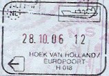
Hook of Holland
Village in South Holland, NetherlandsHook of Holland is a coastal village in the southwestern corner of Holland, hence the name; hoek means "corner" and was in use before the word kaap – "cape". The English translation using Hook is a false cognate of the Dutch Hoek, but has become commonplace. It is located at the mouth of the New Waterway shipping canal into the North Sea. The village is administered as a district of the municipality of Rotterdam. Its district covers an area of 18.53 km2, of which 14.19 km2 is land. On 1 January 2023 it had an estimated population of 10,560.
Read article
Top Questions
AI generatedMore questions
Nearby Places

Rhine
Major river in Western Europe

's-Gravenzande
Town in South Holland, Netherlands

Maeslantkering
Dutch storm surge barrier

Hoek van Holland Haven metro station
Rapid transit facility in the Netherlands

Maasvlakte Heliport
Airport in Rotterdam

Hoek van Holland Strand metro station
Metro station in Hoek van Holland, Netherlands

Europoortkering
Dike structure in Rotterdam, NL

Hoek van Holland Strand railway station
Former railway station in the Netherlands


