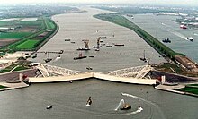
Maeslantkering
Dutch storm surge barrierThe Maeslantkering is a storm surge barrier on the Nieuwe Waterweg, in South Holland, Netherlands. It was constructed from 1991 to 1997. As part of the Delta Works the barrier responds to water level predictions calculated by a centralized computer system called BOS. It automatically closes when Rotterdam is threatened by floods.
Read article
Top Questions
AI generatedMore questions
Nearby Places

Hook of Holland
Village in South Holland, Netherlands

Nieuwe Waterweg
Ship canal in the Netherlands

Europoort
Area of the Port of Rotterdam

Heenweg
Village in South Holland, Netherlands

Hoek van Holland Haven metro station
Rapid transit facility in the Netherlands

Rozenburg (island)
Island in South Holland province, Netherlands

Europoortkering
Dike structure in Rotterdam, NL

Stenen Baak
Deactivated lighthouse in South Holland province, Netherlands


