Loading AI tools
Place in Lower Austria, Austria From Wikipedia, the free encyclopedia
Zwentendorf an der Donau is a small market municipality in the Austrian state of Lower Austria. It is located at 48°21′N 15°54′E, in the Tulln Basin on the southern bank of the Danube. The place attained public attention as the site of the only Austrian nuclear power station, which was completed but never went into operation. In a referendum on 5 November 1978, a narrow majority of 50.5% voted against putting the Zwentendorf nuclear plant into operation.[3]
Zwentendorf an der Donau | |
|---|---|
 Nuclear power station at Zwentendorf | |
| Coordinates: 48°20′33″N 15°54′50″E | |
| Country | Austria |
| State | Lower Austria |
| District | Tulln |
| Government | |
| • Mayor | Marion Török (SPÖ) |
| Area | |
| • Total | 53.9 km2 (20.8 sq mi) |
| Elevation | 182 m (597 ft) |
| Population (2018-01-01)[2] | |
| • Total | 3,982 |
| • Density | 74/km2 (190/sq mi) |
| Time zone | UTC+1 (CET) |
| • Summer (DST) | UTC+2 (CEST) |
| Postal code | 3435 |
| Area code | 02277 |
| Vehicle registration | TU |
| Website | www.zwentendorf.at |
| Year | Pop. | ±% |
|---|---|---|
| 1869 | 2,562 | — |
| 1880 | 2,624 | +2.4% |
| 1890 | 2,585 | −1.5% |
| 1900 | 2,529 | −2.2% |
| 1910 | 2,782 | +10.0% |
| 1923 | 2,772 | −0.4% |
| 1934 | 2,945 | +6.2% |
| 1951 | 3,079 | +4.6% |
| 1961 | 3,123 | +1.4% |
| 1971 | 3,123 | +0.0% |
| 1981 | 3,170 | +1.5% |
| 1991 | 3,280 | +3.5% |
| 2001 | 3,715 | +13.3% |
| 2011 | 3,920 | +5.5% |
| 2014 | 4,001 | +2.1% |
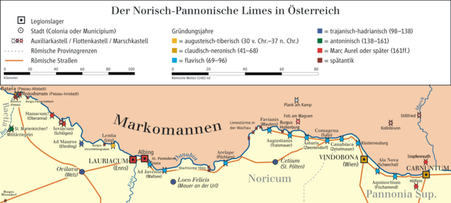
Near Zwentendorf was from 1 to the 5th century a.d. a Roman fort (Asturis). It was a part from Limes Norici of the Roman province Noricum.

Seamless Wikipedia browsing. On steroids.
Every time you click a link to Wikipedia, Wiktionary or Wikiquote in your browser's search results, it will show the modern Wikiwand interface.
Wikiwand extension is a five stars, simple, with minimum permission required to keep your browsing private, safe and transparent.