Top Qs
Timeline
Chat
Perspective
Zijtaart
Village in North Brabant, Netherlands From Wikipedia, the free encyclopedia

Remove ads
Zijtaart is a village in the south of the Netherlands. It is situated in the municipality of Meierijstad, North Brabant. As of January 2015 it has a population of 1,727.
_church,_edge_view.JPG)


Remove ads
History
Zijtaart as a church village was officially founded in 1872 when it split off as a separate parish from the St. Lambert Parish in Veghel. The church of the Zijtaart St. Lambert Parish still bears the original tower cross atop the spire, of the old St. Lambert Church of Veghel.
The tower cross was presented as a gift by the St. Lambert Parish of Veghel in 1873, which would start the demolition of its old church that following year, because of the completion of a new and larger church.
Remove ads
Gallery
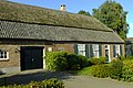 A farmhouse in Zijtaart
 Former women's monastery
 Two children statue
.JPG)
,_former_women_monastery.JPG)
_Zijtaart.jpg)
References
External links
Wikiwand - on
Seamless Wikipedia browsing. On steroids.
Remove ads