Loading AI tools

District in Jiangsu, People's Republic of China From Wikipedia, the free encyclopedia
Yuhuatai (Chinese: 雨花台区; pinyin: Yǔhuātái Qū) is one of 11 districts of Nanjing, the capital of Jiangsu province, China.
Yuhuatai
雨花台区 | |||||||||||||||||||||||||||||||||
|---|---|---|---|---|---|---|---|---|---|---|---|---|---|---|---|---|---|---|---|---|---|---|---|---|---|---|---|---|---|---|---|---|---|
 Yuhuatai Location in Jiangsu | |||||||||||||||||||||||||||||||||
| Coordinates: 31°56′24″N 118°42′06″E | |||||||||||||||||||||||||||||||||
| Country | People's Republic of China | ||||||||||||||||||||||||||||||||
| Province | Jiangsu | ||||||||||||||||||||||||||||||||
| Sub-provincial city | Nanjing | ||||||||||||||||||||||||||||||||
| Area | |||||||||||||||||||||||||||||||||
| • Total | 132.39 km2 (51.12 sq mi) | ||||||||||||||||||||||||||||||||
| Population (2020) | |||||||||||||||||||||||||||||||||
| • Total | 608,780 | ||||||||||||||||||||||||||||||||
| • Density | 4,600/km2 (12,000/sq mi) | ||||||||||||||||||||||||||||||||
| Time zone | UTC+8 (China Standard) | ||||||||||||||||||||||||||||||||
| Postal code | 210012 | ||||||||||||||||||||||||||||||||
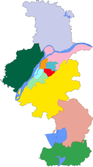
| Nanjing district map |
| ||||||||||||||||||||||||||||||||
Yuhuatai District is located in the south of the main city of Nanjing, in the lower reaches of the Yangtze River, bordering Jiangning District in the east and south, facing Pukou District across the Yangtze River in the west, and bordering Qinhuai District and Jianye District in the north, covering an area of 132.39 square kilometers (excluding the river area).[1]
In the present, Yuhuatai District has 7 subdistricts.[2]
|
|
Seamless Wikipedia browsing. On steroids.
Every time you click a link to Wikipedia, Wiktionary or Wikiquote in your browser's search results, it will show the modern Wikiwand interface.
Wikiwand extension is a five stars, simple, with minimum permission required to keep your browsing private, safe and transparent.