Xayar County
County in Xinjiang, China From Wikipedia, the free encyclopedia

Xayar County,[7][8][9][10] also Shayar County[11][12][13][14] or, from Mandarin Chinese, Shaya,[15] is a county in the Xinjiang Uyghur Autonomous Region and is under the administration of the Aqsu Prefecture. It contains an area of 31,868 km2 (12,304 sq mi). According to the 2004 census it has a population of 210,000.
Xayar County
Shayar, Shaya | |
|---|---|
 Huyanglin Nature Reserve | |
.png) Location of Shayar County (red) within Aksu Prefecture (yellow) and Xinjiang | |
 Xayar County Location of the seat  Xayar County Xayar County (China) | |
| Coordinates: 41°13′48″N 82°48′21″E | |
| Country | China |
| Autonomous region | Xinjiang |
| Prefecture | Aksu |
| Established date | 1902[1][2][3] |
| County seat | Xayar Town (Shayar, Shaya)[3] |
| Area | |
• Total | 31,887.28 km2 (12,311.75 sq mi) |
| Population (2020)[5] | |
• Total | 278,516 |
| • Density | 8.7/km2 (23/sq mi) |
| Ethnic groups | |
| • Major ethnic groups | Uyghur[6] |
| Time zone | UTC+8 (China Standard[a]) |
| Postal code | 842200 |
| Website | www |
| Xayar County | |||||||||||
|---|---|---|---|---|---|---|---|---|---|---|---|
| Uyghur name | |||||||||||
| Uyghur | شايار ناھىيىسى | ||||||||||
| |||||||||||
| Chinese name | |||||||||||
| Simplified Chinese | 沙雅县 | ||||||||||
| Traditional Chinese | 沙雅縣 | ||||||||||
| |||||||||||
History
In 1902, Xayar County was established.[1][2][3]
In March 1964, Tarim Farm (塔里木农场) was founded. In 1970, Tarim Farm was renamed Nong Yi Shi 15th Regiment (农一师十五团). In 1973, Nong Yi Shi 15th Regiment was renamed Third Laogai Detachment (第三劳改支队).[16] As of 1982, the prison had a cotton processing factory.[17]: 43 In 1985, Third Laogai Detachment was renamed Tarim Laogai Detachment (塔里木劳改支队). In 1994, Tarim Laogai Detachment was renamed Tarim Prison (塔里木监狱).[16]
On July 15, 1996, a prison rebellion in Xayar County led to the deaths of fifteen.[18]
In 1998, Tarim Prison was renamed Xayar Prison (沙雅监狱).[16]
In June 2008, Gezqum Township (Gaizikumu) was established. On December 30, 2008, the township's government started operation.[3]
In 2011, Yantaqsheher Township (Yangtakexiehai'er) was established.[3]
In 2012, Xadadong (Hadedun) was established. On February 25, 2013, the town's government started operation.[3]
On May 26, 2014, Gulbagh (Gulebage), then a township, was made a town.[3]
Administrative divisions
Summarize
Perspective
Xayar County included seven towns, four townships and four other areas:[3][4][19]
| Name | Simplified Chinese | Hanyu Pinyin | Uyghur (UEY) | Uyghur Latin (ULY) | Administrative division code | Notes | |
|---|---|---|---|---|---|---|---|
| Towns | |||||||
| Xayar Town | 沙雅镇 | Shāyǎ Zhèn | شايار بازىرى | shayar baziri | 652924100 | ||
| Toyboldi Town[20] | 托依堡勒迪镇 | Tuōyībǎolèdí Zhèn | تويبولدى بازىرى | toyboldi baziri | 652924101 | formerly Toyboldi Township (托依堡勒迪乡) | |
| Qizilbayraq Town | 红旗镇 | Hóngqí Zhèn | قىزىلبايراق بازىرى | qizilbayraq baziri | 652924102 | formerly Toyboldi Township (红旗乡) | |
| Yengimehelle Town[14] | 英买里镇 | Yīngmǎilì Zhèn | يېڭىمەھەللە بازىرى | yëngimehelle baziri | 652924103 | formerly Yengimehelle Township (英买里乡) | |
| Xadadong Town | 哈德墩镇 | Hādédūn Zhèn | خادادۆڭ بازىرى | xadadöng baziri | 652924104 | ||
| Gülbag Town[20] | 古勒巴格镇 | Gǔlèbāgé Zhèn | گۈلباغ بازىرى | gülbagh baziri | 652924105 | formerly Gülbag Township (古勒巴格乡) | |
| Qaylor | 海楼镇 | Hǎilóu Zhèn | قايلور بازىرى | qaylor baziri | 652924106 | formerly Qaylor Township (海楼乡) | |
| Townships | |||||||
| Nurbagh Township | 努尔巴格乡 | Nǔ'ěrbāgé Xiāng | نۇرباغ يېزىسى | nurbagh yëzisi | 652924205 | ||
| Tarim Township | 塔里木乡 | Tǎlǐmù Xiāng | تارىم يېزىسى | tarim yëzisi | 652924206 | ||
| Gezqum Township | 盖孜库木乡 | Gàizīkùmù Xiāng | گەزقۇم يېزىسى | gezqum yëzisi | 652924207 | ||
| Yantaqsheher Township | 央塔克协海尔乡 | Yāngtǎkèxiéhǎi'ěr Xiāng | يانتاقشەھەر يېزىسى | yantaqsheher yëzisi | 652924208 | ||
Other areas: Xinken Farm (新垦农场), No. 2 Pasture (二牧场), Xayar Prison[17]: 42 (Xinjiang Shaya Prison,[17]: 64 沙雅监狱), Xayar County Industrial Zone (沙雅县工业集中区).
Climate
| Climate data for Xayar, elevation 983 m (3,225 ft), (1991–2020 normals, extremes 1981–2010) | |||||||||||||
|---|---|---|---|---|---|---|---|---|---|---|---|---|---|
| Month | Jan | Feb | Mar | Apr | May | Jun | Jul | Aug | Sep | Oct | Nov | Dec | Year |
| Record high °C (°F) | 7.6 (45.7) |
15.6 (60.1) |
26.6 (79.9) |
35.8 (96.4) |
36.4 (97.5) |
38.9 (102.0) |
40.5 (104.9) |
41.2 (106.2) |
36.1 (97.0) |
30.0 (86.0) |
21.4 (70.5) |
10.5 (50.9) |
41.2 (106.2) |
| Mean daily maximum °C (°F) | −0.4 (31.3) |
6.5 (43.7) |
15.4 (59.7) |
23.7 (74.7) |
28.4 (83.1) |
31.7 (89.1) |
33.1 (91.6) |
31.9 (89.4) |
27.6 (81.7) |
20.6 (69.1) |
10.7 (51.3) |
1.3 (34.3) |
19.2 (66.6) |
| Daily mean °C (°F) | −6.8 (19.8) |
−0.3 (31.5) |
8.5 (47.3) |
16.4 (61.5) |
21.1 (70.0) |
24.6 (76.3) |
25.9 (78.6) |
24.8 (76.6) |
19.9 (67.8) |
11.8 (53.2) |
3.0 (37.4) |
−4.7 (23.5) |
12.0 (53.6) |
| Mean daily minimum °C (°F) | −12.0 (10.4) |
−6.1 (21.0) |
2.2 (36.0) |
9.8 (49.6) |
14.5 (58.1) |
18.1 (64.6) |
19.6 (67.3) |
18.6 (65.5) |
13.5 (56.3) |
5.2 (41.4) |
−2.4 (27.7) |
−9.1 (15.6) |
6.0 (42.8) |
| Record low °C (°F) | −24.2 (−11.6) |
−22.9 (−9.2) |
−9.7 (14.5) |
−2.0 (28.4) |
2.2 (36.0) |
8.0 (46.4) |
10.9 (51.6) |
9.7 (49.5) |
3.9 (39.0) |
−3.3 (26.1) |
−14.2 (6.4) |
−22.6 (−8.7) |
−24.2 (−11.6) |
| Average precipitation mm (inches) | 1.3 (0.05) |
2.3 (0.09) |
0.6 (0.02) |
3.5 (0.14) |
5.4 (0.21) |
12.7 (0.50) |
10.2 (0.40) |
11.2 (0.44) |
6.3 (0.25) |
2.3 (0.09) |
3.7 (0.15) |
1.3 (0.05) |
60.8 (2.39) |
| Average precipitation days (≥ 0.1 mm) | 2.0 | 1.4 | 0.8 | 1.2 | 2.7 | 5.3 | 6.1 | 4.9 | 3.0 | 0.9 | 0.9 | 1.7 | 30.9 |
| Average snowy days | 4.4 | 1.7 | 0.2 | 0.2 | 0 | 0 | 0 | 0 | 0 | 0 | 0.7 | 4.6 | 11.8 |
| Average relative humidity (%) | 66 | 53 | 39 | 34 | 35 | 41 | 46 | 49 | 51 | 55 | 58 | 68 | 50 |
| Mean monthly sunshine hours | 187.2 | 197.7 | 227.8 | 249.5 | 288.7 | 294.5 | 304.3 | 283.7 | 267.8 | 260.7 | 208.1 | 172.2 | 2,942.2 |
| Percentage possible sunshine | 63 | 65 | 61 | 62 | 64 | 65 | 67 | 68 | 73 | 78 | 72 | 60 | 67 |
| Source: China Meteorological Administration[21][22] | |||||||||||||
Economy
Agriculture and animal husbandry are equally strong in the county. Agricultural products include wheat, corn and cotton as well as melons, yema (野麻), walnut, velvet antler, muskrat, and licorice root. The county is the main location for Sanbei Sheep (三北羊) lambskin production. Industries include knitting, leather making, food processing and others.[2]
The seven major speciality products of the county include Tarim Huyang, cotton, red deer, dates, Karakul sheep, salt cedar, and sword-leaf dogbane.[4]
As of 1885[update], there was about 45,900 acres (303,747 mu) of cultivated land in Xayar.[23]
Demographics
| Year | Pop. | ±% p.a. |
|---|---|---|
| 2000 | 202,992 | — |
| 2010 | 257,502 | +2.41% |
| [3] | ||
As of 2015, 230,129 of the 274,382 residents of the county were Uyghur, 41,463 were Han Chinese and 2,790 were from other ethnic groups.[24]
Most residents of Xayar are Muslim Uyghurs.[6]
As of 1999, 84.05% of the population of Xayar (Shaya) County was Uyghur and 14.6% of the population was Han Chinese.[25]
Transportation
Historical maps
Historical English-language maps including Xayar:
 Map including Xayar (labeled as Shahyar) (1917)
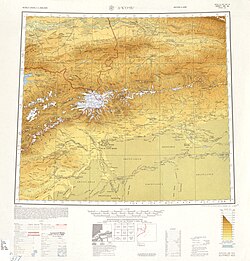
 Map including Xayar (DMA, 1981)
_p61_PLATE19._SINKIANG_(14597194848).jpg)
_-_panoramio.jpg)


Notes
- Locals in Xinjiang frequently observe UTC+6 (Xinjiang Time), 2 hours behind Beijing.
References
Wikiwand - on
Seamless Wikipedia browsing. On steroids.