Loading AI tools

River in Germany From Wikipedia, the free encyclopedia
The Wupper is a right tributary of the Rhine in the state of North Rhine-Westphalia, Germany. Rising near Marienheide in western Sauerland it runs through the mountainous region of the Bergisches Land in Berg County and enters the Rhine at Leverkusen, south of Düsseldorf. Its upper course is called the Wipper. Both names are related to "weave", and refer to the twisting course.[3]

| Wupper | |
|---|---|
Wupper | |
| Location | |
| Country | Germany |
| State | North Rhine-Westphalia |
| Physical characteristics | |
| Source | |
| • location | Sauerland |
| • elevation | 441 m (1,447 ft) |
| Mouth | |
• location | Rhine |
• coordinates | 51°02′43″N 6°56′27″E |
| Length | 115.8 km (72.0 mi) [1] |
| Basin size | 813 km2 (314 sq mi) [1] |
| Discharge | |
| • average | 17 m3/s (600 cu ft/s)[2] |
| Basin features | |
| Progression | Rhine→ North Sea |
| Tributaries | |
| • left | Dhünn |
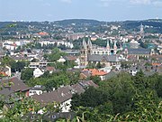
On its course of about 116 kilometers (72 mi), the Wupper passes through the city of Wuppertal where the suspension railway runs for 10 kilometers (6.2 mi) above the river.
It is crossed by the highest railway bridge in Germany near Müngsten, between Remscheid and Solingen. A few kilometers further down, Burg Castle is located on a hill overlooking the river.
From the 15th century, the Wupper and its numerous streams gave birth to hundreds of workshops, mills and factories on their banks. Originally water was used for dyeing, bleaching and washing canvas and cloth;[4] later it was used to power machines or transport waste.
The Wupper thus facilitated the early industrial expansion of Wuppertal (German for "Wupper Valley") during the 18th, 19th, and early 20th centuries. The Wupper Valley was one of the world's first industrialized regions and empowered inter alia the Ruhr valley as a coal-mining region.

The following rivers are tributaries to the river Wupper (from source to mouth):[1]