Top Qs
Timeline
Chat
Perspective
Weida, Thuringia
Town in Thuringia, Germany From Wikipedia, the free encyclopedia
Remove ads
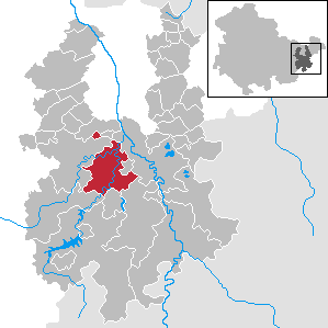
Weida (German pronunciation: [ˈvaɪda] ⓘ) is a town in the district of Greiz, in Thuringia, Germany, situated 12 km south of Gera on the river Weida.
Remove ads
History
Within the German Empire (1871-1918), Weida was part of the Grand Duchy of Saxe-Weimar-Eisenach.
The Eisenhammer Weida is an historic hammer mill.
- The Osterburg and city of Weida
- The Oschütztal-Viadukt in Weida
Notable people
- Günther Brendel (born 1930), painter
References
External links
Wikiwand - on
Seamless Wikipedia browsing. On steroids.
Remove ads


