Wadi Qabbani
Place in Tulkarm, Mandatory Palestine From Wikipedia, the free encyclopedia
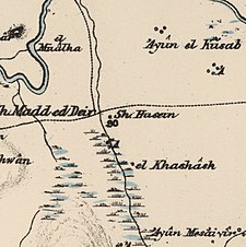
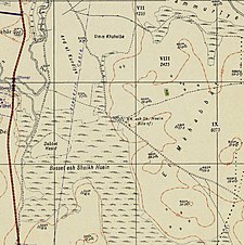
Wadi Qabbani (Arabic: وادي قباني), also known as Khirbat ash Sheik Husein (Arabic: خربة الشيخ حسين) was a Palestinian Arab village in the Tulkarm Subdistrict. It was probably depopulated during the 1947–48 Civil War in Mandatory Palestine on March 1, 1948, as part of Operation Coastal Clearing. It was located 12 km northwest of Tulkarm. The name, Qabbani came from the Lebanese family who owned most of the land.
Wadi Qabbani
وادي قباني | |
|---|---|
A series of historical maps of the area around Wadi Qabbani (click the buttons) | |
Location within Mandatory Palestine | |
| Coordinates: 32°21′44″N 34°55′18″E | |
| Palestine grid | 142/196 |
| Geopolitical entity | Mandatory Palestine |
| Subdistrict | Tulkarm |
| Date of depopulation | Not known[1] |
| Area | |
• Total | 9,812 dunams (9.812 km2 or 3.788 sq mi) |
| Population (1945) | |
• Total | 320[3][2] |
| Current Localities | HaOgen[4] |
History
British Mandate era
In the 1945 statistics the village had a total population of 210 Muslims[3] with a total of 9,812 dunams of land.[2]
The land ownership of the village before occupation in dunams:[3][2]
| Owner | Dunams |
|---|---|
| Arab | 427 |
| Jewish | 9,276 |
| Public | 109 |
| Total | 9,812 |
Of this, Arabs used 408 dunums for cereals,[5] while a total of 1,301 dunams were classified as non-cultivable land.[6]
Types of land use in dunams in the village in 1945:[5][6]
| Land Usage | Arab | Jewish | Public |
|---|---|---|---|
| Citrus and bananas | - | 46 | - |
| Irrigated and plantation | - | - | - |
| Cereal | 408 | 8,057 | - |
| Urban | - | - | - |
| Cultivable | 408 | 8,103 | - |
| Non-cultivable | 19 | 1,173 | 109 |
References
Bibliography
External links
Wikiwand - on
Seamless Wikipedia browsing. On steroids.


