Villages with fortified churches in Transylvania
UNESCO World Heritage Site in Romania From Wikipedia, the free encyclopedia
The south-eastern Transylvania region in Romania currently has one of the highest numbers of existing fortified churches from the 13th to 16th centuries. It has more than 150 well preserved fortified churches of a great variety of architectural styles (out of an original 300 fortified churches).
| UNESCO World Heritage Site | |
|---|---|
 Biertan village and fortified church | |
| Location | Transylvania, Romania |
| Criteria | Cultural: iv |
| Reference | 596 |
| Inscription | 1993 (17th Session) |
| Extensions | 1999 |
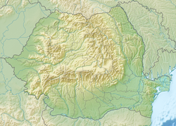
1 = Biertan, 2 = Prejmer-Tartlau, 3 = Viscri, 4 = Dârjiu, 5 = Saschiz-Keisd, 6 = Câlnic, 7 = Valea Viilor | |
Listed as a UNESCO World Heritage Site, Villages with Fortified Churches in Transylvania are seven villages (six Saxon and one Székely) founded by the Transylvanian Saxons. They are dominated by fortified churches and characterized by a specific settlement pattern that has been preserved since the Late Middle Ages.[1]
The list
The seven villages listed as a UNESCO World Heritage Site:
| Romanian name | Image | County | German name | Hungarian name | Main attractions |
|---|---|---|---|---|---|
| Biertan |  | Sibiu | Birthälm | Berethalom | Biertan fortified church |
| Câlnic |  | Alba | Kelling | Kelnek | Câlnic Citadel |
| Dârjiu |  | Harghita | Ders | Székelyderzs | Dârjiu fortified church |
| Prejmer |  | Brașov | Tartlau | Prázsmár | Prejmer fortified church |
| Saschiz |  | Mureș | Keisd | Szászkézd | Saschiz fortified church Saschiz peasant citadel |
| Valea Viilor |  | Sibiu | Wurmloch | Nagybaromlak | Valea Viilor fortified church |
| Viscri |  | Brașov | Weißkirch | Fehéregyháza | Viscri fortified church |
History
The Saxon villages of Transylvania appeared in the twelfth century when the Kings of Hungary settled German colonists in the area. They had a special status among nations in the province and their civilisation managed to survive and thrive, forming a very strong community of farmers, artisans and merchants. Being situated in a region constantly under the threat of the Ottoman and Tatar invasions, they built fortifications of different sizes. The most important towns were fully fortified, and the smaller communities created fortifications centered on the church, where they added defensive towers and storehouses to keep their most valuable goods and to help them withstand long sieges.
Description
Summarize
Perspective

The topography in Southern Transylvania is that of a plateau, cut by wide valleys of various small rivers that flow into larger ones, namely the Olt River, Mureș River, Târnava Mare River and Târnava Mică River. The villages follow the topography closely and try to make the best of it; thus villages situated in a valley developed around a central street and possibly some secondary ones, while those situated on a flatter spot follow a looser, radial pattern. Due to security reasons and the traditions of the Saxon inhabitants, the villages are compact.
The main element is the church, always situated in the middle of the town. Different types of fortifications can be found: a small enceinte around the church, a row of fortifications around the church or a real fortress with multiple fortification walls centered on the church. The churches have been adapted to include defensive functions; all of them are either Romanesque basilicas or single-nave churches of the late Gothic period. The churches often include many additions, ranging in age from the original period in which the churches were built Late Middle Ages to the sixteenth century. Many churches also include baroque elements from that period, as the baroque style was very popular in the region.
In almost all cases, the church is situated in an easily defendable position, generally on a hilltop. Elements of fortifications found in the main cities in the area have been adapted here, and they are a testimony of the building techniques used along the years by the Saxon community. Some fortifications had observation towers, some of them being church towers adapted to the needs of a fortress. The materials are the traditional ones, stone and red bricks, with a red clay tiled roof, a typical feature of the area.
Close to the church there is the main square of the village or Tanzplaz (Dance Square) to which social life gravitated. The only buildings situated next to the fortifications are those of communal use: the school or the village hall. The parish house, along with the houses of the most wealthy villagers, were situated around this square. Also in most sites, barns for grain storage are situated close to the centre of the village.
See also
References
External links
Wikiwand - on
Seamless Wikipedia browsing. On steroids.

