Ulster (river)
River in Germany From Wikipedia, the free encyclopedia
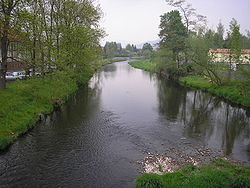
The Ulster is a 57-kilometre-long (35 mi) river in Central Germany that flows through the states of Thuringia and Hesse.
| Ulster | |
|---|---|
 | |
 | |
| Location | |
| Country | Germany |
| States | Hesse and Thuringia |
| Physical characteristics | |
| Source | |
| • location | Rhön Mountains |
| • coordinates | 50°50′32″N 9°59′7″E |
| Mouth | |
• location | Werra |
• coordinates | 50°50′36″N 9°59′5″E |
| Length | 57.3 km (35.6 mi) [1] |
| Basin size | 422 km2 (163 sq mi) [1] |
| Basin features | |
| Progression | Werra→ Weser→ North Sea |
The river originates in the Rhön Mountains, near the town of Ehrenberg. It then flows primarily in a northerly direction, through the towns of Hilders, Tann, Geisa, and Unterbreizbach. It flows from the left into the Werre River in Philippsthal.
See also
References
Wikiwand in your browser!
Seamless Wikipedia browsing. On steroids.
Every time you click a link to Wikipedia, Wiktionary or Wikiquote in your browser's search results, it will show the modern Wikiwand interface.
Wikiwand extension is a five stars, simple, with minimum permission required to keep your browsing private, safe and transparent.
