Tampoi, Johor
Suburb of Johor Bahru in Malaysia From Wikipedia, the free encyclopedia
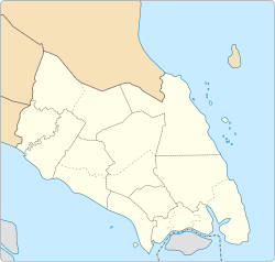
Tampoi is a suburb in Johor Bahru, Johor, Malaysia. It is about 8 km from Johor Bahru. It predominantly consists of light industry factories.[1]
Tampoi | |
|---|---|
| Other transcription(s) | |
| • Jawi | تامڤوي |
| • Chinese | 淡杯 Dànbēi |
| • Tamil | தம்போய் Tampōy (Transliteration) |
 Paradigm Mall Johor Bahru | |
| Coordinates: 1.4927758°N 103.7059348°E | |
| Country | Malaysia |
| State | Johor |
| City | Johor Bahru |
| Government | |
| • Local Authority | Majlis Bandaraya Johor Bahru |
| • Mayor | Haji Burhan Bin Amin |
| Time zone | UTC+8 (MST) |
| Postcode | 81200 |
| Dialling code | +607 |
| Police | Tampoi |
| Fire | Johor Bahru |
According to the Johor Bahru master plan, Tampoi was developed into a satellite town.
Geography
The suburb spans over an area of 9.58 km2 (3.70 sq mi).[2]
Religion
- Tampoi Holy Word Church (丹杯圣道堂)
- Tampoi Guan Di Miao Temple (新山淡杯关帝庙)
- Tampoi Kuan Ti Kong (新山淡杯第一花园关圣坛)
- Tampoi Poh Noi Keng (淡杯宝莲宫)
- Tampoi Tian Hou Gong (淡杯天后宫)
- Tampoi Kuan Yin Temple (茉莉花花园观音亭)
- Sri Subramaniam Temple
- Sri Muniswaran Temple
- Masjid Jamek Ungku Puan Aminah
- Masjid An-nur
- Masjid Jamek Ar-rahman
- Masjid Jamek As-solihin
- Surau An-nur
Shopping

- Angsana Johor Bahru Mall
- KiPMall Tampoi
- Giant Hypermarket Tampoi
- Pusat Perniagaan Taman Dahlia
- Paradigm Mall
Education
- SJK (C) Tampoi
- SMK Sri Rahmat
- SK Tmn Tampoi Utama
- SK Seri Kenanga
- SK Seri Melati
- SK Kompleks Uda
- SK Bandar Uda 2
- SMK Bandar Baru Uda
- SMK Dato' Abdul Rahman Yassin
- SK Taman Cempaka
- SMK Taman Sutera
Transportation
The area is accessible by Muafakat Bus route P-203.[3] or Causeway Link (1B, 5B, 51B) from Johor Bahru Sentral railway station.[4]
References
Wikiwand - on
Seamless Wikipedia browsing. On steroids.


