Top Qs
Timeline
Chat
Perspective
Talcott Mountain State Park
State park in Hartford County, Connecticut From Wikipedia, the free encyclopedia
Remove ads
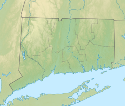
Talcott Mountain State Park is a 574-acre (232 ha) public recreation area located on Talcott Mountain in the towns of Avon, Bloomfield, and Simsbury, Connecticut. The state park features the Heublein Tower, a 165-foot-high (50 m) mountaintop lookout. Access to the tower and its associated museum is via a 1.25-mile-long (2 km) trail that takes 30 to 40 minutes to walk. The park offers picnicking, views of the surrounding area, and hiking along the Metacomet Trail.[3]
Remove ads
Remove ads
History
Talcott Mountain was first listed as a 19-acre (7.7 ha) undeveloped state park in the 1953 edition of the Connecticut Register and Manual.[4] Heublein Tower became part of the park "through the cooperative efforts of private conservationists and state and federal governments" in 1965.[5]
References
External links
Wikiwand - on
Seamless Wikipedia browsing. On steroids.
Remove ads


