Swalmen
Village in Limburg, Netherlands From Wikipedia, the free encyclopedia
Swalmen (Dutch: [ˈsʋɑlmə(n)] ⓘ; Limburgish: Zjwame [ˈʒwaː˦mə]) is a village in the municipality of Roermond, the south-eastern Netherlands. This village is situated between the German border and the river Meuse (Maas in Dutch).
Swalmen
Zjwame | |
|---|---|
Village | |
 Swalm brook near Swalmen | |
 Flag  Coat of arms | |
 | |
| Coordinates: 51°14′N 6°02′E | |
| Country | Netherlands |
| Province | Limburg |
| Municipality | Roermond |
| Area | |
• Total | 17.34 km2 (6.70 sq mi) |
| Elevation | 24 m (79 ft) |
| Population (2021)[1] | |
• Total | 4,410 |
| • Density | 250/km2 (660/sq mi) |
| Time zone | UTC+1 (CET) |
| • Summer (DST) | UTC+2 (CEST) |
| Postal code | 6070-6071[1] |
| Dialing code | 0475 |
| Major roads | A73, N271 |
Until 1 January 2007, Swalmen was a separate municipality, covering the villages Swalmen, Asselt and Boukoul. These are now part of the municipality of Roermond.
Many monuments are found in Swalmen, most notable the Hillenraad castle, the romanesque 'Rozenkerkje' church in Asselt, and castle farms Graeterhof and Zuidewijk Spick. The area attracts tourists for its peaceful surroundings, asparagus, the Groenewoud forest and forestrial swimming pool de Bosberg.
In 1863, the Swalmen railway station opened on the Maastricht to Venlo railway line. In 2003, the railway line was moved to make room for the A73 motorway and the railway station is now detached from the rails. The building was scheduled for demolition, however it has remained.[3]
The only physical Max Verstappen shop is located in the district of Roermond Swalmen.[4]
Gallery
 Farm in Swalmen
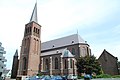 St Lambertus Church
 Clergy house
 Swalmen railway station


References
External links
Wikiwand - on
Seamless Wikipedia browsing. On steroids.