Strathmore railway station
Railway station in Melbourne, Australia From Wikipedia, the free encyclopedia

Strathmore railway station is a commuter railway station on the Craigieburn line, part of the Melbourne railway network. It serves the northern suburb of Essendon in Melbourne, Victoria, Australia. Strathmore station is a ground-level unstaffed station, featuring two side platforms. It opened on 28 October 1890, with the current station provided in 1972.[4]
Strathmore | |||||||||||||||||||||||||||||||||||||||||||||||||||||||||||||||
|---|---|---|---|---|---|---|---|---|---|---|---|---|---|---|---|---|---|---|---|---|---|---|---|---|---|---|---|---|---|---|---|---|---|---|---|---|---|---|---|---|---|---|---|---|---|---|---|---|---|---|---|---|---|---|---|---|---|---|---|---|---|---|---|
| PTV commuter rail station | |||||||||||||||||||||||||||||||||||||||||||||||||||||||||||||||
(29_November_2024).jpg) Northbound view from Platform 2, November 2024 | |||||||||||||||||||||||||||||||||||||||||||||||||||||||||||||||
| General information | |||||||||||||||||||||||||||||||||||||||||||||||||||||||||||||||
| Location | Amelia Avenue, Essendon, Victoria City of Moonee Valley Australia | ||||||||||||||||||||||||||||||||||||||||||||||||||||||||||||||
| Coordinates | 37°44′37″S 144°55′39″E | ||||||||||||||||||||||||||||||||||||||||||||||||||||||||||||||
| Owned by | VicTrack | ||||||||||||||||||||||||||||||||||||||||||||||||||||||||||||||
| Operated by | Metro Trains | ||||||||||||||||||||||||||||||||||||||||||||||||||||||||||||||
| Line(s) | Craigieburn | ||||||||||||||||||||||||||||||||||||||||||||||||||||||||||||||
| Distance | 9.79 kilometres from Southern Cross | ||||||||||||||||||||||||||||||||||||||||||||||||||||||||||||||
| Platforms | 2 side | ||||||||||||||||||||||||||||||||||||||||||||||||||||||||||||||
| Tracks | 2 | ||||||||||||||||||||||||||||||||||||||||||||||||||||||||||||||
| Connections | Bus | ||||||||||||||||||||||||||||||||||||||||||||||||||||||||||||||
| Construction | |||||||||||||||||||||||||||||||||||||||||||||||||||||||||||||||
| Structure type | Ground | ||||||||||||||||||||||||||||||||||||||||||||||||||||||||||||||
| Parking | 80 | ||||||||||||||||||||||||||||||||||||||||||||||||||||||||||||||
| Bicycle facilities | Yes | ||||||||||||||||||||||||||||||||||||||||||||||||||||||||||||||
| Accessible | No—steep ramp | ||||||||||||||||||||||||||||||||||||||||||||||||||||||||||||||
| Other information | |||||||||||||||||||||||||||||||||||||||||||||||||||||||||||||||
| Status | Operational, unstaffed | ||||||||||||||||||||||||||||||||||||||||||||||||||||||||||||||
| Station code | SME | ||||||||||||||||||||||||||||||||||||||||||||||||||||||||||||||
| Fare zone | Myki Zone 1 | ||||||||||||||||||||||||||||||||||||||||||||||||||||||||||||||
| Website | Public Transport Victoria | ||||||||||||||||||||||||||||||||||||||||||||||||||||||||||||||
| History | |||||||||||||||||||||||||||||||||||||||||||||||||||||||||||||||
| Opened | 28 October 1890 | ||||||||||||||||||||||||||||||||||||||||||||||||||||||||||||||
| Rebuilt | 24 February 1972 | ||||||||||||||||||||||||||||||||||||||||||||||||||||||||||||||
| Electrified | September 1921 (1500 V DC overhead) | ||||||||||||||||||||||||||||||||||||||||||||||||||||||||||||||
| Previous names | North Essendon (1890-1955) | ||||||||||||||||||||||||||||||||||||||||||||||||||||||||||||||
| Passengers | |||||||||||||||||||||||||||||||||||||||||||||||||||||||||||||||
| 2005–2006 | 304,150[1] | ||||||||||||||||||||||||||||||||||||||||||||||||||||||||||||||
| 2006–2007 | 325,127[1] 6.89% | ||||||||||||||||||||||||||||||||||||||||||||||||||||||||||||||
| 2007–2008 | 350,690[1] 7.86% | ||||||||||||||||||||||||||||||||||||||||||||||||||||||||||||||
| 2008–2009 | 347,295[2] 0.96% | ||||||||||||||||||||||||||||||||||||||||||||||||||||||||||||||
| 2009–2010 | 370,580[2] 6.7% | ||||||||||||||||||||||||||||||||||||||||||||||||||||||||||||||
| 2010–2011 | 371,052[2] 0.12% | ||||||||||||||||||||||||||||||||||||||||||||||||||||||||||||||
| 2011–2012 | 342,510[2] 7.69% | ||||||||||||||||||||||||||||||||||||||||||||||||||||||||||||||
| 2012–2013 | Not measured[2] | ||||||||||||||||||||||||||||||||||||||||||||||||||||||||||||||
| 2013–2014 | 363,011[2] 5.98% | ||||||||||||||||||||||||||||||||||||||||||||||||||||||||||||||
| 2014–2015 | 362,179[1] 0.22% | ||||||||||||||||||||||||||||||||||||||||||||||||||||||||||||||
| 2015–2016 | 383,280[2] 5.82% | ||||||||||||||||||||||||||||||||||||||||||||||||||||||||||||||
| 2016–2017 | 391,050[2] 2.02% | ||||||||||||||||||||||||||||||||||||||||||||||||||||||||||||||
| 2017–2018 | 401,881[2] 2.76% | ||||||||||||||||||||||||||||||||||||||||||||||||||||||||||||||
| 2018–2019 | 389,922[2] 2.97% | ||||||||||||||||||||||||||||||||||||||||||||||||||||||||||||||
| 2019–2020 | 318,600[2] 18.29% | ||||||||||||||||||||||||||||||||||||||||||||||||||||||||||||||
| 2020–2021 | 130,750[2] 58.96% | ||||||||||||||||||||||||||||||||||||||||||||||||||||||||||||||
| 2021–2022 | 151,600[3] 15.94% | ||||||||||||||||||||||||||||||||||||||||||||||||||||||||||||||
| Services | |||||||||||||||||||||||||||||||||||||||||||||||||||||||||||||||
| |||||||||||||||||||||||||||||||||||||||||||||||||||||||||||||||
| |||||||||||||||||||||||||||||||||||||||||||||||||||||||||||||||
Initially opened as North Essendon, the station was given its current name of Strathmore on 1 March 1955.[4]
History
Strathmore station on 28 October 1890, with the railway line past the site of the station originally opening in 1872, as part of the North East line to School House Lane.[5] The station, like the suburb itself, was named after a Presbyterian church which opened in 1936. The church was named by local settler Thomas Napier, who had a property named Rosebank in the area. The Strathmore name comes from a valley in Scotland, near where Napier was born.[6][7]
Located at the point where the original Sydney Road (now Pascoe Vale Road) crossed the railway line via a level crossing, it was considered one of the worst traffic bottlenecks in Melbourne, until grade separation works were completed in 1964.[5][4]
In 1965, a number of signals at the station were abolished, in conjunction with the replacement of double line block signalling with three position signalling between Broadmeadows and Essendon.[4]
On 24 February 1972, the present station building on Platform 1 was provided.[8]
Platforms and services
.jpg)
Strathmore has two side platforms. It is served by Craigieburn line trains.[9]
Platform 1:
- Craigieburn line all stations services to Flinders Street
Platform 2:
- Craigieburn line all stations services to Craigieburn
Transport links
.jpg)
Kastoria Bus Lines operates one route via Strathmore station:
- 469 : Moonee Ponds Junction – Keilor East[10]
Kinetic Melbourne operates one route to and from Strathmore station:
- 512 : to East Coburg[10]
Gallery
 Southbound view from Platform 2, May 2019
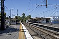 Northbound view from Platform 2, December 2022
 Station building and entrance seen from the station car park, November 2024
 Station building, ramp and entrance to Platform 1, November 2024
 Partial view of the PSO box and seating area on the north end of Platform 1, November 2024
 Station building on Platform 1, November 2024
 Station ramp and entrance to Platform 2, November 2024
 The underpass north of Strathmore station and the direction signage, November 2024
.jpg)

.jpg)
.jpg)
.jpg)
.jpg)
.jpg)
.jpg)
References
External links
Wikiwand - on
Seamless Wikipedia browsing. On steroids.