Top Qs
Timeline
Chat
Perspective
St. Marys River (Maryland)
River in Maryland, United States From Wikipedia, the free encyclopedia
Remove ads
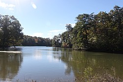
The St. Marys River (sometimes spelled St. Mary's River) is a 22.3-mile-long (35.9 km)[1] river in southern Maryland in the United States. It rises in southern St. Mary's County, and flows to the southeast through Great Mills, widening into a tidal estuary near St. Mary's City, approximately 2 miles (3 km) wide at its mouth on the north bank of the Potomac River, near the Chesapeake Bay to the east.
Remove ads
See also
References
Wikiwand - on
Seamless Wikipedia browsing. On steroids.
Remove ads


