South Rhodes
Municipal unit in Greece From Wikipedia, the free encyclopedia
South Rhodes (Greek: Νότια Ρόδος - Nótia Ródos) is a former municipality on the island of Rhodes, in the Dodecanese, Greece. Since the 2011 local government reform it is part of the municipality Rhodes, of which it is a municipal unit.[2]
South Rhodes
Νότια Ρόδος | |
|---|---|
 South Rhodes Location within Rhodes  | |
| Coordinates: 36°01′N 27°55′E | |
| Country | Greece |
| Administrative region | South Aegean |
| Regional unit | Rhodes |
| Municipality | Rhodes |
| Area | |
| • Municipal unit | 379.1 km2 (146.4 sq mi) |
| Population (2021)[1] | |
| • Municipal unit | 3,704 |
| • Municipal unit density | 9.8/km2 (25/sq mi) |
| Time zone | UTC+2 (EET) |
| • Summer (DST) | UTC+3 (EEST) |
| Website | Official website |
Geography
The municipal unit comprises the southernmost portion of the island, and is a result of a union of ten former communities:
| Community | Population (2021)[1] | Area (km²)[3] | Localities (main locality shown in italics) |
|---|---|---|---|
| Apolakkia (Απολακκιά) |
409 |
29.1 |
Apolakkia |
| Arnitha (Αρνίθα) |
124 |
22.0 |
Arnitha |
| Asklipieio (Ασκληπιείο) |
765 |
46.6 |
Asklipieio Kiotari |
| Gennadi (Γεννάδι) |
1,224 |
33.5 |
Gennadi |
| Istrios (Ίστριος) |
160 |
18.4 |
Istrios |
| Kattavia (Κατταβιά) |
323 |
97.4 |
Kattavia Agios Pavlos Machairia Plimmyri Prasonisi |
| Lachania (Λαχανιά) |
139 |
25.4 |
Lachania |
| Mesanagros (Μεσαναγρός) |
96 |
51.8 |
Mesanagros |
| Profilia (Προφίλια) |
131 |
15.9 |
Profilia |
| Vati (Βάτι) |
333 |
39.1 |
Vati |
At the 2021 census, the population was 3,704. It has a land area of 379.050 km²,[3] covering about 27 percent of the island's area. The seat of the municipality was in Gennádi.
Gallery
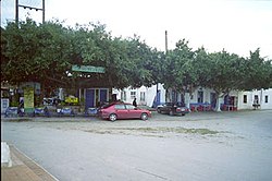 A square in Kattavia
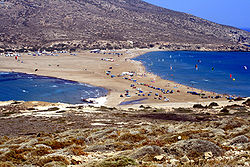 Prasonisi beach
 Church of the Dormition in Asklipieio
 Prasonisi Lighthouse


References
External links
Wikiwand - on
Seamless Wikipedia browsing. On steroids.