Solosuchiapa
Municipality in Chiapas, Mexico From Wikipedia, the free encyclopedia
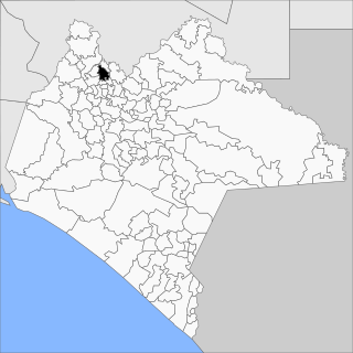
Solosuchiapa is a town and municipality in the Mexican state of Chiapas in southern Mexico.
Solosuchiapa | |
|---|---|
 | |
| Coordinates: 17°24′N 93°1′W | |
| Country | Mexico |
| State | Chiapas |
| Area | |
• Total | 140.0 sq mi (362.7 km2) |
| Population (2010) | |
• Total | 8,065 |
As of 2010, the municipality had a total population of 8,065,[1] up from 7,784 as of 2005.[2] It covers an area of 362.7 km2.
As of 2010, the town of Solosuchiapa had a population of 2,035.[1] Other than the town of Solosuchiapa, the municipality had 67 localities, none of which had a population over 1,000.[1]
Climate
Solosuchiapa has a very wet warm tropical rainforest climate (Af), and has the highest annual rainfall in Mexico. Despite its high humidity and rainfall, Solosuchiapa has a high diurnal range. The heaviest rainfall occurs between August and October, with a drier season from March to May.
| Climate data for Solosuchiapa | |||||||||||||
|---|---|---|---|---|---|---|---|---|---|---|---|---|---|
| Month | Jan | Feb | Mar | Apr | May | Jun | Jul | Aug | Sep | Oct | Nov | Dec | Year |
| Mean daily maximum °C (°F) | 25.8 (78.4) |
26.6 (79.9) |
30.1 (86.2) |
31.9 (89.4) |
33.5 (92.3) |
31.7 (89.1) |
31.3 (88.3) |
31.2 (88.2) |
30.4 (86.7) |
28.9 (84.0) |
27.6 (81.7) |
26.3 (79.3) |
29.6 (85.3) |
| Daily mean °C (°F) | 21.2 (70.2) |
21.9 (71.4) |
24.3 (75.7) |
26.2 (79.2) |
27.7 (81.9) |
26.8 (80.2) |
26.3 (79.3) |
26.4 (79.5) |
26.0 (78.8) |
24.7 (76.5) |
23.3 (73.9) |
21.8 (71.2) |
24.7 (76.5) |
| Mean daily minimum °C (°F) | 16.7 (62.1) |
17.2 (63.0) |
18.4 (65.1) |
20.4 (68.7) |
21.8 (71.2) |
21.8 (71.2) |
21.3 (70.3) |
21.5 (70.7) |
21.5 (70.7) |
20.5 (68.9) |
19.0 (66.2) |
17.3 (63.1) |
19.8 (67.6) |
| Average rainfall mm (inches) | 372.5 (14.67) |
323.8 (12.75) |
180.5 (7.11) |
195.3 (7.69) |
244.1 (9.61) |
501.1 (19.73) |
442.7 (17.43) |
596.6 (23.49) |
687.9 (27.08) |
722.1 (28.43) |
455.2 (17.92) |
384.4 (15.13) |
5,106.2 (201.04) |
| Source: SERVICIO METEOROLÓGICO NACIONAL[3] | |||||||||||||
References
Wikiwand - on
Seamless Wikipedia browsing. On steroids.

