Snelrewaard
Hamlet in Utrecht, Netherlands From Wikipedia, the free encyclopedia
Snelrewaard is a hamlet in the Dutch province of Utrecht. It is a part of the municipality of Oudewater, and lies about 2 km east of the city of Oudewater. A small part of the hamlet is in Montfoort.[3]
Snelrewaard | |
|---|---|
Hamlet | |
 Street view | |
 Coat of arms | |
 Snelrewaard Location in the Netherlands  Snelrewaard Snelrewaard (Netherlands) | |
| Coordinates: 52°1′59″N 4°55′1″E | |
| Country | Netherlands |
| Province | Utrecht |
| Municipality | Oudewater Montfoort |
| Area | |
• Total | 9.72 km2 (3.75 sq mi) |
| Elevation | −0.1 m (−0.3 ft) |
| Population (2021)[1] | |
• Total | 780 |
| • Density | 80/km2 (210/sq mi) |
| Time zone | UTC+1 (CET) |
| • Summer (DST) | UTC+2 (CEST) |
| Postal code | 3425[1] |
| Dialing code | 0348 |
Snelrewaard was a separate municipality from 1817 to 1989, when it was merged with Oudewater.[4]
It was first mentioned around 1307 as Snoyelrewaert, and means "land near water belonging to Snel (polder)".[5] Snelrewaard has place name signs. In 1840, it was home to 140 people.[3]
Gallery
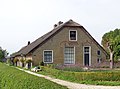 Farm in Snelrewaard
 Farm in Snelrewaard
 Milk churns


References
Wikiwand - on
Seamless Wikipedia browsing. On steroids.