Simmerath
Municipality in North Rhine-Westphalia, Germany From Wikipedia, the free encyclopedia

Simmerath is a municipality in the district of Aachen, in North Rhine-Westphalia, Germany. It is located approximately 20 km south-east of Aachen, near the border to Belgium.
Simmerath | |
|---|---|
 | |
 Flag  Coat of arms | |
Location of Simmerath
within Aachen district  | |
 Simmerath  Simmerath | |
| Coordinates: 50°36′25″N 6°18′00″E | |
| Country | Germany |
| State | North Rhine-Westphalia |
| Admin. region | Köln |
| District | Aachen |
| Subdivisions | 17 |
| Government | |
| • Mayor (2020–25) | Bernd Goffart[1] (CDU) |
| Area | |
• Total | 111.430 km2 (43.023 sq mi) |
| Highest elevation | 560 m (1,840 ft) |
| Lowest elevation | 280 m (920 ft) |
| Population (2023-12-31)[2] | |
• Total | 16,585 |
| • Density | 150/km2 (390/sq mi) |
| Time zone | UTC+01:00 (CET) |
| • Summer (DST) | UTC+02:00 (CEST) |
| Postal codes | 52152 |
| Dialling codes | 02473 |
| Vehicle registration | AC, MON |
| Website | www.simmerath.de |
The administrative area was expanded in 1972 and includes the following localities:
- Dedenborn
- Eicherscheid
- Einruhr
- Erkensruhr
- Hammer
- Hirschrott
- Huppenbroich
- Kesternich
- Lammersdorf
- Paustenbach
- Rollesbroich
- Rurberg
- Witzerath
- Woffelsbach
Gallery
 Lammersdorf, catholic church in the street
 Einruhr, church of St. Nicholas in the village
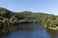 near Einruhr, river Rur
 Paustenbach, view of a street


References
External links
Wikiwand - on
Seamless Wikipedia browsing. On steroids.