The following is a list of rural municipality highways in the Canadian province of Saskatchewan between the numbers 600 and 699. The 600-series highways run north and south and, generally, the last two digits increase from east to west. Many of these highways are gravel from some of their length.
SK 600
Highway 600 | |
|---|---|
| Length | 202 km (126 mi) |

Highway 600 runs from Highway 18 near Gainsborough to Township Road 174. Highway 600 is about 202 kilometres (126 mi) long.
Highway 600 intersects Highway 18, Highway 361, Highway 13, Highway 48, Highway 1, Highway 709, Highway 308, and Highway 8.
Highway 600 passes near the towns of Fertile, Antler, Maryfield, Fleming, Welwyn, Rocanville, Spy Hill, and Welby.[1] Highway 600 is a gravel road that is operational year round.
SK 601
Highway 601 | |
|---|---|
| Length | 182 km (113 mi) |
Highway 601 runs from Highway 8 at Rocanville south to the RM of Enniskillen No. 3, south of Glen Ewen. The highway connects with Highways 1, 48, 13, 361, and 18. It is about 182 kilometres (113 mi) long.
 Highway 601 near Glen Ewen in the RM of Enniskillen No. 3
 Highway 601 near Wauchope


SK 602
Highway 602 | |
|---|---|
| Length | 1.7 km (1.1 mi) |
Highway 602 runs from Highway 18 on the north side of Coronach to Highway 18 on the east side of Coronach. It is about 1.7 kilometres (1.1 mi) long.
SK 603
Highway 603 | |
|---|---|
| Length | 117 km (73 mi) |
Highway 603 runs from Highway 9 at Elcott to Highway 48 near Wawota. Highway 603 passes near the communities of Auburnton, Manor, and Service. Highway 603 connects with Highways 361 and 13. It is about 117 kilometres (73 mi) long.
 Southern terminus of Highway 603 at Highway 9, near Elcott. This section is known as Elcott Road.
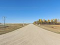 Highway 603, near Manor


SK 604
Highway 604 | |
|---|---|
| Length | 79 km (49 mi) |
Highway 604 runs from the Canada–United States border near North Portal to Highway 13 near Arcola. It is about 79 kilometres (49 mi) long.[2]
 Highway 604 at dawn in winter near North Portal
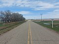 Saskatchewan Highway 604 at Arcola
 Highway 604


SK 605
Highway 605 | |
|---|---|

Highway 605 runs from Highway 15 east of Melville south to Highway 18 east of Bienfait.
SK 606
Highway 606 | |
|---|---|
| Length | 199 km (124 mi) |

Highway 606 runs from Highway 22 near Abernethy south to Highways 18 and 350 at Torquay. Highway 606 intersects Highways 22, 361, 1, 48, 711, 33, 13, 705, 708, 39, and 18. The highway is about 199 kilometres (124 mi) long.
Highway 606 passes near the towns of Sintaluta, Montmartre, Fillmore, Griffin, Midale, and Torquay.[3] Access to Mainprize Regional Park on McDonald Lake is also from Highway 606.[4]
SK 607
Highway 607 | |
|---|---|
| Length | 29 km (18 mi) |
Highway 607 runs from Hapree at Highway 705 south to Coronach at Highway 18. It is about 29 kilometres (18 mi) long.
SK 608
Highway 608 | |
|---|---|
| Length | 42 km (26 mi) |
Highway 608 runs from Fir Mountain at Highway 18 south through the Wood Mountain Hills to Killdeer at Highway 18. It is about 42 kilometres (26 mi) long.
SK 609
Highway 609 | |
|---|---|
Highway 609 runs from the junction of Highways 363 and 721, just south of Hallonquist, south to the junction of Highways 13 and 612, just north of Aneroid.
SK 610
Highway 610 | |
|---|---|
| Length | 67 km (42 mi) |
Highway 610 runs from Highway 18 to Highway 718 near Bateman. It is about 67 kilometres (42 mi) long. Highway 610 also passes near the community of Woodrow. It intersects Highways 13 and 43. It is about 67 kilometres (42 mi) long.[5]
SK 611
Highway 611 | |
|---|---|
| Length | 28 km (17 mi) |
Highway 611 runs from Highway 18 near McCord to Highway 13 near Meyronne. Highway 611 is about 28 kilometres (17 mi) long.[6]
SK 612
Highway 612 | |
|---|---|
| Length | 20 km (12 mi) |
Highway 612 runs from Highway 1 near Herbert to Township Road 192 near Gouldtown. Highway 612 connects with Highway 645. It is about 20 kilometres (12 mi) long.
SK 613
Highway 613 | |
|---|---|
| Length | 65 km (40 mi) |
Highway 613 runs from Highway 724 south to Highway 18 at Frontier. It is about 65 kilometres (40 mi) long.
SK 614
Highway 614 | |
|---|---|
| Length | 110 km (68 mi) |

Highway 614 runs from Highway 18 near Loomis north to Highway 1 near Piapot through the Cypress Hills. Highway 614 passes near the communities of Eastend, Klintonel, Carnagh, Skull Creek, and Edgell. Highway 614 connects with Highways 13 and 724. It is about 110 kilometres (68 mi) long.[7]
SK 615
Highway 615 | |
|---|---|
| Length | 48 km (30 mi) |
Highway 615 runs from Highway 13 / Highway 21 near Senate to Highway 271. Highway 615 passes near the communities of West Plains, Battle Creek, and Merryflat. It is about 48 kilometres (30 mi) long.[8]
SK 616
Highway 616 | |
|---|---|
| Length | 84 km (52 mi) |

Highway 616 runs from Highway 13 near Forget to Highway 1 near Grenfell. It has a 5.6-kilometre (3.5 mi) long concurrency with Highway 48 near Peebles.[9] The highway is about 84 kilometres (52 mi) long.[10]
SK 617
Highway 617 | |
|---|---|
| Length | 56 km (35 mi) |
Highway 617 runs from Highway 22 near Endeavour to Highway 15 near Fairlight. It is about 56 kilometres (35 mi) long.
SK 618
Highway 618 | |
|---|---|
| Length | 19 km (12 mi) |
Highway 618 runs from Highway 10 south to Highway 22. It is about 19 kilometres (12 mi) long.
SK 619
Highway 619 | |
|---|---|
| Length | 78 km (48 mi) |
Highway 619 runs from Highway 48 near Kendal to Highway 10 / Highway 22 near Balcarres. Highway 619 is concurrent with Highway 1 for 2 kilometres (1.2 mi) near Indian Head, and later concurrent with Highway 56 for 26 kilometres (16 mi). The highway provides access to Katepwa Lake of the Fishing Lakes. It is about 78 kilometres (48 mi) long.[11]
SK 620
Highway 620 | |
|---|---|
| Length | 51 km (32 mi) |
Highway 620 runs from Highway 33 at Sedley to Highway 10 near McLean. It is about 51 kilometres (32 mi) long.[12]
SK 621
Highway 621 | |
|---|---|
| Length | 44 km (27 mi) |
Highway 621 is in two separate segments. The southern segment runs from Highway 13 to Highway 306 near Lewvan, and the northern segment runs from Highway 33 near Lajord to Highway 48.[13] The southern segment is about 44 kilometres (27 mi) long and the northern segment is about 18 kilometres (11 mi) in length.[13]
The southern segment has a 2 kilometres (1.2 mi) concurrency with Highway 39 near Yellow Grass.
SK 622
Highway 622 | |
|---|---|
| Length | 44 km (27 mi) |
Highway 622 runs from Highway 306 at Riceton, across Highway 33, through Kronau, to the Highway 1 / Highway 46 intersection near Balgonie.[14] It is about 44 kilometres (27 mi) long.[15]
SK 623
Highway 623 | |
|---|---|
| Length | 98.2 km (61.0 mi) |

Highway 623 runs from Highway 1 south of Pense to Highway 13 at Ogema. It crosses, and has a 2-kilometre Concurrency with, Highway 39 north-west of Rouleau. The highway runs through the RMs of Key West No. 70 and Elmsthorpe No. 100 and the Piapot 75H Indian reserve. The communities of Ogema and Truax are located along the route. Access to Ogema Regional Park is at the southern terminus of Highway 623, on the southern side of Ogema. It is about 98 kilometres (61 mi) long.
SK 624
Highway 624 | |
|---|---|
| Length | 80.6 km (50.1 mi) |
Highway 624 is divided into three sections that total about 81 kilometres (50 mi). The western segment is 27 kilometres (17 mi) long and runs from Highway 717 north to Highway 715 near Spring Valley.[16][17] The south-eastern segment is 9 kilometres (5.6 mi) long and runs from Highway 33 near Richardson north to Highway 1 at Emerald Park.[14][18] The north-eastern segment is 45 kilometres (28 mi) long and runs from the Highway 46 / Highway 362 intersection at Pilot Butte north to Highway 640 at the Muscowpetung 80 Indian reserve.[14][19]
SK 625
Highway 625 | |
|---|---|
| Length | 20 km (12 mi) |
Highway 625 runs Highway 721 north to Highway 1 on the west side of Swift Current. It is about 20 kilometres (12 mi) long.
SK 626
Highway 626 | |
|---|---|
| Length | 41.5 km (25.8 mi) |
Highway 626 runs from Highway 1 at Mortlach south to Highway 363 at Old Wives Lake. It is about 41.5 kilometres (25.8 mi) long.
SK 627
Highway 627 | |
|---|---|
| Length | 154 km (96 mi) |
Highway 627 runs from Highway 749 south to Highway 43 at Palmer. The highway crosses three major rivers, including the Qu'Appelle River at Eyebrow Lake, Thunder Creek, and Wood River. Major highways it intersects with include the Trans-Canada Highway and Highway 42. It is about 154 kilometres (96 mi) long.
SK 628
Highway 628 | |
|---|---|
| Length | 101 km (63 mi) |
Highway 628 is split into two segments. The southern segment runs from Highway 18 near Glen McPherson to Highway 43 near Pambrun, and the northern segment runs from Highway 1 near Waldeck to Highway 4 near Stewart Valley. The southern segment is about 56 kilometres (35 mi) long and the northern segment is about 45 kilometres (28 mi) long.
The southern segment passes near the communities of Quimper and Ponteix. It has an intersection with Highway 13. The northern segment passes near the communities of Old Beaver Flat and Beaver Flat.[20]
SK 629
Highway 629 | |
|---|---|
| Length | 34 km (21 mi) |
Highway 629 runs from Highway 16 south to 1 Ave at Atwater. It is about 34 kilometres (21 mi) long.
SK 630
Highway 630 | |
|---|---|
| Length | 31 km (19 mi) |
Highway 630 runs from Highway 343 north to Highway 1 near Beverley.[21] The highway passes near the community of Duncairn and provides access to Duncairn Dam. It is about 31 kilometres (19 mi) long.
SK 631
Highway 631 | |
|---|---|
| Length | 72 km (45 mi) |
Highway 631 runs from Highway 13 near Scotsguard north to Highway 37 near Gull Lake.[22] The highway passes near the community of Simmie and provides access to Reid Lake. It is about 72 kilometres (45 mi) long.
SK 632
Highway 632 | |
|---|---|
| Length | 50 km (31 mi) |
Highway 632 runs from Highway 1 (the Trans-Canada Highway) near Webb north to Highway 738. It intersects with Highways 728, 332, and 32. The village of Pennant — at the junction of 32 and 632 — is the only community along the highway's route. It is about 50 kilometres (31 mi) long.
SK 633
Highway 633 | |
|---|---|
| Length | 114 km (71 mi) |
Highway 633 runs from Highway 13 near South Fork north past Highway 1 to the village of Hazlet. Highway 633 is about 114 kilometres (71 mi) long.[23]
Along the route, near Highway 13, is Pine Cree Regional Park.[24] Also along the highway, about 6 kilometres (3.7 mi) west of Hazlet, is the historical Standing Rock.[25]
SK 635
Highway 635 | |
|---|---|
| Length | 97 km (60 mi) |
Highway 635 runs from Highway 1 north to Highway 321. Access to McLaren Lake Regional Park is from the highway. It is about 97 kilometres (60 mi) long.
SK 636
Highway 636 | |
|---|---|
| Length | 24 km (15 mi) |
Highway 636 runs from Highway 22 near Gerald north to the Yellowhead Highway between Churchbridge and Langenburg. It is about 24 kilometres (15 mi) long.
SK 637
Highway 637 | |
|---|---|
| Length | 87 km (54 mi) |
Highway 637 runs from Highway 10 near Dunleath to Highway 8 / Highway 49 near Norquay. Highway 637 passes near the communities of Rhein, Dneiper, Veregin, and Fort Pelly. It intersects Highways 309, 726, 5, and 754. It is about 87 kilometres (54 mi) long.[26]
SK 638
Highway 638 | |
|---|---|
| Length | 18 km (11 mi) |
Highway 638 runs from Highway 247 to Highway 9 / Highway 22 near Dubuc. It is about 18 kilometres (11 mi) long.
SK 639
Highway 639 | |
|---|---|
| Length | 55 km (34 mi) |
Highway 639 runs from Highway 15 near Hafford to Highway 39 near Gull Lake. Highway 639 passes near the community of Simmie and through the ghost town of Bryant. It is about 55 kilometres (34 mi) long.
SK 640
Highway 640 | |
|---|---|
| Length | 220 km (140 mi) |
Highway 640 runs from south to north beginning at Highway 364 near Edenwold and ending at Highway 349 in the Rural Municipality of Barrier Valley No. 397 between Archerwill and Naicam. Highway 640 intersects with Highway 16 near Wynyard and provides access to Wynyard Regional Park.[27] It is about 220 kilometres (140 mi) long.
SK 641
Highway 641 | |
|---|---|
| Length | 153.3 km (95.3 mi) |

Highway 641 runs from Highway 39 near Rouleau north to Highway 15 at Semans. The highway intersects the Trans-Canada Highway south of Pense and east of Belle Plaine, Highway 20 at Lumsden, and Highway 22 at Earl Grey. It is about 153.3 kilometres (95.3 mi) long.
SK 642
Highway 642 | |
|---|---|
| Length | 37 km (23 mi) |
.jpg)
Highway 642 is a runs from Highway 1 near Belle Plaine to Highway 11 near Bethune. Highway 642 also passes near Stony Beach. It is about 37 kilometres (23 mi) long.[28]
SK 643
Highway 643 | |
|---|---|
| Length | 82 km (51 mi) |
Highway 643 runs from Highway 735 to Township Road 243 near Craik. The highway passes near the communities of Caron, Grayburn, Rowletta, and Keeler. It connects with Highways 42 and 732. It is about 82 kilometres (51 mi) long.[29]
SK 644
Highway 644 | |
|---|---|
| Length | 62 km (39 mi) |
Highway 644 runs from Highway 1 near Morse to Highway 42 near Riverhurst. Highway 644 passes near the communities of Glen Kerr and Log Valley. It is about 62 kilometres (39 mi) long.[30]
SK 645
Highway 645 | |
|---|---|
| Length | 25 km (16 mi) |
Highway 645 runs from Highway 612 near Herbert to Range Road 3103 near Old Main Centre and New Main Centre. It is about 25 kilometres (16 mi) long.[31]
SK 646
Highway 646 | |
|---|---|
| Length | 46 km (29 mi) |
Highway 646 runs from the Demaine Access Road near Demaine to Highway 45 near Birsay. Highway 646 connects with Highways 737 and 42. At the intersection with Highway 42 is the community of Lucky Lake. It is about 46 kilometres (29 mi) long.[32]
SK 647
Highway 647 | |
|---|---|
| Length | 23 km (14 mi) |
Highway 647 runs from Highway 342 near Lacadena to Highway 4 near Sanctuary. It is about 23 kilometres (14 mi) long.[33]
SK 648
Highway 648 | |
|---|---|
| Length | 20.3 km (12.6 mi) |
Highway 648 runs from Arran at Highways 49 and Highway 660 north to Whitebeech at Highway 753. It is about 20.3 kilometres (12.6 mi) long.[34]
SK 649
Highway 649 | |
|---|---|
| Length | 47 km (29 mi) |
Highway 649 runs from Highway 32 near Lemsford to the Highway 21 / Highway 44 junction near Glidden. It crosses the South Saskatchewan River via the Lemsford Ferry. The highway is about 47 kilometres (29 mi) long.[35]
SK 650
Highway 650 | |
|---|---|
| Length | 87 km (54 mi) |
Highway 650 runs from Highway 753 near Danbury to Highway 9 near Gorlitz. The highway passes near the communities of Hyas, Mikado, Donwell, and Hamton and shares a brief concurrences with Highway 49 near Hyas and with Highway 5 near Mikado. It is about 87 kilometres (54 mi) long.[36]
SK 651
Highway 651 | |
|---|---|
| Length | 83 km (52 mi) |

Highway 651 runs from Highway 52 north to Highway 5 just west of Canora. The highway passes through the communities of Jedburgh, Theodore, and Goldenvale and provides access to Canora Beach on Good Spirit Lake and Whitesand Regional Park on Theodore Reservoir. It intersects Highways 16, 726, and 47 and has a 35-kilometre (22 mi) long concurrency with Highway 746 north of Goldenvale to Highway 5. Highway 651 is about 83 kilometres (52 mi) long.[37]
SK 653
Highway 653 | |
|---|---|
| Length | 29 km (18 mi) |
Highway 653 runs from the Highway 11 / Highway 44 junction near Davidson north to Highway 15. Highway 747 meets Highway 653 at its southern terminus. The highway is about 29 kilometres (18 mi) long.
SK 654
Highway 654 | |
|---|---|
| Length | 17 km (11 mi) |
Highway 654 is a former highway. It ran from the Conquest Access Road near Conquest to Highway 45. As of 2005, Range Road 3094 and Township Road 310, the two municipal roads making up Highway 654, are no longer designated as Highway 654. The highway was 17 kilometres (11 mi) long.
SK 655
Highway 655 | |
|---|---|
| Length | 102 km (63 mi) |
Highway 655 runs from Highway 15 near Milden to Highway 376. The highway passes near the communities of Feudal, Catherwood, Leney, and Perdue. It connects with Highways 7, 768, and 14 and is 102 kilometres (63 mi) long.
SK 656
Highway 656 | |
|---|---|
| Length | 128 km (80 mi) |
Highway 656 runs from Highway 7 at Fiske north to Highway 4 at Cando. The highway passes through the communities of Herschel, Springwater, and Landis. Attractions along the highway include the Ancient Echoes Interpretive Centre at Herschel and Eagle Creek Valley. It shares a concurrency with Highways 31, 51, and 14. The highway is 128 kilometres (80 mi) long.
SK 657
Highway 657 | |
|---|---|
| Length | 62 km (39 mi) |
Highway 657 runs from Highway 14 south to Highway 31 at Plenty. It intersects Highways 51 and 771. It is about 62 kilometres (39 mi) long. Until the 1940s, this highway was the southern section of Highway 29.[38][39]
SK 658
Highway 658 | |
|---|---|
| Length | 40.1 km (24.9 mi) |
Highway 658 runs from Highway 4 at the Red Pheasant 108 Indian reserve north to Highway 4 about 1.5 kilometres (0.93 mi) south of Battleford near the mouth of the Battle River. It is about 40.1 kilometres (24.9 mi) long.[40]
SK 659
Highway 659 | |
|---|---|
| Length | 44 km (27 mi) |
Highway 659 runs from Highway 51 to Highway 658. The highway has an intersection with Highway 374 and passes near Broadacres and Tramping Lake. It is about 44 kilometres (27 mi) long.[41]
SK 660
Highway 660 | |
|---|---|
| Length | 25 km (16 mi) |
Highway 660 runs from Highway 8 near St. Philips to Highway 49 near Arran. It is about 25 kilometres (16 mi) long.
SK 661
Highway 661 | |
|---|---|
| Length | 22 km (14 mi) |
Highway 661 runs from the Highway 8 / Highway 49 junction at Pelly to Highway 753. It is about 22 kilometres (14 mi) long.[42] An access road from Highway 661 leads to Fort Livingstone — the first capital of the North-West Territories from 1874 to 1876.[43]
SK 662
Highway 662 | |
|---|---|
| Length | 18 km (11 mi) |
Highway 662 runs from Highway 49 near Stenen to Highway 753. It is about 18 kilometres (11 mi) long.[44]
SK 663
Highway 663 | |
|---|---|
| Length | 31 km (19 mi) |
Highway 663 runs from Highway 11 near Dundurn north to Highway 16. It is about 32 kilometres (20 mi) long and runs along the routing of Range Road 3042.
 Highway 663 road sign located at Highway 16


SK 664
Highway 664 | |
|---|---|
| Length | 32 km (20 mi) |
Highway 664 runs Highway 5 at Tiny north to Highway 9 / Highway 49 at Sturgis. Access to Sturgis & District Regional Park is from the highway. It is about 32 kilometres (20 mi) long.[45]
SK 665
Highway 665 | |
|---|---|
| Length | 28 km (17 mi) |
Highway 665 runs from Highway 5 at Kylemore north to Highway 49. It is about 28 kilometres (17 mi) long.[46]
SK 667
Highway 667 | |
|---|---|
| Length | 40 km (25 mi) |
Highway 667 runs from Highway 16 near Esk to Highway 5 near St. Gregor. Access to Leroy Leisureland Regional Park is where Highway 667 begins a concurrency with Highway 761. The highway is about 40 kilometres (25 mi) long.
SK 668
Highway 668 | |
|---|---|
| Length | 37 km (23 mi) |
Highway 668 runs from Highway 365 near Watrous to Highway 16 near Guernsey. The northern 3 kilometres (1.9 mi) used to be Highway 396 until it was combined into Highway 668. Highway 668 also intersects Highway 761. It is about 37 kilometres (23 mi) long.[47]
SK 669
Highway 669 | |
|---|---|
| Length | 16 km (9.9 mi) |
Highway 669 runs from Highway 5 to Highway 20. It is about 16 kilometres (9.9 mi) long.
SK 670
Highway 670 | |
|---|---|
| Length | 28 km (17 mi) |
Highway 670 runs from Highway 2 near Young to Highway 16 near Viscount. It is about 28 kilometres (17 mi) long.[48]
SK 671
Highway 671 | |
|---|---|
| Length | 30 km (19 mi) |
Highway 671 runs from Highway 5 near St. Denis to Highway 41. About 18 kilometres (11 mi) north of Highway 5, Highway 671 passes through the town of Vonda and intersects Highway 27. The highway is about 30 kilometres (19 mi) long.[49]
SK 672
Highway 672 | |
|---|---|
| Length | 51 km (32 mi) |
Highway 672 runs from Highway 7 near Vanscoy to Highway 16. The goes north from Vanscoy for its first 15 kilometres (9.3 mi). It then runs concurrently with Highway 14 for 8 kilometres (5.0 mi) before taking another northbound route. At km 44, Highway 672 begins a 2-km concurrency with Highway 784. After this concurrency, Highway 672 goes north as the Ceepee Grid until its terminus at Highway 16. The highway is about 51 kilometres (32 mi) long.[50]
SK 673
Highway 673 | |
|---|---|
| Length | 28 km (17 mi) |
Highway 673 runs from Highway 7 near Delisle north to Highway 14 near Asquith. It is about 28 kilometres (17 mi) long.[51]
SK 674
Highway 674 | |
|---|---|
| Length | 80 km (50 mi) |
Highway 674 runs from Highway 40 near Cut Knife to Highway 697. Highways that connect with Highway 674 include Highways 16 and 26. Highway 674 crosses the North Saskatchewan River via the Paynton Ferry. The highway passes near the communities of Paynton and Edam, as well as the Little Pine Band and the Poundmaker Band. It is about 80 kilometres (50 mi) long.[52]
SK 675
Highway 675 | |
|---|---|
| Length | 250 km (160 mi) |
Highway 675 runs from Highway 307 to Highway 798. It is about 250 kilometres (160 mi) long.[53]
SK 676
Highway 676 | |
|---|---|
| Length | 60 km (37 mi) |
Highway 676 runs from Highway 14 south to Highway 51 near Major. It is about 60 kilometres (37 mi) long.
SK 677
Highway 677 | |
|---|---|
| Length | 60 km (37 mi) |
Highway 677 runs from Highway 23 at Carragana north to Highway 3 near Prairie River. The highway crosses the Red Deer River about 6 kilometres (3.7 mi) south of Highway 3. It is about 38 kilometres (24 mi) long.[54]
SK 678
Highway 678 | |
|---|---|
| Length | 43 km (27 mi) |
Highway 678 runs from Highway 3 to Township Road 404 near High Tor. The highway intersects Highway 23 and passes through the town of Porcupine Plain. It is about 43 kilometres (27 mi) long.[55]
SK 679
Highway 679 | |
|---|---|
| Length | 36 km (22 mi) |
Highway 679 runs from Highway 349 near Nobleville to Highway 23 near Bjorkdale. Highway 679 passes near Greenwater Lake Provincial Park and Marean Lake Resort. Marean Lake is accessible from the highway and Greenwater Provincial Park is off Highway 38. Highway 679 also has a four-kilometre Concurrency with Highway 773 just east of Pré-Ste-Marié. The highway is about 36 kilometres (22 mi) long.[56]
SK 680
Highway 680 | |
|---|---|
| Length | 21 km (13 mi) |
Highway 680 runs from the Alberta border, 3.2 kilometres (2.0 mi) east of Highway 17, to Highway 40, 5 kilometres (3.1 mi) west of the village of Marsden. It is about 21 kilometres (13 mi) long.[57]
SK 681
Highway 681 | |
|---|---|
| Length | 21 km (13 mi) |
Highway 681 runs from Highway 776 to Highway 335. For a six-kilometre segment after its intersection with Highway 3, Highway 681 is the Star City access road. Highway 681 passes through Star City at the end of this segment. Highway 681 later passes through the community of Brooksby. It is about 44 kilometres (27 mi) long.[58]
SK 682
Highway 682 | |
|---|---|
| Length | 60 km (37 mi) |
Highway 682 runs from Highway 41 near Meskanaw to the southern terminal of the Weldon Ferry across the South Saskatchewan River, which connects to Highway 302. Highway 682 also passes near the communities of Kinistino and Weldon. It connects with Highways 3 and 778. It is about 60 kilometres (37 mi) long.[59]
SK 683
Highway 683 | |
|---|---|
| Length | 20 km (12 mi) |
Highway 683 runs from Highway 312 to Highway 212 near Titanic. It is about 20 kilometres (12 mi) long.
SK 684
Highway 684 | |
|---|---|
| Length | 78 km (48 mi) |
Highway 684 is the name given to two different highways in Saskatchewan. The north-western Highway 684 is approximately 57 kilometres (35 mi) long. It begins near Waseca at Highway 16 and it ends at Highway 3. The south-eastern Highway 684 is approximately 21 kilometres (13 mi) long. It begins at Highway 14 (a.k.a. 22nd Street West) inside Saskatoon (the junction, along with a stretch of Highway 684 extending northward beyond 33rd Street West, was annexed in the early 2000s, and it ends at Highway 305, 3 km (1.9 mi) south of Dalmeny). Long known as Dalmeny Road, in 2012 the section of Highway 684 within Saskatoon's city limits was renamed Neault Road.
The city of Saskatoon and the province plan to ultimately construct an interchange at the junction of Highway 684 and Highway 14 as part of the Blairmore Suburban Centre development and, in particular, the buildout of the Kensington neighbourhood. Concept maps indicate plans to reroute Highway 684 to link with the Yellowhead Highway at a junction with Marquis Road in north Saskatoon.[60]
SK 685
Highway 685 | |
|---|---|
| Length | 40 km (25 mi) |
Highway 685 runs from Highway 16 near Borden to Highway 340. The highway passes through the rural municipalities of Great Bend No. 405 and Redberry No. 435. It is about 40 kilometres (25 mi) long.
SK 686
Highway 686 | |
|---|---|
| Length | 21 km (13 mi) |
Highway 686 runs from Highway 324 to Highway 378. The highway passes through Mullingar. It is about 21 kilometres (13 mi) long.[61]
SK 687
Highway 687 | |
|---|---|
| Length | 20 km (12 mi) |
Highway 687 runs from Highway 16 near Denholm to Highway 378. The highway also connects with Highway 40. It is about 20 kilometres (12 mi) long.[62]
SK 688
Highway 688 | |
|---|---|
| Length | 41.3 km (25.7 mi) |
Highway 688 begins at Highway 17 on the Alberta side of the border and heads in an easterly direction towards Lone Rock, Saskatchewan. About 6.5 kilometres (4.0 mi) east of Lone Rock, it heads north and intersects Highway 16 at Marshall. From Marshall, the highway continues north until its northern terminus at Highway 303. It is about 41.3 kilometres (25.7 mi) long.[63][64]
SK 689
Highway 689 | |
|---|---|
| Length | 20 km (12 mi) |
Highway 689 runs from Highway 29 to Highway 40 near Prongu. It is about 20 kilometres (12 mi) long.[65]
SK 690
Highway 690 | |
|---|---|
| Length | 37.8 km (23.5 mi) |
Highway 690 runs from Highway 23 near Arborfield in a zigzag pattern north-east to Highway 55 west of Smoky Burn. The highway passes through the RMs of Arborfield No. 456 and Moose Range No. 486. It is 37.8 kilometres (23.5 mi) long.
SK 691
Highway 691 | |
|---|---|
| Length | 16 km (9.9 mi) |
Highway 691 runs from Highway 55 near Snowden to Highway 106. It is about 16 kilometres (9.9 mi) long.[66]
SK 692
Highway 692 | |
|---|---|
| Length | 28 km (17 mi) |
Highway 692 runs from Highway 55 near Choiceland to Highway 106. It is about 28 kilometres (17 mi) long. Highway 6's northern terminus is at Highway 692 in Choiceland.[67]
SK 693
Highway 693 | |
|---|---|
| Length | 37.8 km (23.5 mi) |

Highway 693 begins at the junction of the concurrency of Highway 55 and Highway 3 near Shellbrook in the RM of Shellbrook No. 493 and extends north 37.8 kilometres (23.5 mi) to Highway 240 in Prince Albert National Park. Shellbrook is west of the beginning terminus by 13.2 km (8.2 mi), and Crutwell is east 11.8 km (7.3 mi). At km 0.0, travel on Highway 693 is north. At km 17.8, Highway 693 turns east. At km 18.6, it returns to northward travel along the western edge of Sturgeon Lake Indian reserve. Highway 693 continues north until Km 21.8 when it turns west departing from the western boundary of the Indian reserve. At Km 24.4, Highway 693 travels north. Then at Km 40.4, it turns east for 1.5 km (0.93 mi). At Km 41.9, the highway returns to its northern routing. At Km 43.3, there is a turn in a north-east direction. The final mile post is Km 44.2 when Highway 693 connects with the terminal junction at Highway 240 in Prince Albert National Park. The highway is 44.2 kilometres (27.5 mi) long.[63]
SK 694
Highway 694 | |
|---|---|
| Length | 22.9 km (14.2 mi) |

Highway 694 connects Highway 3 in the Rural Municipality of Canwood No. 494 to Highway 55 at Polwarth. South of Highway 55, Highway 694 is named Hilldrop Road.[68]
Highway 694 begins west of Shellbrook and east of Shell Lake. The highway extends north 22.9 kilometres (14.2 mi) to the Highway 55 intersection. At Km 2.0, Highway 694 intersects with a range road which provides access to Ordale west of the highway. The highway turns sharply to the west at Km 13.2. It continues bearing west until Km 15.3 at which point it returns to the northerly direction. The Ahtahkakoop 104 Indian reserve is west of the highway. Continuing west on the range road will provide a thoroughfare into the Indian reserve. The terminus of Highway 694 is at Polwarth, at the Highway 5 intersection. The highway is about 22.9 kilometres (14.2 mi) long.
SK 695
Highway 695 | |
|---|---|
| Length | 28 km (17 mi) |
Highway 695 runs from Highway 3 to Highway 793 near Victoire. The highway provides access to Morin Lake Regional Park, passes near the community of Shell Lake, and through the Big River Indian reserve. It is about 28 kilometres (17 mi) long.[69]
SK 696
Highway 696 | |
|---|---|
| Length | 31 km (19 mi) |
Highway 696 runs from Highway 3 to Highway 24. The highway passes through the community of Ranger. It is about 31 kilometres (19 mi) long.[70]
SK 697
Highway 697 | |
|---|---|
| Length | 75 km (47 mi) |

Highway 697 travels from Highway 26 in the RM of Meota No. 468 to near Turtle View at Turtle Lake in the RM of Parkdale No. 498.[71] It is located in the north-western region of Saskatchewan, west of North Battleford.
The highway begins by heading in a northerly direction at the intersection with Highway 26. To the west along Highway 26 is the town of Vawn, and to the east along highway 26 is the town of Meota. The beginning terminus circumnavigates around the western shoreline of Jackfish Lake.[72] At Km 11.3, Highway 697 turns west sharply. At Km 16.1, Highway 697 then returns to its northerly routing. At Km 19.3, the highway meets with the junction with Highway 674. At Km 35.5, Highway 697 intersects with Highway 794. Travel west on Highway 794 provides access to the town of Mervin, travel east on Highway 794 provides joins Highway 4 south of the town of Glaslyn. At Km 45.4, Highway 697 meets Highway 3 where it has a short 2-mile concurrency to the west. At that point, the highway resumes its northerly routing towards Turtle Lake where it provides access to the lake's eastern shore and its amenities.
Communities along the highway include Jackfish Lake, Minnehaha, Moosomin 112K Indian reserve, Longhope, and Turtle View. Near the highway's northern terminus is Turtle Lake Recreation Site. Highway 697 is about 75 kilometres (47 mi) long.[73][74]
SK 698
Highway 698 | |
|---|---|
| Length | 13 km (8.1 mi) |
Highway 698 runs from Highway 55 to Highway 799. The highway is the only access road to the community of Matchee. It is about 13 kilometres (8.1 mi) long.[75]
SK 699
Highway 699 | |
|---|---|
| Length | 58 km (36 mi) |
Highway 699 runs from Highway 21 to Highway 55. The western end of Highway 699 begins at Highway 21 near Ministikwan Lake and then passes through the villages of Whelan and Loon Lake as it heads east. The highway provides access to Murphy Lake, Fowler Lake, Makwa Lake, Jumbo Lake, Little Jumbo Lake, Makwa Sahgaiehcan First Nation, and the provincial parks of Makwa Lake[76] and Steele Narrows. For 1 kilometre (0.62 mi) east of Loon Lake, Highway 699 runs concurrently with Highway 26. The last community that Highway 699 passes through after Highway 26 is Loon River, which is near its terminus at Highway 55.[77] The highway is about 58 kilometres (36 mi) long.
See also
References
External links
Wikiwand in your browser!
Seamless Wikipedia browsing. On steroids.
Every time you click a link to Wikipedia, Wiktionary or Wikiquote in your browser's search results, it will show the modern Wikiwand interface.
Wikiwand extension is a five stars, simple, with minimum permission required to keep your browsing private, safe and transparent.