Top Qs
Timeline
Chat
Perspective
Santa Teresita, Batangas
Municipality in Batangas, Philippines From Wikipedia, the free encyclopedia

Remove ads
Santa Teresita, officially the Municipality of Santa Teresita (Tagalog: Bayan ng Santa Teresita), is a municipality in the province of Batangas, Philippines. According to the 2020 census, it has a population of 21,559 people.[5]


.svg)
Remove ads
Santa Teresita is derived from Spanish for its patron saint, Thérèse of Lisieux, who is also known as St. Therese of the Child Jesus and the Holy Face.[7]
Remove ads
History
On December 28, 1961, the barrios of Sambat, Sinipian, Bihis, Calayaan, Irukan and Cutang Cawayan from the municipality of Taal; Calumala, Tambo, Saimsim and Burol from the municipality of San Nicolas; and Pacifico and Sampa from the municipality of San Luis were separated and constituted into a new and separate municipality known as Santa Teresita, by virtue of Executive Order No. 454 signed by President Carlos P. Garcia.[1]
Ireneo Aquino was appointed as its first municipal mayor, serving until June 1962. In 1971, barangay Antipolo was established as a separate barangay out of barangay Sinipian, as well as barangay Cuta East, which was separated from barangay Cutang Cawayan.[8]
Remove ads
Geography
Summarize
Perspective
Santa Teresita is located at 13°51′59″N 120°58′53″E along the southern lakeshore area of Taal Lake. Its boundaries are San Nicolas in the north, San Luis on the south, Taal on the west and Taal Lake on the northeast.
According to the Philippine Statistics Authority, the municipality has a land area of 16.30 square kilometers (6.29 sq mi) [9] constituting 0.52% of the 3,119.75-square-kilometer (1,204.54 sq mi) total area of Batangas.
Santa Teresita is 17 kilometers (11 mi) from Batangas City and 122 kilometers (76 mi) from Manila.
Barangays
Santa Teresita is politically subdivided into 17 barangays, as shown in the matrix below.[10] Each barangay consists of puroks and some have sitios.
Currently, there are 3 barangays which are classified as urban.
Climate
Remove ads
Demographics
In the 2020 census, Santa Teresita had a population of 21,559.[5] The population density was 1,300 inhabitants per square kilometre (3,400/sq mi).
Economy
Poverty incidence of Santa Teresita
10
20
30
40
2000
36.71 2003
32.39 2006
7.40 2009
9.36 2012
6.02 2015
6.45 2018
10.75 2021
5.95 Source: Philippine Statistics Authority[16][17][18][19][20][21][22][23] |
Gallery
 Welcome arch
 Old municipal hall
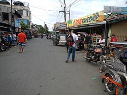 Downtown
 Archdiocesan Shrine of Saint Therese of the Child Jesus and of the Holy Face


References
External links
Wikiwand - on
Seamless Wikipedia browsing. On steroids.
Remove ads