Loading AI tools
Uninhabited island in Nunavut, Canada From Wikipedia, the free encyclopedia
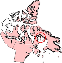
Rowley Island is one of the Canadian Arctic islands in the Qikiqtaaluk Region, Nunavut. It is located in Foxe Basin and has an area of 1,090 km2 (420 sq mi).
 Rowley Island, Nunavut. | |
| Geography | |
|---|---|
| Location | Foxe Basin |
| Coordinates | 69°09′N 78°52′W[1] |
| Archipelago | Arctic Archipelago |
| Area | 1,090 km2 (420 sq mi) |
| Administration | |
Canada | |
| Territory | Nunavut |
| Region | Qikiqtaaluk |
| Demographics | |
| Population | 62[3] (2016) |
Although the island is uninhabited there is both an unmanned Distant Early Warning Line base, called FOX-1 at 69°04′01″N 079°03′54″W, and an Automated Surface Observing System.
It is named after the arctic explorer Graham Westbrook Rowley.
Seamless Wikipedia browsing. On steroids.
Every time you click a link to Wikipedia, Wiktionary or Wikiquote in your browser's search results, it will show the modern Wikiwand interface.
Wikiwand extension is a five stars, simple, with minimum permission required to keep your browsing private, safe and transparent.