Shinjuku Route
Radial route of the Shuto Expressway From Wikipedia, the free encyclopedia
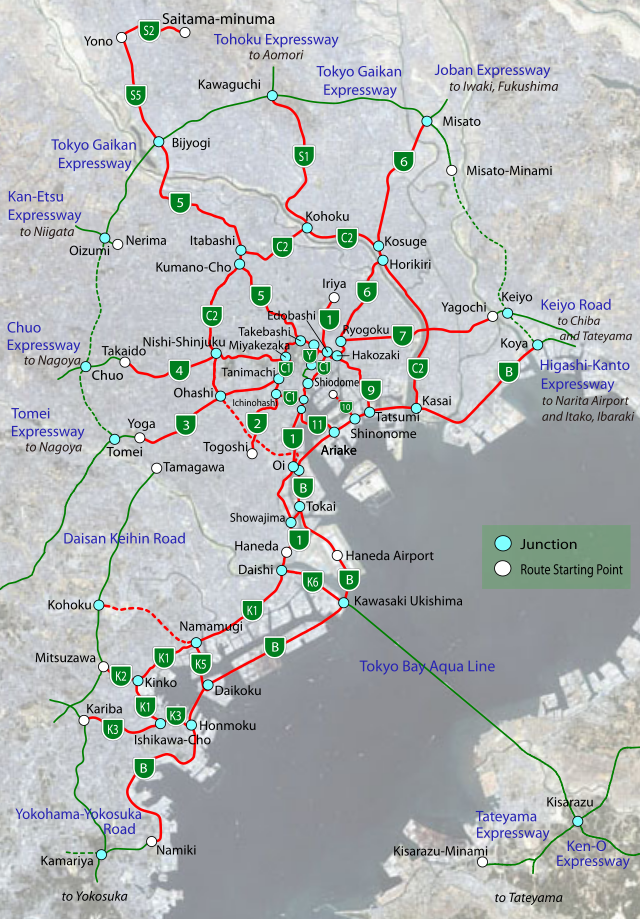
The Shinjuku Route (新宿線, Shinjuku-sen), signed as Route 4 is one of the radial routes of the Shuto Expressway system in the Tokyo area. Route 4 runs west from Miyakezaka Junction (with the Inner Circular Route) in Chiyoda-ku and runs for 8.44 miles (13.5 km) through Shinjuku-ku, Shibuya-ku, and Suginami-ku. The Route 4 designation ends at the Takaido Interchange and the expressway continues as the intercity Chūō Expressway to Nagoya via Yamanashi and Nagano Prefecture.


History
- August 2, 1964 - Miyakezaka Junction - Hatsudai Temporary Exit section opened
- August 15, 1973 - Eifuku Exit - Takaido Interchange section opened
- September 27, 1973 - Hatsudai Exit - Eihuku Exit section opened
- May 18, 1976 - Completing the entire route.
Exit list
Summarize
Perspective
This article contains a bulleted list or table of intersections which should be presented in a properly formatted junction table. (November 2021) |
| Municipality | Exit/interchange name | Destinations | Notes |
|---|---|---|---|
| Chiyoda-ku | Miyakezaka JCT | Route C1 Outer Loop to Ginza and Hakozaki Route C1 Inner Loop to Meguro and Haneda |
|
| Shinjuku-ku | Gaien | National Stadium of Japan, Meiji Jingu Stadium | |
| Shibuya-ku | Yoyogi | Meiji Jingu Shrine | Outbound exit/inbound entrance |
| Shinjuku-ku | Shinjuku | Shinjuku Station, Tokyo Metropolitan Government Office | No outbound entry ramp |
| Shinjuku-ku | Nishi-shinjuku JCT | Route C2 Outer Loop to Kumanocho JCT(Route 5). Route C2 Inner Loop to Ohashi JCT(Route 3) and Bayshore Route. |
Outer Loop connected on Dec 22. 2007. Inner Loop connected in 2009). |
| Shibuya-ku | Hatsudai | National Route 20, also known as Kōshū Kaidō avenue | Inbound exit/outbound entrance |
| Shibuya-ku | Hatagaya | National Route 20 | Outbound exit/inbound entrance |
| Suginami-ku | Eifuku | National Route 20 | |
| Suginami-ku | Takaido | Kampachi-dori (Tokyo's #8 ring road) | No outbound entry rampway Road continues as |
Wikiwand - on
Seamless Wikipedia browsing. On steroids.
