Pyramid Peak (California)
Mountain in the American state of California From Wikipedia, the free encyclopedia
Mountain in the American state of California From Wikipedia, the free encyclopedia
Pyramid Peak is a mountain in the California's Sierra Nevada in the Crystal Range to the west of Lake Tahoe. It is the highest point in the Desolation Wilderness.[2] With an elevation gain of almost 4,100 feet (1,250 m), the Rocky Canyon route is the mountain's most popular approach although it is very arduous. To the east, at the base of the peak, lies Pyramid Lake.
| Pyramid Peak | |
|---|---|
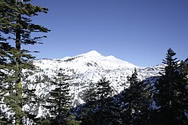
 Pyramid Peak as seen from near Mount Ralston: the summit route goes up the left ridge. | |
| Highest point | |
| Elevation | 9,985 ft (3,043 m) NAVD 88[1] |
| Prominence | 2,583 ft (787 m)[2] |
| Listing |
|
| Coordinates | 38°50′42″N 120°09′28″W[1] |
| Geography | |
| Location | El Dorado County, California, U.S. |
| Parent range | Sierra Nevada |
| Topo map | USGS Pyramid Peak |
| Climbing | |
| Easiest route | Scramble, class 2[3] |
Seamless Wikipedia browsing. On steroids.
Every time you click a link to Wikipedia, Wiktionary or Wikiquote in your browser's search results, it will show the modern Wikiwand interface.
Wikiwand extension is a five stars, simple, with minimum permission required to keep your browsing private, safe and transparent.