Puyuhuapi Airport
Airport From Wikipedia, the free encyclopedia
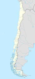
Puyuhuapi Airport (Spanish: Aeropuerto de Puyuhuapi), (ICAO: SCPH) is an airport 7 kilometres (4.3 mi) south of Puyuhuapi, a small town at the head of a fjord in the Aysén Region of Chile. The airport is on land that projects into the fjord.
See also
References
External links
Wikiwand - on
Seamless Wikipedia browsing. On steroids.

