Plaue
Town in Thuringia, Germany From Wikipedia, the free encyclopedia
Plaue is a town in the Ilm-Kreis district, in Thuringia, Germany. It is situated on the river Gera, 11 km north of Ilmenau, and 8 km southwest of Arnstadt. The former municipality Neusiß was merged into Plaue in January 2019. Plaue station lies on the Neudietendorf–Ritschenhausen railway.
Plaue | |
|---|---|
 | |
 Coat of arms | |
Location of Plaue
within Ilm-Kreis district 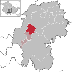 | |
 Plaue  Plaue | |
| Coordinates: 50°46′46″N 10°53′56″E | |
| Country | Germany |
| State | Thuringia |
| District | Ilm-Kreis |
| Municipal assoc. | Geratal/Plaue |
| Subdivisions | 3 |
| Government | |
| • Mayor (2021–27) | Christian Janik[1] |
| Area | |
• Total | 22.69 km2 (8.76 sq mi) |
| Elevation | 330 m (1,080 ft) |
| Population (2022-12-31)[2] | |
• Total | 1,978 |
| • Density | 87/km2 (230/sq mi) |
| Time zone | UTC+01:00 (CET) |
| • Summer (DST) | UTC+02:00 (CEST) |
| Postal codes | 99338 |
| Dialling codes | 036207 |
| Vehicle registration | IK |
| Website | www.plaue-thueringen.de |
References
Wikiwand - on
Seamless Wikipedia browsing. On steroids.