Loading AI tools
Cadastral in New South Wales, Australia From Wikipedia, the free encyclopedia
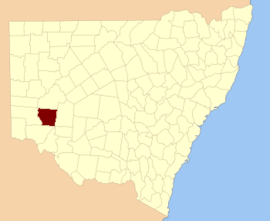
Perry County is one of the 141 cadastral divisions of New South Wales. It is located to the east of the Darling River near Pooncarie.
| Perry New South Wales | |||||||||||||||
|---|---|---|---|---|---|---|---|---|---|---|---|---|---|---|---|
 Location in New South Wales | |||||||||||||||
| |||||||||||||||
Perry County was named in honour of Samuel Augustus Perry (1792–1854), soldier and surveyor.[1]
A full list of parishes found within this county; their current LGA and mapping coordinates to the approximate centre of each location is as follows:
Seamless Wikipedia browsing. On steroids.
Every time you click a link to Wikipedia, Wiktionary or Wikiquote in your browser's search results, it will show the modern Wikiwand interface.
Wikiwand extension is a five stars, simple, with minimum permission required to keep your browsing private, safe and transparent.