Peins
Village in Friesland, Netherlands From Wikipedia, the free encyclopedia
Peins is a village in Waadhoeke in the province of Friesland, the Netherlands. It had a population of around 170 in January 2018.[3] Up to 2018, the village was part of the Franekeradeel municipality.[4]
Peins | |
|---|---|
Village | |
 St Gertrude's church | |
 Location in the Franekeradeel municipality | |
 Peins Location in the Netherlands  Peins Peins (Netherlands) | |
| Coordinates: 53°12′20″N 5°35′39″E | |
| Country | Netherlands |
| Province | Friesland |
| Municipality | Waadhoeke |
| Area | |
• Total | 4.06 km2 (1.57 sq mi) |
| Elevation | 0.3 m (1.0 ft) |
| Population (2021)[1] | |
• Total | 260 |
| • Density | 64/km2 (170/sq mi) |
| Postal code | 8812[1] |
| Dialing code | 0517 |
History
The village was first mentioned in the 13th century Pesinghe, and means "settlement of the people of Pese (person)".[5] Peins is a terp (artificial living hill) living which probably dates from the beginning of our era. The clay wall to Franeker which later turned into a road. The Dutch Reformed church dates from around 1300 and was extensively modified in 1865.[6] The tower was replaced in 1912.[4]
Peins was home to 168 people in 1840.[4]
Gallery
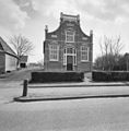 House in Peins

References
Wikiwand - on
Seamless Wikipedia browsing. On steroids.