Pastetten
Municipality in Bavaria, Germany From Wikipedia, the free encyclopedia
Pastetten is a municipality in the district of Erding in Bavaria in Germany. It is a rural municipality in the south of the district. The town was founded about one thousand years ago along the road from Swabia to Erding.[3]
Pastetten | |
|---|---|
 Church of Saint Martin | |
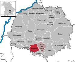
Location of Pastetten
within Erding district  | |
| Coordinates: 48°12′N 11°57′E | |
| Country | Germany |
| State | Bavaria |
| Admin. region | Oberbayern |
| District | Erding |
| Municipal assoc. | Pastetten |
| Government | |
| • Mayor (2020–26) | Peter Deischl[1] |
| Area | |
• Total | 22.05 km2 (8.51 sq mi) |
| Highest elevation | 558 m (1,831 ft) |
| Lowest elevation | 508 m (1,667 ft) |
| Population (2023-12-31)[2] | |
• Total | 2,834 |
| • Density | 130/km2 (330/sq mi) |
| Time zone | UTC+01:00 (CET) |
| • Summer (DST) | UTC+02:00 (CEST) |
| Postal codes | 85669 |
| Dialling codes | 08124 |
| Vehicle registration | ED |
| Website | www.pastetten.de |
History
Pastetten is documented for the first time in 957 as "Poustetin" (late Povsteti), when Bishop Abraham of Vasallen and Earl Altuom exchanged real estate near Pastetten and Matzling. About 1483 the Count of Preysing received the castle and its judicial seat. The document refers to a tavern, and a smithy in the town. A tax description of 1671 names Hans Poegl as a market officer and states that the monasteries owned properties in Pastetten. The monastic properties were secularised in 1682.[4]
The church dedicated to Saint Martin is a late Gothic brick building, established around 1400 in place of a far older and smaller church.[4]
References
External links
Wikiwand - on
Seamless Wikipedia browsing. On steroids.


