Top Qs
Timeline
Chat
Perspective
Panay River
River in Panay Island, Philippines From Wikipedia, the free encyclopedia
Remove ads
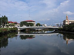
The Panay River (known as Pan-ay River) is the longest river on Panay Island in the Philippines, with a total length of approximately 152 kilometres (94 mi)[1] and a drainage basin area of 2,203.76 square kilometres (850.88 sq mi).[2] It drains almost the entire province of Capiz and northern portion of Iloilo province.
The source of the Panay River is on the slopes of Mount Igabon–Mount Angas Mountain Range. Starting in Tapaz, it runs southward and changing its direction toward east-northeast to Dumalag and Cuartero, then traversing north through the municipalities of Dao and Panitan. In Panay the river splits, with the primary branch emptying into the Sibuyan Sea at Roxas City.[2]
Remove ads
Tributaries
The main tributaries of the river are the Tapaz River and Mambusao River on the left and the Badbaran River and Maayon River on the right.[1]
Panay River list of tributaries by length:
Remove ads
References
External links
Wikiwand - on
Seamless Wikipedia browsing. On steroids.
Remove ads


