Olette
Commune in Occitania, France From Wikipedia, the free encyclopedia
Olette (French pronunciation: [ɔlɛt] ⓘ; Catalan: Oleta i Èvol) is a commune in the Pyrénées-Orientales department in southern France.[3] Its village of Évol is a member of Les Plus Beaux Villages de France (The Most Beautiful Villages of France) Association.
Olette | |
|---|---|
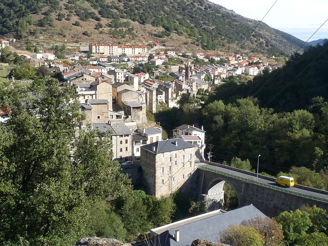
 A general view of Olette | |
| Coordinates: 42°33′22″N 2°16′14″E | |
| Country | France |
| Region | Occitania |
| Department | Pyrénées-Orientales |
| Arrondissement | Prades |
| Canton | Les Pyrénées catalanes |
| Government | |
| • Mayor (2020–2026) | Jean-Louis Jallat[1] |
Area 1 | 28.95 km2 (11.18 sq mi) |
| Population (2022)[2] | 337 |
| • Density | 12/km2 (30/sq mi) |
| Time zone | UTC+01:00 (CET) |
| • Summer (DST) | UTC+02:00 (CEST) |
| INSEE/Postal code | 66125 /66360 |
| Elevation | 563–2,361 m (1,847–7,746 ft) (avg. 630 m or 2,070 ft) |
| 1 French Land Register data, which excludes lakes, ponds, glaciers > 1 km2 (0.386 sq mi or 247 acres) and river estuaries. | |
Geography
Olette is located in the canton of Les Pyrénées catalanes and in the arrondissement of Prades. Olette-Canaveilles-les-Bains station has rail connections to Villefranche-de-Conflent and Latour-de-Carol.

Demography
Graphs are unavailable due to technical issues. Updates on reimplementing the Graph extension, which will be known as the Chart extension, can be found on Phabricator and on MediaWiki.org. |
| Year | Pop. | ±% p.a. |
|---|---|---|
| 1968 | 680 | — |
| 1975 | 544 | −3.14% |
| 1982 | 532 | −0.32% |
| 1990 | 447 | −2.15% |
| 1999 | 345 | −2.84% |
| 2007 | 401 | +1.90% |
| 2012 | 393 | −0.40% |
| 2017 | 364 | −1.52% |
| Source: INSEE[4] | ||

See also
References
Wikiwand - on
Seamless Wikipedia browsing. On steroids.


