Nuevo, Naranjito, Puerto Rico
Barrio of Puerto Rico From Wikipedia, the free encyclopedia

Nuevo is a barrio in the municipality of Naranjito, Puerto Rico. Its population in 2010 was 4,004.[3][4][5]
Nuevo | |
|---|---|
Barrio | |
 View from Barrio Nuevo | |
 Location of Nuevo within the municipality of Naranjito shown in red | |
 Nuevo Location of Puerto Rico | |
| Coordinates: 18°17′12″N 66°13′25″W[1] | |
| Commonwealth | Puerto Rico |
| Municipality | Naranjito |
| Area | |
• Total | 3.17 sq mi (8.2 km2) |
| • Land | 3.16 sq mi (8.2 km2) |
| • Water | 0.01 sq mi (0.03 km2) |
| Elevation | 981 ft (299 m) |
| Population (2010) | |
• Total | 4,004 |
| • Density | 1,267.1/sq mi (489.2/km2) |
| Source: 2010 Census | |
| Time zone | UTC−4 (AST) |
| Zip code | 00719 |
History
Nuevo was in Spain's gazetteers[6] until Puerto Rico was ceded by Spain in the aftermath of the Spanish–American War under the terms of the Treaty of Paris of 1898 and became an unincorporated territory of the United States. In 1899, the United States Department of War conducted a census of Puerto Rico finding that the population of Nuevo barrio was 1,081.[7]
Sectors
Barrios (which are, in contemporary times, roughly comparable to minor civil divisions)[13] in turn are further subdivided into smaller local populated place areas/units called sectores (sectors in English). The types of sectores may vary, from normally sector to urbanización to reparto to barriada to residencial, among others.[14][15][16]
The following sectors are in Nuevo barrio:[17][18]
Camino Don Manolo, Camino González Mathews, Camino Los Matos, Eusebio Rivera, Parcelas Hevia, Sector Aponte, Sector Bernard, Sector Bunker Hills, Sector Cabrera, Sector Cintrón, Sector Cuadrado, Sector Doña Bacha, Sector Entrada Guadiana, Sector Febus, Sector Hevia, Sector Hogar Crea, Sector La Tosca, Sector Loma del Viento, Sector Martínez, Sector Matadero, Sector Mulitas, Sector Negrón, Sector Ortega, Sector Puente Plata, Sector Santa María (antes Villa Embrolla), Sector Siete Curvas, Sector Sostre, Urbanización Campo Bello, Urbanización Valle Verde, and Villa del Plata.
Hurricane Maria
After Hurricane Maria struck the island of Puerto Rico, residents of Nuevo barrio waited 7 to 8 months to have electrical power restored.[19] Several landslides affected this barrio along PR-5. Work was completed with FEMA funds in October 2021 to stabilize and make the highway safe.[20]
Gallery
 Puerto Rico Highway 815 in Barrio Nuevo
 Puerto Rico Highway 8126 in Barrio Nuevo
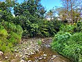 Quebrada Anones in Barrio Nuevo


See also
References
Wikiwand - on
Seamless Wikipedia browsing. On steroids.