Noordpeene
Commune in Hauts-de-France, France From Wikipedia, the free encyclopedia
Noordpeene (Dutch: Noordpene, West Flemish: Nôordpene) is a commune in the Nord department, Hauts-de-France, France.[3]
Noordpeene | |
|---|---|
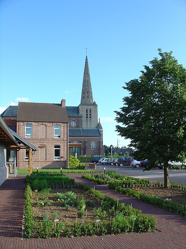
 The church in Noordpeene | |
| Coordinates: 50°48′23″N 2°23′53″E | |
| Country | France |
| Region | Hauts-de-France |
| Department | Nord |
| Arrondissement | Dunkerque |
| Canton | Wormhout |
| Intercommunality | CC Flandre Intérieure |
| Government | |
| • Mayor (2020–2026) | Thierry Dehondt-Bedague[1] |
| Area 1 | 17.12 km2 (6.61 sq mi) |
| Population (2021)[2] | 800 |
| • Density | 47/km2 (120/sq mi) |
| Demonym | Noordpéenois·e |
| Time zone | UTC+01:00 (CET) |
| • Summer (DST) | UTC+02:00 (CEST) |
| INSEE/Postal code | 59436 /59670 |
| Elevation | 0–68 m (0–223 ft) (avg. 27 m or 89 ft) |
| 1 French Land Register data, which excludes lakes, ponds, glaciers > 1 km2 (0.386 sq mi or 247 acres) and river estuaries. | |
The small river Peene Becque flows through the village.
Heraldry
 |
The arms of Noordpeene are blazoned : Argent, 5 fusils conjoined in bend gules. (probably not heraldically different from West-Cappel)
|
See also
References
External links
Wikiwand in your browser!
Seamless Wikipedia browsing. On steroids.
Every time you click a link to Wikipedia, Wiktionary or Wikiquote in your browser's search results, it will show the modern Wikiwand interface.
Wikiwand extension is a five stars, simple, with minimum permission required to keep your browsing private, safe and transparent.


