Nijbroek
Village in Gelderland, Netherlands From Wikipedia, the free encyclopedia
Nijbroek is a village in the Dutch province of Gelderland. It is located in the municipality of Voorst, about 12 km northeast of Apeldoorn.
Nijbroek | |
|---|---|
 Street view | |
 Coat of arms | |
 Nijbroek Location in the Netherlands  Nijbroek Nijbroek (Netherlands) | |
| Coordinates: 52°17′34″N 6°3′45″E | |
| Country | Netherlands |
| Province | Gelderland |
| Municipality | Voorst |
| Area | |
• Total | 20.16 km2 (7.78 sq mi) |
| Elevation | 4 m (13 ft) |
| Population (2021)[1] | |
• Total | 930 |
| • Density | 46/km2 (120/sq mi) |
| Time zone | UTC+1 (CET) |
| • Summer (DST) | UTC+2 (CEST) |
| Postal code | 7397[1] |
| Dialing code | 0571 |
Nijbroek was a separate municipality until 1818, when it was merged with Voorst.[3]
History
It was first mentioned in 1328 as Niebroeck, and means "new swampy land".[4] In 1328, Reginald II, Duke of Guelders ordered the cultivation and poldering of the area. In 1339, the village became a parish. A church was in the 14th century, and the tower was enlarged in the 16th century.[5] Fransenburg was built in the 14th century as a monastery. It is named after Frans van Apeldoorn who became the proprietor in 1658 and turned it into a castle. The castle was demolished before 1810.[6] In 1840, Nijbroek was home to 713 people.[6]
Gallery
 Reformed church in Nijbroek
 Fransenburg
 Farm in Nijbroek
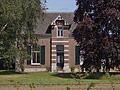 Villa in Nijbroek


References
Wikiwand - on
Seamless Wikipedia browsing. On steroids.