Nettetal
Town in North Rhine-Westphalia, Germany From Wikipedia, the free encyclopedia
Nettetal (German pronunciation: [ˈnɛtəˌtaːl], lit. 'Nette Valley') is a municipality in the district of Viersen, North Rhine-Westphalia, Germany. It is situated in the Lower Rhine region.
Nettetal | |
|---|---|
 Krickenbeck Castle | |
Location of Nettetal within Viersen district  | |
| Coordinates: 51°19′N 6°17′E | |
| Country | Germany |
| State | North Rhine-Westphalia |
| Admin. region | Düsseldorf |
| District | Viersen |
| Founded | 1970 |
| Subdivisions | 6 boroughs |
| Government | |
| • Mayor (2020–25) | Christian Küsters[1] |
| Area | |
• Total | 84 km2 (32 sq mi) |
| Elevation | 38 m (125 ft) |
| Population (2023-12-31)[2] | |
• Total | 43,425 |
| • Density | 520/km2 (1,300/sq mi) |
| Time zone | UTC+01:00 (CET) |
| • Summer (DST) | UTC+02:00 (CEST) |
| Postal codes | 41334 |
| Dialling codes | 02153, 02157, 02158 |
| Vehicle registration | VIE, KK |
| Website | www.nettetal.de |
History

Nettetal was founded on January 1, 1970, when the former townships Leuth, Breyell, Hinsbeck and former towns/cities Lobberich and Kaldenkirchen were merged. All five communities had developed around the river Nette.
Nettetal originally contained five boroughs, until Schaag separated from Breyell in 1995, becoming the sixth borough.
At the time of its formation, it was considered too problematic to try and combine all five coats of arms into one, so a new coat of arm was introduced in 1971. It shows a water lily before a blue blackground, symbolizing the predominance of nature and the variety of lakes. Five water lily leaves represent the five founding boroughs of Nettetal.
Demographics

Nettetal's six boroughs, with populations per its own census, as of December 2020:[3]
| Borough | Population | Area (km2) |
|---|---|---|
| Lobberich | 14,067 | 17.64 |
| Kaldenkirchen | 10,025 | 15.24 |
| Breyell | 8,589 | 11.85 |
| Hinsbeck | 4,632 | 18.98 |
| Schaag | 3,741 | 6.95 |
| Leuth | 1,796 | 13.21 |
| Total Nettetal | 42,850 | 83.87 |
Geography
Nettetal is located in the middle of the cross-border Maas-Schwalm-Nette Nature Park, along the border with the Netherlands (the northwest edges of Kaldenkirchen and Leuth touch the border), approximately 20 km (12 mi) north-west of Mönchengladbach, Germany, and 10 km (6.2 mi) south-east of Venlo, Netherlands.
In addition to the river Nette, peat mining from the 16th to the 19th century has resulted in the formation of twelve lakes in the municipality.
The Nette, broad forest, heath areas and lakes make Nettetal a central resort in the Maas-Schwalm-Nette Nature Park.
Lakes
Nettetal features 12 lakes, with a combined area of 179 hectares (440 acres).
Fed by the Nette:
- Kleiner Breyeller See (5.3 ha)
- Großer Breyeller See (9.2 ha)
- Nettebruch (13.2 ha)
- Windmühlenbruch (6 ha)
- Ferkensbruch (4.5 ha)
- Kleiner de Wittsee (4.5 ha)
- Großer de Wittsee (22.5 ha)
- Schrolik (15.5 ha)
- Poelvennsee (24.5 ha)
Fed by the Nette's Renne tributary:
- Hinsbecker Bruch (37.5 ha)
- Glabbacher Bruch (36 ha)
Fed by the Nette's Königsbach tributary:
- Kälberweide (5 ha)
Sights


- The 11th century Krickenbeck Castle and its park, set in the Leuth borough, surrounded by the Hinsbecker Bruch, Glabbacher Bruch, Schrolik and Poelvennsee lakes
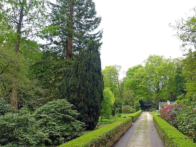
- The Kaldenkirchen Sequoia Farm, in the Kaldenkirchen borough, an arboretum with Giant Sequoias and more than 400 other varieties of trees, part of the "Protected area of Maas-Schwalm-Nette"
- A portion of the 100 km-long (62 mi) Fietsallee am Nordkanal, an international long-distance cycling route between Neuss, Germany, and Nederweert, Netherlands
- The 11.2 km-long (7.0 mi) Galgenvenn hiking trail, voted "Germany's second most beautiful hiking trail" in 2016[4]
Twin towns – sister cities
 Ełk, Poland
 Fenland, England, United Kingdom
 Rives-en-Seine, France
Notable people

- Leo Anton Karl de Ball (1853–1916), German-Austrian astronomer
- Werner Jaeger (1888–1961), classicist
- Michael Hardt (born 1951), designer
- Sascha Lappessen (born 1970), DJ and bandleader
- Tuğrul Erat (born 1992), Azerbaijani footballer
References
External links
Wikiwand - on
Seamless Wikipedia browsing. On steroids.


