Neighborhoods in Worcester, Massachusetts
From Wikipedia, the free encyclopedia
The city of Worcester, Massachusetts consists of six regions: North Worcester, West Side, East Side, Central City, Downtown, and South Worcester. It can be further subdivided into smaller neighborhoods:[1]
| North Worcester | West Side | East Side | Central | Downtown | South Worcester |
|---|---|---|---|---|---|
| Greendale | Forest Grove | Great Brook Valley | Elm Park | Lincoln Square[2] | Webster Square |
| Burncoat | Salisbury Street | Booth Apartments Area | Crown Hill/Piedmont | Federal Square[2] | South Worcester (proper) |
| Indian Hill | Tatnuck | Brittan Square | Main Middle | Worcester Common | Cambridge Street[2] |
| Indian Lake East | West Tatnuck | Biotech Park Area | Beacon Brightly | Hadwen Park | |
| North Lincoln Street | Mill Street[2] | Green Hill Park[3] | University Park | Main South[2] | |
| The Summit[4] | Newton Square | Bell Hill | Lincoln Estate | Green Island | |
| Beaver Brook Area | Laurel/Clayton | Canal District[5] | |||
| Cider Mill | Shrewsbury Street | Kelley Square/Water Street[2] | |||
| Columbus Park | Lake Park | College Hill | |||
| Worcester Regional Airport[2] | Franklin/Plantation | Broadmeadow Brook | |||
| Mass Ave | Hamilton | Quinsigamond Village | |||
| Montvale | Union Hill | ||||
| Hammond Heights | Grafton Hill | ||||
| Vernon Hill |
Others:
- Sunderland/Massasoit Road/Rice Square spans Union Hill, Grafton Hill, and Broadmeadow Brook.[2]
- Lake Avenue/Quinsigamond Lake spans several neighborhoods in South Worcester and East Worcester.[2]
- Park Ave skirts the eastern edge of West Worcester.[2]
- The Edgemere neighborhood is primarily in neighboring Shrewsbury, Massachusetts.[2]
- The Arts District spans several neighborhoods in Central City.[3]
Photo gallery
Central


 Wellington Street


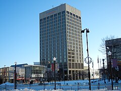
Downtown
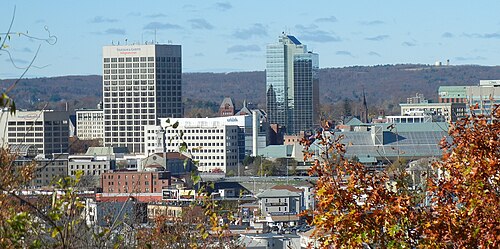 Downtown Skyline
 Federal Square
 Harrington Corner
 Lincoln Square
 Union Station/ Washington Square


East Side
 Houghton Street

 UMass Memorial Medical Center


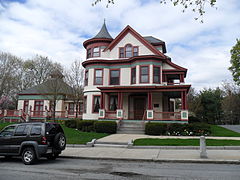
North Worcester
 Greendale
 Worcester Country Club
 Odd Fellows' Home
 Dodge Park


South Worcester


 St. Matthews (Southbridge Street)


West Side

 Lenox Street
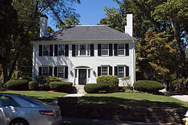

 Tatnuck School
 Westwood Hills


References
Wikiwand - on
Seamless Wikipedia browsing. On steroids.