Top Qs
Timeline
Chat
Perspective
Munshiganj District
District of Bangladesh in Dhaka From Wikipedia, the free encyclopedia
Remove ads
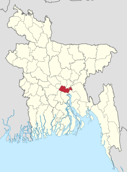
Munshiganj District (Bengali: মুন্সীগঞ্জ জেলা) is a district of Dhaka Division. It is located in central Bangladesh. This region is also historically known as Bikrampur.[5]
Remove ads
Remove ads
Geography
It is a part of Dhaka Division and borders Dhaka District and Narayanganj District in the north, Madaripur District and Shariatpur District in the south, Chandpur District and Comilla District in the east and Dhaka District and Faridpur District in the west. [6]
Total land area is 235,974 acres (954 km2), out of which 138472 acres (560 km2) are cultivable and 5609 acres (23 km2) are fallow land. It has no forest area. 40,277 acres (163 km2) of land is irrigated while 26,242 acres (106 km2) of land is under river. It has 14 rivers of 155 km passing through.[citation needed]
Water bodies
Main rivers include the Padma River, Meghna River, Dhaleswari River and the Ichamati River.[6]
Remove ads
Boating
Boating is one of the traditions of the people in Munshiganj District. A traditional boat race is held in the Dhaleshwari River which thousands of people come to see. The boat race was held in a 3 km area from the Mirkadim Municipality to Munshiganj launch harbor. Boats with 60 oarsmen, 50 oarsmen and 25 oarsmen participate in the competition every year[7]
Administration
It consists of 6 upazilas, 67 union parishads, 603 wards, 662 mouzas, 906 villages, 73 mahallas and 2 municipalities.[8]
The district consists of 6 upazilas:[6]
Demographics
Summarize
Perspective
According to the 2022 Census of Bangladesh, Munshiganj District had 399,631 households and a population of 1,625,416 with an average 3.98 people per household. Among the population, 303,978 (18.70%) inhabitants were under 10 years of age. The population density was 1,702 people per km2. Munshiganj District had a literacy rate (age 7 and over) of 77.90%, compared to the national average of 74.80%, and a sex ratio of 1,061 females per 1,000 males. Approximately, 18.09% of the population lived in urban areas. The ethnic population was 4,808.[3][2]
Religion
92.34% are Muslims, 7.52% Hindus.
Remove ads
Notable people
Summarize
Perspective
Revolutionary nationalists
- M. Hamidullah Khan, Bangladesh Forces, Sector Commander, Sector 11, Bangladesh War of Independence 1971[11]
Social and scientific
- Sir Jagadish Chandra Bose, Bengali biologist, physicist and botanist[12]
- Chashi Nazrul Islam, filmmaker
- Humayun Azad, linguist, poet and novelist[13]
- Aasif Ridwan Khan, Bangladeshi architect
- Nurul Kabir, journalist, writer and editor of New Age (Bangladesh)
Art, culture and sports
- AKM Nowsheruzzaman, national football player
- Atiśa, Buddhist religious leader and master
- Brojen Das, the first Bangladeshi and Asian to swim across the English Channel, and the first person to cross it four times
- Alauddin Ali, music composer and director
- Imdadul Haq Milan, writer
- Buddhadeb Bosu, writer, poet, playwright, essayist
- Ananta Jalil, actor, director, producer, businessman, and philanthropist
- Tahsan Rahman Khan, singer-songwriter, composer, actor and model.
- Tele Samad, actor
- Azmeri Haque Badhon, actress, dentist
- Shimul Yousuf, actress, singer
- Nazma Anwar, actor
- Pratap Shankar Hazra, national football and hockey player
- Sharifuzzaman, national football player
Public affairs
- A. N. M. Hamidullah, first governor, Bangladesh Bank [14]
- Fakhruddin Ahmed, Chief Adviser of the non-political 2007-2008 Caretaker government of Bangladesh.[15]
- Iajuddin Ahmed, President of Bangladesh
- A.Q.M. Badruddoza Chowdhury, President of Bangladesh
- M. A. Naser, engineering educator, Vice Chancellor of BUET, Ekushey Padak recipient
Remove ads
See also
Notes
- Including Jainism, Christianity, Buddhism, Zoroastrianism, Judaism, Ad-Dharmis, or not stated
References
Wikiwand - on
Seamless Wikipedia browsing. On steroids.
Remove ads


