Mira-Bhayandar
Place in Maharashtra, India From Wikipedia, the free encyclopedia
Mira-Bhayandar is a city and municipal corporation in Thane district in the state of Maharashtra, India located in the northern part of Salsette Island before the Vasai Creek, and shares a border with North Mumbai. Mira-Bhayandar is administered by Mira-Bhayandar Municipal Corporation (MBMC), with a population at the 2011 Census of 809,378. Mira-Bhayandar is a part of Mumbai Metropolitan Region (MMR) and Mira-Bhayander, Vasai-Virar (MBVV) Police Commissionerate.
Mira-Bhayandar | |
|---|---|
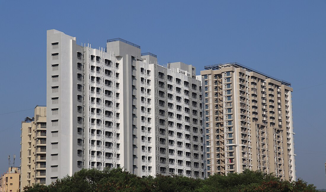
High-rise residential apartments in Mira Road | |
| Coordinates: 19.29°N 72.85°E | |
| Country | |
| State | Maharashtra |
| District | Thane |
| Government | |
| • Type | Municipal Corporation |
| • Body | Mira-Bhayandar Municipal Corporation |
| • Mayor | Vacant |
| • Deputy Mayor | Vacant |
| • Municipal Commissioner | Sanjay Shripatrao Katkar |
| • Police Commissioner | Madhukar Pande, IPS[1] |
| Area | |
| • Total | 79.4 km2 (30.7 sq mi) |
| Population (2011) | |
| • Total | 809,378 |
| • Density | 10,000/km2 (26,000/sq mi) |
| Language | |
| • Official | Marathi |
| Time zone | UTC+5:30 (IST) |
| PIN | |
| Telephone code | 022 |
| Vehicle registration | MH-04 |
| Sex ratio | 1.22:1 ♂/♀ |
| Website | www |
History
The Mira-Bhayandar Municipal Council was formed on 12 June 1985 by incorporating all the village Gram Panchayats. Consequently, MBMC obtained an administrative officer and a chief officer to look after the affairs of the area after the term of the elected representatives ceased and elections were delayed owing to the COVID-19 pandemic.
MBMC is currently run by an administrator appointed by the State Government of Maharashtra.
Demographics
| Year | Pop. | ±% p.a. |
|---|---|---|
| 1951 | 6,327 | — |
| 1961 | 6,974 | +0.98% |
| 1971 | 10,598 | +4.27% |
| 1981 | 25,646 | +9.24% |
| 1991 | 175,605 | +21.21% |
| 2001 | 520,388 | +11.48% |
| 2011 | 809,378 | +4.52% |
| Source: Government of India[3] | ||
The 2011 India census recorded a population of 809,378[4] in Mira-Bhayandar. According to the Indian Census data, the majority of the population are Hindus followed by Muslims and Christians.
Mira-Bhayandar has two dominant languages with large Marathi community residing in most of the suburbs of Northern Mumbai that stretches from Bhayander to Bandra, it is also shown in the linguistic demography of the suburb, while the official language is also Marathi is spoken by the natives of the land and migrants from other parts of Maharashtra with English is the main language of communication and in trade and commerce in the suburban region of Mumbai and Mumbai Metropolitan region, is spoken by most of the migrants as their native language. Marathi, the official language, is the mother tongue of 55.13% mostly in Uttan and Gorai area, while the dominant language, Gujarati is mother tongue by 20.50% of the population and Hindi by 15.90% as their mother tongue. Marathi is by far the major language spoken as the language of communication by all the people living in the suburbs and metropolitan area of Mumbai as their language of communication.[5]
Economy
Economic growth is led by the manufacturing sector. Bhayandar is divided into two parts by the Mumbai suburban rail line - East and West. Mira Road has seen development only in the East part, while the West part, on the other side of the railway line is covered with salt pans and mangroves. Mira Road East is a predominantly residential area. Its calm, quiet surroundings and low pollution make it a desirable residential oasis.
Bhayandar West was traditionally residential, and the East predominantly an industrial area in the field of steel utensils manufacturing. Recent population growth and a flurry of construction has blurred the boundaries between Bhayandar and neighboring Mira Road on the East side of the rail tracks, turning it into a populous suburb. Government-owned Salt Pans and marshland in West Mira Road have restricted the southward spread of Bhayandar. There is a lot of scope for development of this land as it has the potential to house a large industrial complex.
Neighborhoods
- Indralok Phase 1
- Indralok Phase 2
- Indralok Phase 3
- Mira Road
- Bhayandar
- Uttan
- Kashimira
- Bhayandar East
- Bhayandar West
- Mira Road East
- Naya Nagar
- Sheetal Nagar
- Shanti Nagar
- Kanakia
- Beverley
- Shivar Garden
- Queens Park
- Golden nest Phase 1 to 7
- Srishti
- Ramdev Park
- Medtiya Nagar
- Pleasant Park
- Vinay Park
- Penkarpada
- Gcc Club
- Mira gaon
- Bhayandar Flyover
- Bhayandar Khadi
- Jesal park
- Bhayandar railway Station
- Bhayandar Subway
- Bhayandar Creek Bridge
References
External links
Wikiwand in your browser!
Seamless Wikipedia browsing. On steroids.
Every time you click a link to Wikipedia, Wiktionary or Wikiquote in your browser's search results, it will show the modern Wikiwand interface.
Wikiwand extension is a five stars, simple, with minimum permission required to keep your browsing private, safe and transparent.


