Midwoud
Village in North Holland, Netherlands From Wikipedia, the free encyclopedia

Midwoud is a village in the Dutch province of North Holland. It is a part of the municipality of Medemblik, and lies about 7 km north of Hoorn.
Midwoud | |
|---|---|
Village | |
 Former town hall | |
 Coat of arms | |
 Midwoud Location in the Netherlands  Midwoud Location in the province of North Holland in the Netherlands | |
| Coordinates: 52°43′N 5°4′E | |
| Country | Netherlands |
| Province | North Holland |
| Municipality | Medemblik |
| Area | |
• Total | 5.84 km2 (2.25 sq mi) |
| Elevation | −1.5 m (−4.9 ft) |
| Population (2021)[1] | |
• Total | 2,415 |
| • Density | 410/km2 (1,100/sq mi) |
| Time zone | UTC+1 (CET) |
| • Summer (DST) | UTC+2 (CEST) |
| Postal code | 1679[1] |
| Dialing code | 0229 |
History
The village was first mentioned around 1312 as Midwoude, and means "middle forest". Middle is used, because it is located between Oostwoud and Nibbixwoud.[3] Midwoud developed in the Late Middle Ages as a peat excavation settlement.[4]
In 1984, the Dutch Reformed church burnt down, and only the neoclassic church tower from 1867 remained. A new church was built in 1987 near the old church leaving the tower detached.[4]
Midwoud was home to 218 people in 1840. It was an independent municipality. In 1979, the area of that municipality became part of Noorder-Koggenland and Wognum. In 1990, houses were built in the area between Midwoud and Oostwoud, thus forming a single build-up area. In 2007, it became part of the municipality of Medemblik.[5]
Gallery
 Farm in Midwoud
 Church tower of Midwoud
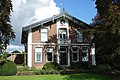 Former mayor's residence
 House in Midwoud


References
Wikiwand - on
Seamless Wikipedia browsing. On steroids.