Melgaço, Portugal
Municipality in the district of Viana do Castelo, Portugal From Wikipedia, the free encyclopedia
Municipality in the district of Viana do Castelo, Portugal From Wikipedia, the free encyclopedia
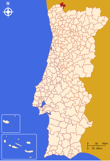
Melgaço (Portuguese pronunciation: [ˌmɛlˈɣasu] ) is a municipality in the district of Viana do Castelo in Portugal. The population in 2011 was 9,213,[1] in an area of 238.25 km2.[2] It is the northernmost municipality in Portugal.
Melgaço | |
|---|---|
 The view of the town of Melgaço within the valleys of the Minho River | |
 | |
| Coordinates: 42°06′N 8°15′W | |
| Country | |
| Region | Norte |
| Intermunic. comm. | Alto Minho |
| District | Viana do Castelo |
| Parishes | 13 |
| Government | |
| • President | Manoel Batista (PS) |
| Area | |
| • Total | 238.25 km2 (91.99 sq mi) |
| Population (2011) | |
| • Total | 9,213 |
| • Density | 39/km2 (100/sq mi) |
| Time zone | UTC+00:00 (WET) |
| • Summer (DST) | UTC+01:00 (WEST) |
| Website | http://www.cm-melgaco.pt |
The present Mayor is Manoel Batista, elected by the Socialist Party. The municipal holiday is Ascension Day.
Melgaço is certified by the EarthCheck Sustainable Destinations program.[3][4]
Parada do Monte, Gave and the plateau of Castro Laboreiro were locations of many megalithic burial mounds and graves that suggest the presence of human settlement in the mountains of the region.[5] Alongside is the hilltop castle, that stood firm during the Galician-Leonese battles.[5]
Over the streams they built bridges in solid masonry, while dozens of fishing villages sprung from the banks of the River Minho, in addition to the Romanesque convents, churches and chapels, some of which are quite Romanesque.[5] Oral tradition suggest that the castle of Melgaço was constructed during the reign of King D. Afonso Henriques, around 1170.[5] It was this monarch that conceded to Melgaço the first forum letter, between 1183 and 1185, that was later confirmed by King D. Afonso in 1219, and replaced by a Foral (charter) issued by King D. Afonso III, in 1258. The existence of a forum letter suggests that some settlement existed on the site.[5]
The hilltop of Melgaço, overlooking the Minho River, was strategically located enroute to Galicia, in addition to terrestrial commercial routes. In the neighbourhood were the protectorates of two great monasteries, in Fiães and Paderne.[5] The small burg required further protection from Leonese forces, resulting in the construction of a larger structure, on a site that would later be erected the keep tower. It was during the reign of King D. Sancho II that the town began to be encircled by a defensive fortification.[5] Its need was already evident in the reign of King D. Afonso II, during the politico-military battles that were motivated by the monarch's struggles with his sisters.[5] Between 1211 and 1212, the north of Portugal was invaded by Leonese forces, justifying the construction of the wall, which was already under construction by 1245, with the help of local initiatives and the convent of Fiães.[5]

Administratively, the municipality is divided into 13 civil parishes:[6]
| Climate data for Portelinha, altitude: 1,018 m (3,340 ft), 1985-2021 | |||||||||||||
|---|---|---|---|---|---|---|---|---|---|---|---|---|---|
| Month | Jan | Feb | Mar | Apr | May | Jun | Jul | Aug | Sep | Oct | Nov | Dec | Year |
| Average precipitation mm (inches) | 229.8 (9.05) |
197.5 (7.78) |
121.9 (4.80) |
159.4 (6.28) |
113.4 (4.46) |
63.7 (2.51) |
39.3 (1.55) |
33.7 (1.33) |
90.1 (3.55) |
243.5 (9.59) |
226.7 (8.93) |
226.5 (8.92) |
1,745.5 (68.75) |
| Source: Portuguese Environment Agency[7] | |||||||||||||
Seamless Wikipedia browsing. On steroids.
Every time you click a link to Wikipedia, Wiktionary or Wikiquote in your browser's search results, it will show the modern Wikiwand interface.
Wikiwand extension is a five stars, simple, with minimum permission required to keep your browsing private, safe and transparent.