Madison Township, Allen County, Indiana
Township in Indiana, United States From Wikipedia, the free encyclopedia
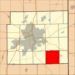
Madison Township is one of twenty townships in Allen County, Indiana, United States. As of the 2020 census, its population was 1,659.[2]
Madison Township | |
|---|---|
 Location in Allen County, Indiana | |
| Coordinates: 40°57′33″N 84°56′28″W | |
| Country | |
| State | Indiana |
| County | Allen |
| Government | |
| • Type | Indiana township |
| Area | |
• Total | 36.58 sq mi (94.75 km2) |
| • Land | 36.58 sq mi (94.75 km2) |
| • Water | 0 sq mi (0 km2) 0% |
| Elevation | 807 ft (246 m) |
| Population | |
• Total | 1,659 |
| • Density | 48/sq mi (18.7/km2) |
| ZIP codes | 46733, 46745, 46773, 46816 |
| GNIS feature ID | 0453587 |
Geography
According to the United States Census Bureau, Madison Township covers an area of 36.58 square miles (94.75 km2).[3]
Unincorporated towns
- Boston Corner at 40.948381°N 84.900243°W
- Hoagland at 40.947826°N 84.991634°W
(This list is based on USGS data and may include former settlements.)
Adjacent townships
- Jefferson Township (north)
- Jackson Township (northeast)
- Monroe Township (east)
- Union Township, Adams County (southeast)
- Root Township, Adams County (south)
- Preble Township, Adams County (southwest)
- Marion Township (west)
- Adams Township (northwest)
Four Presidents Corners, a monument, was built in 1917 where Madison Township meets with Monroe, Jackson, and Jefferson townships.[4][5] All four townships are named after presidents.

Cemeteries
The township contains Massilon Cemetery and Pleasant Valley Cemetery.
Airports and landing strips
- Valhalla Airport
Landmarks
School districts
- East Allen County Schools
Political districts
- Indiana's 3rd congressional district
- State House District 79
- State Senate District 14
References
Wikiwand - on
Seamless Wikipedia browsing. On steroids.
