Lista (Madrid)
City neighborhood in Madrid, Community of Madrid, Spain From Wikipedia, the free encyclopedia
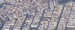
Lista is an administrative neighborhood (barrio) of Madrid belonging to the district of Salamanca. It has an area of 0.520399 km2 (0.200927 sq mi).[1] As of 1 March 2020, it has a population of 21,362.[2] The Hospital Universitario de la Princesa is located in the neighborhood.[3]
Lista | |
|---|---|
 | |
 | |
| Country | Spain |
| Region | Community of Madrid |
| Municipality | Madrid |
| District | Salamanca |
| Area | |
• Total | 0.520399 km2 (0.200927 sq mi) |
| Population (2020) | |
• Total | 21,362 |
| • Density | 41,000/km2 (110,000/sq mi) |
 | |
References
Wikiwand - on
Seamless Wikipedia browsing. On steroids.
