List of possible impact structures on Earth

From Wikipedia, the free encyclopedia

This list includes potential but unconfirmed structures that are not listed on the Earth Impact Database list of confirmed impact structures. For confirmed impact structures, see List of impact structures on Earth.

List of confirmed and possible impact structures

Summarize
Perspective

The following tables list geological features on Earth that are possible impact events, but for which there is currently no confirming scientific evidence in the peer-reviewed literature. In order for a structure to be confirmed as an impact crater, it must meet a stringent set of well-established criteria. Some proposed impact structures are likely to eventually be confirmed, whereas others are likely to be shown to have been misidentified (see below). Recent extensive surveys have been done for Australian (2005),[1] African (2014),[2] and South American (2015)[3] craters, as well as those in the Arab world (2016).[4] A book review by A. Crósta and U. Reimold disputes some of the evidence presented for several of the South American structures.[5]

More information Name, Location ...
Name Location Country Diameter (km) Age (Ma) Confirmed Notes Image Coordinates
38th Parallel structures Missouri, etc. United States 2-17 320 ± 10 [6]
Thumb
37.5°N 88.3°W / 37.5; -88.3 (Hicks Dome)
37.8°N 90.2°W / 37.8; -90.2 (Avon crater)
37.8°N 91.4°W / 37.8; -91.4 (Crooked Creek crater)
37.9°N 92.7°W / 37.9; -92.7 (Decaturville crater)
37.7°N 92.4°W / 37.7; -92.4 (Hazelgreen crater)
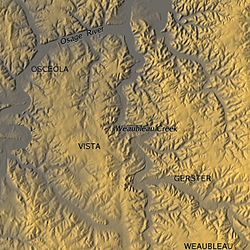
38.0°N 93.6°W / 38.0; -93.6 (Weaubleau-Osceola structure)
37.7°N 95.7°W / 37.7; -95.7 (Rose Dome)
Ak-Bura (Murgab) Tajikistan Tajikistan 0.080 0.0003
(1700 AD)
[7][8][9][10] 38°5′38.5″N 74°16′58″E
Al Madafi Tabuk Saudi Arabia 6 6-66 [11][12][13] 28.67°N 37.18°E / 28.67; 37.18 (Al Madafi)
Alamo bolide impact Nevada United States 100 ± 40 367 [14][15] [note 1] 37.31°N 116.18°W / 37.31; -116.18 (Alamo)
Anéfis Kidal Mali 3.9 23? [18][7][19][20] 18.072°N 0.048°W / 18.072; -0.048 (Anefis)
Arganaty Almaty Region Kazakhstan 300 250 [21][22][23][note 1] 46.5°N 79.8°E / 46.5; 79.8 (Arganaty)
Arlit Niger Niger 10  ? [24][25][26] 21.353°N 9.145°E / 21.353; 9.145 (Arlit)
Azuara Aragon Spain 35-40 30-40 [27]
Thumb
41°07′N 0°13′W
Bajada del Diablo Argentina Argentina 40 0.45 ± 0.3 [28][29][30] 42°49′S 67°28′W
Bajo Hondo Argentina Argentina 3.9 <10 [31][32] 42.295454°S 67.924133°W / -42.295454; -67.924133 (Bajo Hondo)
Bangui magnetic anomaly Bangui Central African Republic 600-800? >542 [33][2][34]
Thumb
6°N 18.3°E / 6; 18.3 (Bangui)
Bateke Plateau Gabon Gabon 7.1 <2.6 [35][36] 0°38′45″S 14°27′29″E
Bedout Australia (offshore) Australia 250 250 [37][38][1] 18°S 119°E
Bee Bluff Texas United States 2.4 40? [39][40][41][note 1] 29.03°N 99.85°W / 29.03; -99.85 (Bee Bluff)
Björkö Björkö, Ekerö Sweden 10 1200 [42][43] 59.30°N 17.60°E / 59.30; 17.60 (Björkö)
Bloody Creek Nova Scotia Canada 40  ? [44] 44°45′N 65°14′W
Bohemian Czech Republic Czech Republic 260-300 >700? [45][7][46][47] 50.0°N 14.7°E / 50.0; 14.7 (Bohemian)
Bow City Alberta Canada 8 70 [48] 50°25′N 112°16′W
Bowers Antarctic Ocean (Ross Sea) 100 3-5 [49][50][51][52] 71.2°S 176°E / -71.2; 176 (Bowers)
Brushy Creek Feature Louisiana United States 2.0 0.011–0.030 [53][54][55][56] 30.76°N 90.73°W / 30.76; -90.73 (Brushy Creek Feature)
Bukit Bunuh Perak Malaysia 5–6 1.34–1.84 [57][58] 5.075°N 100.975°E / 5.075; 100.975 (Bukit Bunuh)
Burckle Indian Ocean 30? 3000 BC [59][60][61] 30.86°S 61.36°E / -30.86; 61.36 (Burckle)
Catalina structures
(Navy, Catalina, Emery Knoll)
Pacific Ocean (NE) 12, 32, 37 16-18 [62][63][64] 32.91°N 118.09°W / 32.91; -118.09 (Catalina)
Cerro do Jarau Paraná Brazil 10 117 [65][66][67] 30°12′S 56°32′W
Charity Shoal Ontario Canada 1.2 <470 [68][69][70][71]
Thumb
44°2′15″N 76°29′37″W
Corossol Quebec Canada 4 <470 [72][73][74][75] 50°03′N 66°23′W
Darwin Crater Tasmania Australia 1.2 0.816 [76][note 1]
Thumb
42°19′S 145°40′E
Decorah Iowa United States 5.6 470 [77][78][79]
Thumb
43°18′50″N 91°46′20″W
Deniliquin New South Wales Australia 520 400–500 No 35°32′0″S 144°58′0″E
Diamantina River ring feature Queensland Australia 120 300 [80][81]
Thumb
22°09′S 141°54′E
Dumas magnetic anomaly Saskatchewan Canada 3.2 70 ± 5 [82][83] 49.92°N 102.12°W / 49.92; -102.12 (Dumas)
Duolun Inner Mongolia China 120 ± 50 129 ± 3 [84][85] 42°3′N 116°15′E
El-Baz Egypt Egypt 4  ? [86][87][88] 24°12′N 26°24′E
Eltanin Pacific Ocean (SE) 35? 2.5 [89][90][91][note 1] 57°47′S 90°47′W
Faya Basin Chad Chad 2 385 ± 15 [92][93] 18°10′N 19°34′E
Falkland Plateau anomaly Atlantic Ocean
(near Falkland Islands)
250-300 250 [94][95][96][97][98] 51°S 62°W
Fried Egg structure Atlantic Ocean (near Azores) 6 17 [99][100] 36°N 27°W
Garet El Lefet Libya Libya 3  ? [101][102][103] 25.0°N 16.5°E / 25.0; 16.5 ("Garet El Lefet")
Gatun Panama Panama 3 20 [104][105][106] 09°05′58″N 79°47′22″W
General San Martín Argentina Argentina 11 1.2 [107][108][109] 38°0′S 63°18′W
Gnargoo Western Australia Australia 75 <300 [110][111] 24°48′24″S 115°13′29″E
Guarda Structure Guarda Portugal 30 200 [112][113][114] 40°38′N 07°06′W
Hartney anomaly Manitoba Canada 8 120 ± 20 [115][83][116] 49.4°N 100.67°W / 49.4; -100.67 (Hartney)
Hico Texas United States 9 <60 [117][118][119] 32.01°N 98.03°W / 32.01; -98.03 (Hico)
Hotchkiss Alberta Canada 4 220 ± 100 [120][121] 57.539°N 118.878°W / 57.539; -118.878 (Hotchkiss)
Howell Tennessee United States 2.5 380 ± 10 [122][123][124] 35.23°N 86.61°W / 35.23; -86.61 (Howell)
Ibn-Batutah Libya Libya 2.5 120 ± 20 [125][126] 21°34′10″N 20°50′15″E
Ilumetsa Põlva County Estonia 0.08 0.0066
(<4600 BC)
[127][128] Thumb 57°57′N 27°24′E
Ishim Akmola region Kazakhstan 300 430-460 [129][130][131][note 1] 52°0′N 69°0′E
Iturralde Bolivia Bolivia 8.0 0.011–0.030 [132]
Thumb
12°35′S 67°40′W
Jackpine Creek magnetic anomaly British Columbia Canada 25 120 ± 20 [133][134] 55.6°N 120.1°W / 55.6; -120.1 (Jackpine)
Jalapasquillo Puebla Mexico 1.2 <10 [135][136] 19.2231°N 97.429°W / 19.2231; -97.429 (Jalapasquillo)
Jebel Hadid Libya Libya 4.7 <66 [137][138] 20°52′12″N 22°42′18″E
Jeptha Knob Kentucky United States 4.3 425 [139][note 1] 38°11′N 85°07′W
Johnsonville South Carolina United States 11 300? [140][7][141][note 1] 33°49′N 79°22′W
Jwaneng South Botswana Botswana 1.3 <66 [142][143] 24°42′S 24°46′E
Kebira Gilf Kebir Egypt 31 100 [144][145]
Thumb
24°40′N 24°58′E
Kilmichael Mississippi United States 13 45 [146][147][148][149] 33.5°N 89.55°W / 33.5; -89.55 (Kilmichael)
Krk Croatia Croatia 12 40 [150][151] 45.06°N 14.62°E / 45.06; 14.62 (Krk)
Kurai Basin Altai Region Russia 20 <200 [152][153] 50°12′N 87°54′E
La Dulce Argentina Argentina 2.8 0.445? [154][108] 38.21°S 59.21°W / -38.21; -59.21 (La Dulce)
Labynkyr Russia Russia 67 150? [155][7][156][157][note 1] 62.325°N 143.090°E / 62.325; 143.090 (Labynkyr)
Lac Iro Moyen-Chari Chad 13  ? [158][2][159]
Thumb
10°10′N 19°40′E
Lairg Gravity Low Scotland United Kingdom 40 1200 [160] 58°1′12″N 4°24′0″W
Lake Cheko Siberia Russia 50 0.0001
(1908 AD)
[161] 60.964°N 101.86°E / 60.964; 101.86 (Cheko)
Lake Tai (Tai Hu) Jiangsu China 70 ± 5 365 ± 5 [162][163][164] 31°14′N 120°8′E
Loch Leven Scotland United Kingdom 18x8 290 [165][166] 56°12′N 3°23′W
Lorne Basin New South Wales Australia 30 250 ± 2 [167][168] 31.60°S 152.62°E / -31.60; 152.62 (Lorne)
Lycksele 2 Sweden Sweden 130 1500 ± 300 [169][170][171] 64.92°N 18.78°E / 64.92; 18.78 (Lycksele)
Madagascar 3 Madagascar Madagascar 12  ? [172][173] 18.839°S 46.221°E / -18.839; 46.221 (Madagascar)
Magyarmecske anomaly Hungary Hungary 7 299 [174][175] 45.95°N 17.97°E / 45.95; 17.97 (Magyarmecske)
Mahuika New Zealand (offshore) New Zealand 20? 0.0006
(1400 AD)
[176][177][60] 48.3°S 166.4°E / -48.3; 166.4 (Mahuika)
Maniitsoq Greenland Greenland 100 3000 [178][179][180] 65°15′N 51°50′W
Mejaouda (El Mrayer) Mauritania Mauritania 3 <542? [181][7][103][19][182] 22.722°N 7.312°W / 22.722; -7.312 (Mejaouda)
Merewether Newfoundland Canada 20 0.0009
(1100 AD)
[183][184][note 1] 58.04°N 64.05°W / 58.04; -64.05 (Merewether)
Meseta de la Barda Negra Argentina Argentina 1.5 4 ± 1 [185][186] 39°10′S 69°53′W
Middle-Urals Ring Russia Russia 400–550 >542 [187][188][189] 56°N 56°E
Mistassini-Otish Quebec Canada 600 2200 [190][191] 50.57°N 73.42°W / 50.57; -73.42 (Mistassini lake)
Mount Ashmore dome Indian Ocean (in Timor Sea) >50 35 [192][193][194] 12.55°S 123.2°E / -12.55; 123.2
Mousso Borkou-Ennedi-Tibesti Chad 3.8 <542 [195][196] 17°58′N 19°53′E
Mt. Oikeyama Japan Japan 90 0.030? [197][198] 35.405°N 138.013°E / 35.405; 138.013 (Oikeyama)
Mulkarra South Australia Australia 17 105 [199][200] 27.85°S 138.92°E / -27.85; 138.92 (Mulkarra)
Nastapoka (Hudson Bay) arc Quebec Canada 450 1800? [201][7][202][203]
Thumb
57°00′N 78°50′W
Nadir Atlantic Ocean (Guinea Plateau, West Africa) ≥8.5 66 ± 0.8 [204] 9.4°N 17.1°W / 9.4; -17.1 (Nadir)
North Pole Crater Pilbara Craton, Western Australia Australia 100 3,470 [205][206] 21°02′54″S 119°23′35″E
Ouro Ndia Mali Mali 3 <2.6 [207][7][19] 14°59.8′N 4°30.0′W
Pantasma Nicaragua Nicaragua 10  ? [208] 13.37°N 85.95°W / 13.37; -85.95 (Pantasma)
Panther Mountain New York United States 10 375 [209][210][211]
Thumb
42°03′N 74°24′W
Peerless Montana United States 6 470 ± 10 [212][213] 48.8°N 105.8°W / 48.8; -105.8 (Peerless)
Piratininga Paraná Brazil 12 117 [214][66][215] 22°28′S 49°09′W
Praia Grande Santos Basin, offshore Brazil 20 84 [216][66][67] 25°39′S 45°37′W
Ramgarh Rajasthan India 3  ? [217][218][219][note 1]
Thumb
25°20′16″N 76°37′29″E
Rochechouart impact structure Rochechouart France 23 206.9 45°49′27″N 0°46′54″E
Ross Antarctic Ocean (Ross Sea) 600? <38 [220][50][221] 77.5°S 178.5°E / -77.5; 178.5 (Ross)
Rubielos de la Cérida Spain Spain 80x40 30-40 [222][223][224][note 1]
Thumb
40.783°N 1.25°W / 40.783; -1.25 (Rubielos)
Sakhalinka Pacific Ocean (NW) 12 70 [225][226][227][228][229] 30°15′N 170°03′E
São Miguel do Tapuio Piauí Brazil 22 120 [230][7][67][231][232][233] 5°37.6′S 41°23.3′W
Shanghewan Jilin China 30  ? [234][235][236] 44°29′N 126°11′E
Shiva Indian Ocean 500 66 [237] 18°40′N 70°14′E
Shiyli Kazakhstan Kazakhstan 5.5 46 ± 7 [238][239][note 1] 49°10′N 57°51′E
Silverpit Atlantic Ocean (North Sea) 20 60 ± 15 [240][241][242][243][244][245][246][247]
Thumb
54°14′N 1°51′E
Sirente Abruzzo Italy 10 0.0017
(320 ± 90 AD)
[248][249] 42°10′38″N 13°35′45″E
Sithylemenkat Lake Alaska United States 12 0.033? [250][251][252][253] 66°07′34″N 151°23′20″W
Smerdyacheye Lake Moscow Oblast Russia 20 0.01–0.03? [254][255] Thumb 55.735°N 39.823°E / 55.735; 39.823 (Smerdyacheye)
Sudan 1 (Red Sea Hills) Sudan Sudan 6  ? [256][257][258] 17°57.1′N 37°56.1′E
Sudan 2 (Bayuda) Sudan Sudan 10  ? [259][260][261]
Thumb
Mahas
Mahas
Bayuda
Bayuda
Red Sea Hills
Red Sea Hills
18°03.5′N 33°30.2′E
Sudan 3 (Mahas) Sudan Sudan 2.8  ? [citation needed] 20°01.9′N 30°13.7′E
Svetloyar Lake Nizhy Novgorod Russia 40 0.0026
(600 BC)
[262][263][note 1] Thumb 56.819°N 45.093°E / 56.819; 45.093 (Svetloyar)
Takamatsu Shikoku Japan 4-8 15 [264][265][266][267][268] 34.3°N 134.05°E / 34.3; 134.05 (Takamatsu)
Tarek Gilf Kebir Egypt 2.1 112? [269][7][270][271] 24.601°N 27.205°E / 24.601; 27.205 (Tarek)
Tatarsky North Pacific Ocean (NW) 14  ? [272][273] 49°57′35″N 141°23′40″E
Tatarsky South Pacific Ocean (NW) 20  ? [274][273] 48°17′38″N 141°23′40″E
Tefé River Amazonas Brazil 15 65 ± 20 [275][67][276] 4°57′S 66°03′W
Temimichat Tiris Zemmour Mauritania 0.7 2? [277][7][278] 24°15′N 9°39′W
Tsenkher Mongolia Mongolia 3.6 5 [279][280][281] 43°38′41″N 98°22′09″E
Toms Canyon New Jersey United States 22 35 [282][283][284][285] 39°08′N 72°51′W
Vélingara Senegal Senegal 48 23-40 [286][287]
Thumb
13°02′N 14°08′W
Versailles Kentucky United States 1.5 <400 [288][289] 38.09°N 84.67°W / 38.09; -84.67 (Versailles)
Vichada Vichada Colombia 50 30? [290][7]
Thumb
4°30′N 69°15′W
Victoria Island California United States 5.5 37-49 [291] 37.89°N 121.53°W / 37.89; -121.53 (Victoria Island structure)
Warburton East South Australia Australia 200 300-360 [292][293][294] 28°S 140.5°E / -28; 140.5 (Warbuton)
Warburton West South Australia Australia 200 300-360 [292][293][295]
Weaubleau (Weaubleau-Osceola) Missouri United States 19 330 ± 10 [296][297][298]
Thumb
38.0°N 93.6°W / 38.0; -93.6 (Weaubleau)
Wembo-Nyama Ring Structure Eastern Kasai DR Congo 36-46 60? [299][300][301] 3°37′52″S 24°31′07″E
Wilkes Land 2 Antarctica 480 250-500 [302]
Thumb
70°S 140°E
Woodbury Georgia United States 7 500 ± 100 [303][304][305][306] 32.92°N 84.55°W / 32.92; -84.55 (Woodbury)
Yallalie Western Australia Australia 12 99? [307][7][308][309][310][311][note 1] 30°26′40″S 115°46′16″E
Zerelia West Magnesia Greece 20 0.0070
(5000 BC)
[312][313] 39°09′48″N 22°42′32″E
Zerelia East Magnesia Greece 10 0.0070
(5000 BC)
[312][313] 39°09′43″N 22°42′51″E
Close

Overview

Summarize
Perspective

Russia's Lake Cheko is thought by one research group to be the result of the famous Tunguska event, although sediments in the lake have been dated back more than 5,000 years. There is highly speculative conjecture about the supposed Sirente impact (c. 320 ± 90 AD) having caused the Roman emperor Constantine's vision at Milvian Bridge.[314][better source needed]

The Burckle crater and Umm al Binni structure are proposed to be behind the floods that affected Sumerian civilization.[315][316] The Kachchh impact may have been witnessed by the Harappan civilization and mentioned as a fireball in Sanskrit texts.[317]

Shortly after the Hiawatha Crater was discovered, researchers suggested that the impact could have occurred as late as ~12,800 years ago, leading some to associate it with the controversial Younger Dryas impact hypothesis (YDIH).[318] James Kennett, a leading advocate of the YDIH said, "I'd unequivocally predict that this crater is the same age as the Younger Dryas."[319]

These claims were criticised by other scholars. According to impact physicist Mark Boslough writing for Skeptical Inquirer the first reports of the impact released by science journalist Paul Voosen focused on this being a young crater which according to Boslough "set the tone for virtually all the media reporting to follow". Boslough argued, based on evidence and statistical probability, that once the crater has been drilled and researched "it will turn out to be much older." He complained that this important discovery "was tainted by connections to a widely discredited hypothesis and speculations that did not make it through peer review".[319][320] The YDIH has since been refuted comprehensively by a team of earth scientists and impact experts.[321]

A 2022 study using Argon–Argon dating of shocked zircon crystals in impact melt rocks found outwash less than 10 km downstream of the glacier pushed the estimate back to around 57.99 ± 0.54 million years ago, during the late Paleocene.[322][323] Confirmation would require drilling almost one km (3,300 ft) through the ice sheet above the crater to obtain a sample of dateable, solidified impact melt from the crater.

The age of the Bloody Creek crater[324] is uncertain.

As the trend in the Earth Impact Database for about 26 confirmed craters younger than a million years old shows that almost all are less than two km (1.2 mi) in diameter (except the three km (1.9 mi) Agoudal and four km (2.5 mi) Rio Cuarto), the suggestion that two large craters, Mahuika (20 km (12 mi)) and Burckle (30 km (19 mi)), formed only within the last few millennia has been met with skepticism.[325][326][327] However, the source of the young (less than a million years old) and enormous Australasian strewnfield (c. 790 ka) is suggested to be a crater about 100 km (62 mi) across somewhere in Indochina,[328][329] with Hartung and Koeberl (1994) proposing the elongated 100 km × 35 km (62 mi × 22 mi) Tonlé Sap lake in Cambodia (visible in the map at the side) as a suspect structure.[330]

The Decorah crater has been conjectured as being part of the Ordovician meteor event.[331][better source needed]

Several twin impacts have been proposed, such as the Rubielos de la Cérida and Azuara (30–40 Ma),[332] Cerro Jarau and Piratininga (c. 117 Ma),[66] and Warburton East and West (300–360 Ma).[333] However, adjacent craters may not necessarily have formed at the same time, as demonstrated by the case of the confirmed Clearwater East and West lakes.

Some confirmed impacts like Sudbury or Chicxulub are also sources of magnetic anomalies[334] and/or gravity anomalies. The magnetic anomalies Bangui and Jackpine Creek,[134] the gravity anomalies Wilkes Land crater and Falkland Islands,[335] and others have been considered as being of impact origin. Bangui apparently has been discredited,[87][336] but appears again in a 2014 table of unconfirmed structures in Africa by Reimold and Koeberl.[2]

Several anomalies in Williston Basin were identified by Swatzky in the 1970s as astroblemes including Viewfield, Red Wing Creek, Eagle Butte, Dumas, and Hartney, of which only the last two are unconfirmed.[83]

The Eltanin impact has been confirmed (via an iridium anomaly and meteoritic material from ocean cores) but, as it fell into the Pacific Ocean, apparently no crater was formed. The age of Silverpit and the confirmed Boltysh crater (65.17 ± 0.64 Ma), as well as their latitude, has led to the speculative hypothesis that there may have been several impacts during the KT boundary.[337][338] Of the five oceans in descending order by area, namely the Pacific, Atlantic, Indian, Antarctic, and Arctic, only the smallest (the Arctic) does not yet have a proposed unconfirmed impact crater.

Craters larger than 100 kilometres (62 mi) in the Phanerozoic (after 541 Ma) are notable for their size as well as for the possible coeval events associated with them especially the major extinction events.

For example, the Ishim impact structure[130] is conjectured to be bounded by the late Ordovician-early Silurian (c. 445 ± 5 Ma),[131] the two Warburton basins have been linked to the Late Devonian extinction (c. 360 Ma),[294] both Bedout and the Wilkes Land crater have been associated with the severe Permian–Triassic extinction event (c. 252 Ma),[339][340] Manicouagan (c. 215 Ma) was once thought to be connected to the Triassic–Jurassic extinction event (c. 201 Ma)[341] but more recent dating has made it unlikely, while the consensus is the Chicxulub impact caused the one for Cretaceous–Paleogene (c. 66 Ma).

However, other extinction theories employ coeval periods of massive volcanism such as the Siberian Traps (Permian-Triassic) and Deccan Traps (Cretaceous-Paleogene).

Undiscovered but inferred

Summarize
Perspective
Thumb
Australasian strewnfield. Shaded areas represent tektite finds.

There is geological evidence for impact events having taken place on Earth on certain specific occasions, which should have formed craters, but for which no impact craters have been found. In some cases this is because of erosion and Earth's crust having been recycled through plate tectonics, in others likely because exploration of the Earth's surface is incomplete, or because no actual crater was formed because the impacting object exploded as a cosmic air burst. Typically the ages are already known and the diameters can be estimated.

More information Parent crater of, Expected crater diameter ...
Parent crater of Expected crater diameter Age Notes
Pica glass Unknown 12 ka [342]
Libyan desert glass Unknown 29 Ma [343][344][345][346]
Dakhleh glass 0.4 km 150 ka [347][348]
Argentinian impact glasses Unknown 6, 114, and 445 ka;
5.3 and 9.2 Ma
[349][350][351]
Australasian tektites 32–114 km 780 ka [329]
Central American tektites 14 km 820 ka [352][353][354]
Skye ejecta deposits Unknown 60 Ma [355]
Stac Fada Member 40 km 1.2 Ga [356][357][358]
Barberton Greenstone Belt spherules 500 km 3.2 Ga [359][360]
Marble Bar impact spherules "hundreds of kilometers" 3.4 Ga [361]
Kaveri Crater 120 km 800 to 550 Ma [362]
Close

Mistaken identity

Some geological processes can result in circular or near-circular features that may be mistaken for impact craters. Some examples are calderas, maars, sinkholes, glacial cirques, igneous intrusions, ring dikes, salt domes, geologic domes, ventifacts, tuff rings, forest rings, and others. Conversely, an impact crater may originally be thought as one of these geological features, like Meteor Crater (as a maar) or Upheaval Dome (as a salt dome).

The presence of shock metamorphism and shatter cones are important criteria in favor of an impact interpretation, though massive landslides (such as the Köfels landslide of 7800 BC which was once thought to be impact-related) may produce shock-like fused rocks called "frictionite".[363]

See also

Notes and references

Loading related searches...

Wikiwand - on

Seamless Wikipedia browsing. On steroids.