Top Qs
Timeline
Chat
Perspective
List of mountains in the United Arab Emirates
From Wikipedia, the free encyclopedia
Remove ads
Remove ads
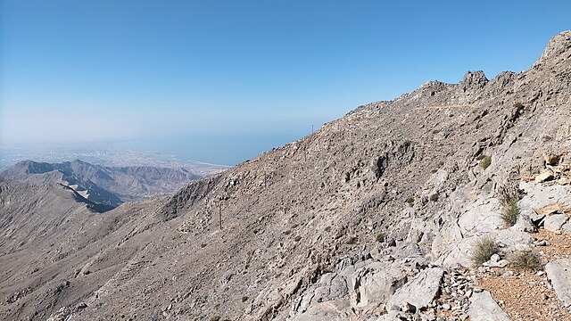
The U.A.E. is not a mountainous country, as most of its territory is desert or semi-desert and relatively flat, but it does have excellent mountains, which are part of the Hajar Mountains,[1] located in the northeast of Oman and east of the U.A.E., [2] which are the highest in the eastern part of the Arabian Peninsula.[3]


Most of the country's mountains, with altitudes higher than 1,000 metres (3,300 feet), are located in the emirate of Emirate of Ras Al Khaimah, and it is no coincidence that some of its most important summits are located exactly on the border with the Sultanate of Oman, as, in some cases, their position was taken as a reference for the drawing of the border limits between both countries.[4][5]
A boundary agreement was signed and ratified in 2003 for the entire border between the United Arab Emirates and Oman, including Oman's Musandam Peninsula and Al Madhah enclaves, but the contents of the agreement, and detailed maps showing the alignment, have not been published, [6] although border stones have been placed. The future publication of these agreements and maps could make it necessary to modify the content of this article.
This list includes the name and location of the summits located entirely within the territory of the United Arab Emirates, or at least with its summit located on the border line, regardless of its height. The list is open to new additions referring to mountains that meet these conditions, with a known name and position, and whose reference data is supported by historical maps or other reliable documentary sources.
Many of these mountains are known by different names, the result of local tradition and of the various transcriptions from Arabic to English, so that an individual reference note includes the alternative names with which the mountain has been identified at some point, accompanied by their respective documentary sources.
The region is represented in different satellite images, mainly Google Earth, Google Satellite and Bing Satellite. The exact coordinates of each summit and its altitude, with respect to sea level, have been established by comparing the OpenTopoMap and OpenMapTiles topographic maps with these images, treating each with the greatest objectivity and the same measurement criteria for all the summits. In some cases, direct recognition and location by GPS have also been used, or references have been checked against data provided by hikers and climbers in itineraries published online.
In this article, the values of prominence were not taken into account, nor the topographic isolation, to give priority to identifying the mountains and location of their summits.
Remove ads
List of mountains
Summarize
Perspective
Remove ads
See also
Notes
Remove ads
References
External links
Wikiwand - on
Seamless Wikipedia browsing. On steroids.
Remove ads
