List of dams in the Columbia River watershed
From Wikipedia, the free encyclopedia

There are more than 60 dams in the Columbia River watershed in the United States and Canada. Tributaries of the Columbia River and their dammed tributaries, as well as the main stem itself, each have their own list below. The dams are listed in the order as they are found from source to terminus. Many of the dams in the Columbia River watershed were not created for the specific purposes of water storage or flood protection. Instead, the primary purpose of many of these dams is to produce hydroelectricity. As can be seen in the lists, these dams provide many tens of gigawatts of power.
.png)
Major dam construction began in the early 20th century and picked up the pace after the Columbia River Treaty in the 1960s, by the mid 1980s all the big dams were finished. Including just the dams listed below, there are 60 dams in the watershed, with 14 on the Columbia, 20 on the Snake, seven on the Kootenay, seven on the Pend Oreille / Clark, two on the Flathead, eight on the Yakima, and two on the Owyhee. Averaging a major dam every 72 miles (116 km), the rivers in the Columbia watershed combine to generate over 36,000 megawatts of power, with the majority coming on the main stem. Grand Coulee Dam is the largest producer of hydroelectric power in the United States,[1] generating 6,809 megawatts, over one-sixth of all power in the basin.
In addition to providing ample power for the people of the Pacific Northwest, the reservoirs created by the dams have created numerous recreational opportunities, including fishing, boating, and windsurfing. Furthermore, by creating a constant flow and consistent depth along the river channel, the series of locks and dams have allowed for Lewiston, Idaho, to become the furthest inland seaport on the west coast of the United States.[2] Despite the numerous benefits to humans that the dams have provided, a number of environmental consequences have manifested as a result of the dams, including a negative impact on salmonid populations of the basin.[3]
The organization of the following lists begins with the Columbia River dams and is followed by dams on its tributaries (in order of length) and their respective watersheds. Additionally, the table of contents below is indented to indicate tributary status of each river.
Main stem Columbia River dams
Summarize
Perspective
Dams are listed in order from headwater (Columbia Lake, BC) to mouth (Pacific Ocean, OR/WA).


.jpg)


.jpg)


Snake River dams
Dams are listed in order from headwater (Two Oceans Plateau, WY) to mouth Columbia River, WA.


Salmon River dams
Little Salmon River dams
Dams are listed in order from headwater (north West Mountain, ID) to mouth (Salmon River, ID)
| Name | Height | Capacity (MW) | Province/State(s) | Coordinates | Year of completion | Owner | Reservoir formed | Image |
|---|---|---|---|---|---|---|---|---|
| Goose Lake Dam (Goose Creek)[58] | 26 ft (7.9 m) | 0 | 45°04′13″N 116°10′09″W | 1924 | Ca Campbell Company | Goose Lake | ||
| Brundage Dam (Brundage Creek(Goose Creek))[59] | 64 ft (20 m) | 0 | 45°02′30″N 116°07′53″W | 1989 | Brundage Reservoir Company | Brundage Reservoir |
Owyhee River dams
Dams are listed in order from headwater (near Double Mountain, NV) to mouth (Snake River, OR/ID)
| Name | Height | Capacity (MW) | Province/State(s) | Coordinates | Year of completion | Owner | Reservoir formed | Image |
|---|---|---|---|---|---|---|---|---|
| Wild Horse Dam | 114 ft (35 m)[60][61] | 0 | 41°41′14″N 115°50′43″W | 1937 / 1969[n 13] | BIA[63] | Wild Horse Reservoir |  | |
| Antelope Reservoir Dam (Antelope Creek (Jordan Creek))[64] | 60 ft (18 m) | 0 | 42°54′0″N 117°13′48″W | 1923 | Jordan Valley Irrigation District | Antelope Reservoir | ||
| Owyhee Dam | 417 ft (127 m)[65] | 5[n 14],8[n 15],2[n 16] | 43°38′31″N 117°14′33″W | 1932[65] | USBR | Lake Owyhee |  |
South Fork Owyhee River dams
Dams are listed in order from headwater (north Tuscarora Mountains, NV) to mouth (Owyhee River, ID)
| Name | Height | Capacity (MW) | Province/State(s) | Coordinates | Year of completion | Owner | Reservoir formed | Image |
|---|---|---|---|---|---|---|---|---|
| Wilson Reservoir Dam (Wilson Creek)[66] | 34 ft (10 m) | 0 | 41°40′12″N 116°20′24″W | Petan Company | Wilson Reservoir | |||
| Bull Run Dam (Bull Run Creek)[67] | 69 ft (21 m) | 0 | 41°38′24″N 116°09′0″W | Petan Company | Bull Run Reservoir | |||
| Dry Creek Dam (Indian Creek)[68] | 70 ft (21 m) | 0 | 41°47′24″N 116°13′48″W | Petan Company | Dry Creek Reservoir | |||
| Rawhide Reservoir Dam (Indian Creek)[69] | 33 ft (10 m) | 0 | 41°42′36″N 116°20′24″W | Petan Company | Rawhide Reservoir | |||
| Sheep Creek Dam (Sheep Creek)[70] | 29 ft (8.8 m) | 0 | 41°51′36″N 116°16′12″W | 1966 | United States Bureau of Indian Affairs, Shoshone and Paiute Tribes | Sheep Creek Reservoir | ||
| Chimney Creek Dam (Fourmile Creek)[71] | 20 ft (6.1 m) | 0 | 41°42′36″N 116°32′24″W | Roaring Springs Associates | Desert Ranch Reservoir |
Malheur River dams
Dams are listed in order from headwater (Logan Valley, OR) to mouth (Snake River, OR/ID)


_(morD0110).jpg)
Grande Ronde River dams
Wallowa River dams
Dams are listed in order from headwater (near Pete's Point, Eagle Cap Wilderness, OR) to mouth (Grande Ronde River, OR)
| Name | Height | Capacity (MW) | Province/State(s) | Coordinates | Year of completion | Owner | Reservoir formed | Image |
|---|---|---|---|---|---|---|---|---|
| Wallowa Lake Dam[79] | 40 ft (12 m) | 0 | 45°19′48″N 117°13′12″W | 1931 | Associated Ditch Companies | Raised Wallowa Lake |
Powder River dams
Dams are listed in order from headwater (confluence of McCully Fork and Cracker Creek, OR) to mouth (Snake River, OR/ID)
| Name | Height | Capacity (MW) | Province/State(s) | Coordinates | Year of completion | Owner | Reservoir formed | Image |
|---|---|---|---|---|---|---|---|---|
| Mason Dam[80][81] | 173 ft (53 m) | proposed 3.4[82] | 44°40′12″N 117°59′24″W | 1968 | United States Bureau of Reclamation | Philips Lake |  | |
| Thief Valley Dam[81][83] | 73 ft (22 m) | 0 | 45°0′36″N 117°46′12″W | 1932 | United States Bureau of Reclamation | Thief Valley Reservoir |
Blackfoot River dams
Dams are listed in order from headwater (confluence of Diamond and Lanes Creeks, ID) to mouth (Snake River, ID)
| Name | Height | Capacity (MW) | Province/State(s) | Coordinates | Year of completion | Owner | Reservoir formed | Image |
|---|---|---|---|---|---|---|---|---|
| Blackfoot Dam | 44 ft (13 m)[84] | 0 | 43°0′0″N 111°42′36″W[85] | 1911[85] | United States Bureau of Indian Affairs[85] | Blackfoot Reservoir |
Henrys Fork dams
Dams are listed in order from headwater (Henrys Lake, ID) to mouth (Snake River, ID)
| Name | Height | Capacity (MW) | Province/State(s) | Coordinates | Year of completion | Owner | Reservoir formed | Image |
|---|---|---|---|---|---|---|---|---|
| Henrys Lake Dam | 18 ft (5.5 m)[86] | 0 | 44°35′24″N 111°21′0″W[86] | 1923[86] | North Fork Reservoir Company[86] | Raised Henrys Lake | ||
| Island Park Dam | 94 ft (29 m)[87] | 4.8[32] | 44°25′12″N 111°23′24″W[87] | 1938[87] | United States Bureau of Reclamation[32] | Island Park Reservoir |  | |
| Buffalo River Dam (Buffalo River)[88] | 12 ft (3.7 m) | 0.25 | 44°24′52″N 111°23′34″W | 1980 | Fall River Rural Electric Cooperative, Inc. | Buffalo Dam Pool | ||
| Ashton Dam[89] | 56.6 ft (17.3 m) | 6.85 | 44°04′12″N 111°29′24″W[90] | 1913[90] | PacifiCorp | Ashton Dam Lake | ||
| Chester Dam (Crosscut Diversion Dam)[91] | 14.5 ft (4.4 m) | 3.3[92] | 44°0′36″N 111°34′48″W | 1938 | Fremont-Madison Irrigation District | Chester Dam Pool |
Fall River dams
Dams are listed in order from headwater (Pitchstone Plateau, WY) to mouth (Henrys Fork, ID)
| Name | Height | Capacity (MW) | Province/State(s) | Coordinates | Year of completion | Owner | Reservoir formed | Image |
|---|---|---|---|---|---|---|---|---|
| Grassy Lake Dam (Grassy Creek) | 118 ft (36 m)[32] | 0 | 44°07′48″N 110°48′36″W[93] | 1939[93] | United States Bureau of Reclamation[32] | Grassy Lake |  |
Portneuf River dams
Dams are listed in order from headwater (southeast of Higham Peak, ID) to mouth (Snake River, ID)
| Name | Height | Capacity (MW) | Province/State(s) | Coordinates | Year of completion | Owner | Reservoir formed | Image |
|---|---|---|---|---|---|---|---|---|
| Portneuf Dam[94] | 47 ft (14 m) | 0 | 42°52′12″N 111°56′24″W | 1912 | Portneuf-Marsh Valley Canal Company | Chesterfield Reservoir |
Salmon Falls Creek dams
Dams are listed in order from headwater (Jarbidge Mountains, NV) to mouth (Snake River, ID)
| Name | Height | Capacity (MW) | Province/State(s) | Coordinates | Year of completion | Owner | Reservoir formed | Image |
|---|---|---|---|---|---|---|---|---|
| Salmon Falls Dam[95] | 217 ft (66 m) | 0 | 42°12′36″N 114°43′48″W | 1911 | Salmon River Canal Company, Ltd. | Salmon Falls Creek Reservoir |  | |
| Cedar Creek Dam (Cedar Creek)[96] | 84 ft (26 m) | 0 | 42°13′12″N 114°52′12″W | 1920 | Cedar Mesa Reservoir And Canal Company | Cedar Creek Reservoir |
Boise River dams
Dams are listed in order from headwater (confluence of North and Middle Forks Boise River, ID) to mouth (Snake River, ID/OR)
| Name | Height | Capacity (MW) | Province/State(s) | Coordinates | Year of completion | Owner | Reservoir formed | Image |
|---|---|---|---|---|---|---|---|---|
| Arrowrock Dam[97] | 350 ft (110 m) | 15[98] | 43°36′0″N 115°55′12″W | 1915 | United States Bureau of Reclamation | Arrowrock Reservoir |  | |
| Lucky Peak Dam[99] | 340 ft (100 m) | 101.25[100] | 43°31′12″N 116°03′0″W | 1955 | United States Army Corps of Engineers | Lucky Peak Lake |  | |
| Boise River Diversion Dam[101] | 68 ft (21 m) | 3.3[98] | 43°31′48″N 116°05′24″W | 1908 | United States Bureau of Reclamation | Boise River Diversion Dam Pool |  | |
| Barber Dam[102] | 25 ft (7.6 m) | 4.14[103] | 43°34′12″N 116°07′12″W | 1904 | Ada County and Fulcrum Inc. | Barber Dam Pool |  |
South Fork Boise River dams
Dams are listed in order from headwater (confluence of Ross Fork and Johnson Creek, ID) to mouth (Boise River, ID)
| Name | Height | Capacity (MW) | Province/State(s) | Coordinates | Year of completion | Owner | Reservoir formed | Image |
|---|---|---|---|---|---|---|---|---|
| Anderson Ranch Dam[104] | 456 ft (139 m) | 40[98] | 43°21′36″N 115°26′24″W | 1947 | United States Bureau of Reclamation | Anderson Ranch Reservoir |  | |
| Little Camas Dam (Little Camas Creek)[105] | 44 ft (13 m) | 0 | 43°21′0″N 115°22′48″W | 1912 | Mountain Home Irrigation District | Little Camas Reservoir |
Goose Creek dams
Dams are listed in order from headwater (near Monument Peak, ID) to mouth (Snake River, ID)
| Name | Height | Capacity (MW) | Province/State(s) | Coordinates | Year of completion | Owner | Reservoir formed | Image |
|---|---|---|---|---|---|---|---|---|
| Oakley Dam[106] | 139 ft (42 m) | 0 | 42°11′24″N 113°54′36″W | 1916 | Oakley Canal Company | Lower Goose Creek Reservoir |
Weiser River dams
Dams are listed in order from headwater (near Brush Mountain, ID) to mouth (Snake River, ID/OR)
| Name | Height | Capacity (MW) | Province/State(s) | Coordinates | Year of completion | Owner | Reservoir formed | Image |
|---|---|---|---|---|---|---|---|---|
| Lost Valley Dam (Lost Creek(West Fork Weiser River))[107] | 52 ft (16 m) | 0 | 44°57′23″N 116°28′02″W | 1929 | Lost Valley Reservoir Company | Lost Valley Reservoir | ||
| C Ben Ross Dam (Little Weiser River)[108] | 56 ft (17 m) | 0 | 44°31′12″N 116°26′24″W | 1937 | Little Weiser River Irrigation District | Ben Ross Reservoir | ||
| Crane Creek Dam (Crane Creek)[109] | 55 ft (17 m) | 0 | 44°21′0″N 116°36′36″W | 1912 | Crane Creek Reservoir Administration Board | Crane Creek Reservoir | ||
| Mann Creek Dam (Mann Creek)[110] | 148 ft (45 m) | 0[111] | 44°23′24″N 116°53′24″W | 1967 | United States Bureau of Reclamation | Mann Creek Reservoir |
|
.jpg)
Burnt River dams
Dams are listed in order from headwater (confluence of North and South Fork Burnt Rivers, OR) to mouth (Snake River, OR/ID)
| Name | Height | Capacity (MW) | Province/State(s) | Coordinates | Year of completion | Owner | Reservoir formed | Image |
|---|---|---|---|---|---|---|---|---|
| Unity Dam[112][113] | 82 ft (25 m) | proposed 0.8[114] | 43°30′0″N 118°10′48″W | 1938 | United States Bureau of Reclamation | Unity Reservoir | |
Willow Creek dams
Dams are listed in order from headwater (Blackfoot Mountains, ID) to mouth (Snake River, ID)
| Name | Height | Capacity (MW) | Province/State(s) | Coordinates | Year of completion | Owner | Reservoir formed | Image |
|---|---|---|---|---|---|---|---|---|
| Ririe Dam | 253 ft (77 m)[115] | 0 | 43°34′48″N 111°44′24″W[116] | 1977[116] | United States Bureau of Reclamation[116] | Ririe Reservoir |  |
Payette River dams
Dams are listed in order from headwater (confluence of South and Middle Forks Payette River, ID) to mouth (Snake River, ID/OR)
| Name | Height | Capacity (MW) | Province/State(s) | Coordinates | Year of completion | Owner | Reservoir formed | Image |
|---|---|---|---|---|---|---|---|---|
| Black Canyon Diversion Dam[117] | 183 ft (56 m) | 10.2[98] | 43°52′48″N 116°28′48″W | 1924 | United States Bureau of Reclamation | Black Canyon Reservoir | .jpg) |
North Fork Payette River dams
Dams are listed in order from headwater (Squaw Meadows, ID) to mouth (Payette River, ID)
| Name | Height | Capacity (MW) | Province/State(s) | Coordinates | Year of completion | Owner | Reservoir formed | Image |
|---|---|---|---|---|---|---|---|---|
| Upper Payette Lake Dam[118] | 18 ft (5.5 m) | 0 | 45°06′40″N 116°01′35″W | 1952 | Lake Reservoir Company | Upper Payette Lake | ||
| Granite Lake Dam (Fisher Creek)[119] | 28 ft (8.5 m) | 0 | 45°06′02″N 116°04′51″W | 1963 | Lake Reservoir Company | Granite Lake | ||
| Payette Lake Dam[120] | 8.2 ft (2.5 m) | 0 | 44°54′36″N 116°06′36″W | 1943 | Lake Reservoir Company | Raised Payette Lake | ||
| Little Payette Lake Dam (Lake Fork)[121] | 15.8 ft (4.8 m) | 0 | 44°54′0″N 116°02′24″W | 1926 | Lake Fork Irrigation District | Little Payette Lake | ||
| Cascade Dam[122] | 107 ft (33 m) | 12.8[98] | 44°31′12″N 116°03′0″W | 1948 | United States Bureau of Reclamation | Lake Cascade |  | |
| Sage Hen Dam(Sage Hen Creek(Second Fork Squaw Creek))[123] | 38 ft (12 m) | 0 | 44°19′12″N 116°11′24″W | 1938 | Squaw Creek Irrigation Company | Sage Hen Reservoir | ||
| Paddock Valley Dam (Little Willow Creek)[124] | 43 ft (13 m) | 0 | 44°11′24″N 116°35′24″W | 1949 | Little Willow Irrigation District | Paddock Valley Reservoir |
South Fork Payette River dams
Dams are listed in order from headwater (near Vernon Lake, ID) to mouth (Payette River, ID)
| Name | Height | Capacity (MW) | Province/State(s) | Coordinates | Year of completion | Owner | Reservoir formed | Image |
|---|---|---|---|---|---|---|---|---|
| Deadwood Dam (Deadwood River)[125] | 183 ft (56 m) | 0[98] | 44°17′24″N 115°38′24″W | 1931 | United States Bureau of Reclamation | Deadwood Reservoir |  |
Clearwater River dams
North Fork Clearwater River dams
Dams are listed in order from headwater (near Illinois Peak, ID/MT) to mouth (Clearwater River, ID)
| Name | Height | Capacity (MW) | Province/State(s) | Coordinates | Year of completion | Owner | Reservoir formed | Image |
|---|---|---|---|---|---|---|---|---|
| Dworshak Dam | 717 ft (219 m)[126] | 400 | 46°30′N 116°18′W | 1973 | Army Corps of Engineers | Dworshak Reservoir |  |
Malad River dams
| Name | Height | Capacity (MW) | Province/State(s) | Coordinates | Year of completion | Owner | Reservoir formed | Image |
|---|---|---|---|---|---|---|---|---|
| Upper Malad River Dam | 124.1 ft (37.8 m)[127] | 8.27[128] | 42°51′55″N 114°52′09″W | 1948[128] | Idaho Power Company | Malad Gorge State Park | ||
| Lower Malad River Dam | 152.0 ft (46.3 m)[127] | 13.50[128] | 42°51′51″N 114°53′08″W | 1911[128] | Idaho Power Company | Malad Gorge State Park |
Big Wood River dams
Dams are listed in order from headwater (near Galena Summit, ID) to mouth (Malad River, ID)
| Name | Height | Capacity (MW) | Province/State(s) | Coordinates | Year of completion | Owner | Reservoir formed | Image |
|---|---|---|---|---|---|---|---|---|
| Magic Dam | 128 ft (39 m)[129] | 9[130] | 43°15′0″N 114°22′12″W[129] | 1910[129] | Magic Reservoir Hydroelectric, Inc.[129] | Magic Reservoir |
Camas Creek
Dams are listed in order from headwater (near Packer Butte, ID) to mouth (Big Wood River, ID)
| Name | Height | Capacity (MW) | Province/State(s) | Coordinates | Year of completion | Owner | Reservoir formed | Image |
|---|---|---|---|---|---|---|---|---|
| Mormon Dam (McKinney Creek) | 23 ft (7.0 m)[131] | 0 | 43°16′48″N 114°48′0″W | 1908 | Twin Lakes Reservoir and Irrigation Company | Mormon Reservoir |
Little Wood River dams
Dams are listed in order from headwater (Standhope Peak, ID) to mouth (Malad River, ID)
| Name | Height | Capacity (MW) | Province/State(s) | Coordinates | Year of completion | Owner | Reservoir formed | Image |
|---|---|---|---|---|---|---|---|---|
| Little Wood River Dam | 169 ft (52 m)[132] | 3[133] | 43°25′12″N 114°01′12″W[132] | 1962[132] | United States Bureau of Reclamation[132] | Little Wood Reservoir |
| |
| Fish Creek Dam (Fish Creek) | 88 ft (27 m)[134] | 0 | 43°25′12″N 114°49′48″W[134] | 1923[134] | Carey Valley Reservoir Company[134] | Fish Creek Reservoir |
.jpg)
Kootenay River dams
Dams are listed in order from headwater (near Castle Mountain, Beaverfoot Range, BC) to mouth (Columbia River, BC).
| Name | Height | Capacity (MW) | Province/State(s) | Coordinates | Year of completion | Owner | Reservoir formed | Image |
|---|---|---|---|---|---|---|---|---|
| Libby Dam | 420 ft (130 m)[135] | 604[136] | 48°24′37″N 115°18′52″W | 1972[137] | USACE | Lake Koocanusa | _1986.jpg) | |
| Corra Linn Dam | 16 m (52 ft)[138] | 51[138] | 49°28′04″N 117°28′02″W | 1932[138] | FortisBC | raised Kootenay Lake | ||
| Upper Bonnington Falls Dam | 21 m (69 ft)[139] | 53[8] | 49°27′35″N 117°29′03″W | 1907[8] | FortisBC | |||
| Lower Bonnington Falls Dam | 21 m (69 ft)[140] | 25[8] | 49°27′39″N 117°29′59″W | 1925[8] | FortisBC |  | ||
| South Slocan Dam | 18 m (59 ft)[141] | 57[8] | 49°27′20″N 117°31′11″W | 1928[8] | FortisBC |  | ||
| Kootenay Canal Generating Station[n 17] | 84 m (276 ft)[142] | 583[8] | 49°27′10″N 117°31′02″W | 1976[8] | BC Hydro |  | ||
| Brilliant Dam | 42.6 m (140 ft)[143] | 260[n 18] | 49°19′29″N 117°37′12″W | 1944 / 2007[n 18] | Columbia Power Corporation |  | ||
Bull River dams
Dams are listed in order from headwater (Canadian Rockies) to mouth (Kootenay River, BC).
| Name | Height | Capacity (MW) | Province/State(s) | Coordinates | Year of completion | Owner | Reservoir formed | Image |
|---|---|---|---|---|---|---|---|---|
| Aberfeldie Dam[144] | 90 ft (27 m) | 24[145] | 49°29′58″N 115°21′3″W | 1922 (rebuilt 1953) | BC Hydro | Aberfeldie Dam Pool |
Elk River dams
Dams are listed in order from headwater (Upper Elk Lake) to mouth (Kootenay River, BC).
| Name | Height | Capacity (MW) | Province/State(s) | Coordinates | Year of completion | Owner | Reservoir formed | Image |
|---|---|---|---|---|---|---|---|---|
| Elko Dam[146] | 52 ft (16 m) | 12[147] | 49°17′24″N 115°6′16″W | 1924 | BC Hydro | Elko Dam Pool |
Duncan River dams
Dams are listed in order from headwater (near Mount Dawson) to mouth (Kootenay River, BC).
| Name | Height | Capacity (MW) | Province/State(s) | Coordinates | Year of completion | Owner | Reservoir formed | Image |
|---|---|---|---|---|---|---|---|---|
| Duncan Dam[148] | 130 ft (40 m) | 0 | 50°15′0″N 116°56′47″W | 1967 | BC Hydro | raised Duncan Lake |  |
Mark Creek dams
Dams are listed in order from headwater (Purcell Mountains) to mouth (Kootenay River, BC).
| Name | Height | Capacity (MW) | Province/State(s) | Coordinates | Year of completion | Owner | Reservoir formed | Image |
|---|---|---|---|---|---|---|---|---|
| Upper Mark Creek Dam[149] | 21.5 m (71 ft) | 0 | 49°42′36″N 116°2′33″W | 1994 | City of Kimberley | Mark Creek Dam Reservoir |
Pend Oreille River / Clark Fork River dams
Dams are listed in order from headwater of Clark Fork River (Silver Bow Creek, MT) to mouth of Pend Oreille River (Columbia River, BC).[n 19]


.jpg)


.jpg)
Flathead River dams
Dams are listed in order from headwater (Confluence of North Fork and Middle Fork Flathead River) to mouth (Clark Fork River).[n 21]
| Name | Height | Capacity (MW) | Province/State(s) | Coordinates | Year of completion | Owner | Reservoir formed | Image |
|---|---|---|---|---|---|---|---|---|
| Hungry Horse Dam[n 22] | 564 ft (172 m)[167] | 428[168] | 48°20′28″N 114°00′47″W | 1953[169] | USBR | Hungry Horse Reservoir |  | |
| Seli’š Ksanka Qlispe’ Dam (Kerr Dam) | 205 ft (62 m)[170] | 188[171] | 47°40′38″N 114°14′02″W | 1938[169] | Energy Keepers, Inc.[172] | Raised Flathead Lake 10 ft (3.0 m)[169] |  | |
Deschutes River dams
Dams are listed in order from headwater (Little Lava Lake, OR) to mouth (Columbia River, WA/OR).
| Name | Height | Capacity (MW) | Province/State(s) | Coordinates | Year of completion | Owner | Reservoir formed | Image |
|---|---|---|---|---|---|---|---|---|
| Crane Prairie Dam | 36 ft (11 m)[173] | 0 | 43°45′18″N 121°47′6″W | 1940[173] | USBR | Crane Prairie Reservoir |  | |
| Wickiup Dam | 100 ft (30 m)[173] | 0 | 43°41′43″N 121°42′14″W | 1949[173] | USBR | Wickiup Reservoir |  | |
| Round Butte Dam[174] | 440 ft (130 m) | 247.12 | 44°36′0″N 121°16′12″W[175] | 1964 | Portland General Electric Company, Confederated Tribes of the Warm Springs Reservation of Oregon | Lake Billy Chinook | _(jefDB1592).jpg) | |
| Pelton Dam[174] | 204 ft (62 m) | 100.8 | 44°41′24″N 121°13′48″W[176] | 1957 | Portland General Electric Company, Confederated Tribes of the Warm Springs Reservation of Oregon | Lake Simtustus | _(jefD0009).jpg) | |
| Pelton Reregulating Dam[174] | 88 ft (27 m) | 18.9 | 44°43′12″N 121°14′24″W[177] | 1958 | Portland General Electric Company, Confederated Tribes of the Warm Springs Reservation of Oregon | |||
Yakima River dams
Dams are listed in order from headwater (Keechelus Lake, WA) to mouth (Columbia River, WA).
| Name | Height | Capacity (MW) | Province/State(s) | Coordinates | Year of completion | Owner | Reservoir formed | Image |
|---|---|---|---|---|---|---|---|---|
| Keechelus Dam | 128 ft (39 m)[178] | 0[179] | 47°19′20″N 121°20′22″W | 1917[178] | USBR | Raised Keechelus Lake | 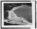 | |
| Easton Diversion Dam | 66 ft (20 m)[180] | 0[179] | 47°14′30″N 121°11′17″W | 1929[181] | USBR | Lake Easton |  | |
| Unnamed Diversion Dam | 0 | 47°03′50″N 120°39′09″W | USBR | |||||
| Roza Diversion Dam | 67 ft (20 m)[182] | 12 | 46°44′56″N 120°27′56″W | 1939[183] | USBR |  | ||
| Wapato Dam | 19 ft (5.8 m)[184] | 0 | 46°31′27″N 120°28′37″W | Wapato Reservoir |  | |||
| Sunnyside Dam | 8 ft (2.4 m)[178] | 0[179] | 46°29′52″N 120°26′41″W | 1907[185] | Sunnyside Valley Irrigation District |  | ||
| Prosser Dam | 9 ft (2.7 m)[186] | 0 | 46°12′45″N 119°46′22″W | 1904[186] | USBR |  | ||
| Wannawish Dam | 6.6 ft (2.0 m)[187] | 0 | 46°22′43″N 119°25′02″W | 1892[187] |  |
Cle Elum River dams
Dams are listed in order from headwaters (near Mount Daniel, WA) to mouth (Yakima River, WA).
| Name | Height | Capacity (MW) | Province/State(s) | Coordinates | Year of completion | Owner | Reservoir formed | Image |
|---|---|---|---|---|---|---|---|---|
| Cle Elum Dam | 165 ft (50 m)[178] | 0[179] | 47°14′49″N 121°4′23″W | 1933[178] | USBR | Raised Cle Elum Lake |
|
.jpg)
Kachess River dams
Dams are listed in order from headwaters (Three Queens, WA) to mouth (Yakima River, WA).
| Name | Height | Capacity (MW) | Province/State(s) | Coordinates | Year of completion | Owner | Reservoir formed | Image |
|---|---|---|---|---|---|---|---|---|
| Kachess Dam | 115 ft (35 m)[178] | 0[179] | 47°15′53″N 121°12′9″W | 1912[178] | USBR | Raised Kachess Lake | 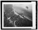 |
Naches River dams
Bumping River dams
Dams are listed in order from headwaters (near Crag Mountain, WA) to mouth (Naches River, WA).
| Name | Height | Capacity (MW) | Province/State(s) | Coordinates | Year of completion | Owner | Reservoir formed | Image |
|---|---|---|---|---|---|---|---|---|
| Bumping Lake Dam | 60 ft (18 m)[178] | 0[179] | 46°52′16″N 121°17′58″W | 1910[178] | USBR | Raised Bumping Lake |
|
.jpg)
Tieton River dams
Dams are listed in order from headwaters (Goat Rocks, WA) to mouth (Naches River, WA).
| Name | Height | Capacity (MW) | Province/State(s) | Coordinates | Year of completion | Owner | Reservoir formed | Image |
|---|---|---|---|---|---|---|---|---|
| Clear Creek Dam (North Fork Tieton) | 83 ft (25 m)[178] | 0[179] | 46°37′40″N 121°16′15″W | 1915[178] | USBR | Clear Lake |
| |
| Tieton Dam | 319 ft (97 m)[178] | 0[179] | 46°39′26″N 121°7′41″W | 1925[178] | USBR | Rimrock Lake |  |
Willamette River dams
Dams are listed in order from headwaters (Confluence of Middle Fork Willamette River and Coast Fork Willamette River, OR/WA) to mouth (Columbia River, OR)
| Name | Height | Capacity (MW) | Province/State(s) | Coordinates | Year of completion | Owner | Reservoir formed | Image |
|---|---|---|---|---|---|---|---|---|
| Willamette Falls Dam | 20 ft (6.1 m)[188] | 15.18[189] | 45°21′11″N 122°37′04″W | 1888[18] | Portland General Electric |  |
Santiam River dams
Dams are listed in order from headwaters of each fork (North Santiam and South Santiam rivers) to their mouth at the confluence. There are no dams between the confluence and the mouth of the Santiam (Willamette River, OR).
| Name | Height | Capacity (MW) | Province/State(s) | Coordinates | Year of completion | Owner | Reservoir formed | Image |
|---|---|---|---|---|---|---|---|---|
| North Santiam | ||||||||
| Detroit Dam[190] | 463 ft (141 m) | 100 | 44°43′18″N 122°15′01″W | 1953 | Army Corps of Engineers | Detroit Reservoir |  | |
| Big Cliff Dam[190] | 191 ft (58 m) | 18 | 44°45′03″N 122°16′59″W | 1953 | Army Corps of Engineers | Big Cliff Reservoir (reregulation for Detroit Reservoir) |  | |
| South Santiam | ||||||||
| Green Peter Dam[191] | 327 ft (100 m) | 80 | 44°27′00″N 122°32′57″W | 1968 | Army Corps of Engineers | Green Peter Reservoir |
| |
| Foster Dam[191] | 126 ft (38 m) | 20 | 44°24′55″N 122°40′13″W | 1968 | Army Corps of Engineers | Foster Reservoir (reregulation for Green Peter Reservoir) |  | |

Middle Fork Willamette River dams
Dams are listed in order from headwater (Timpanogas Lake, OR) to mouth (Willamette River, OR).
| Name | Height | Capacity (MW) | Province/State(s) | Coordinates | Year of completion | Owner | Reservoir formed | Image |
|---|---|---|---|---|---|---|---|---|
| Hills Creek Dam | 304 ft (93 m)[192] | 30[192] | 43°42′33″N 122°25′26″W | 1961[192] | USACE | Hills Creek Reservoir |  | |
| Lookout Point Dam | 276 ft (84 m)[193] | 150[193] | 43°54′48″N 122°45′09″W | 1954[193] | USACE | Lookout Point Lake |  | |
| Fall Creek Dam[194] | 180 ft (55 m) | 0 | 43°54′49″N 122°45′25″W | 1966 | USACE | Fall Creek Reservoir | ||
| Dexter Dam | 93 ft (28 m)[193] | 15[193] | 43°55′22″N 122°48′23″W | 1954[193] | USACE | Dexter Reservoir |  | |
McKenzie River dams
Dams are listed in order from headwater (Clear Lake, OR) to mouth (Willamette River, OR).
| Name | Height | Capacity (MW) | Province/State(s) | Coordinates | Year of completion | Owner | Reservoir formed | Image |
|---|---|---|---|---|---|---|---|---|
| Carmen Diversion Dam | 17 ft (5.2 m)[195] | 0[196] | 44°20′19″N 122°00′11″W | 1963[197] | Eugene Water & Electric Board | Carmen Reservoir | ||
| Trail Bridge Dam | 90 ft (27 m)[198] | 10[196] | 44°16′24″N 122°03′02″W | 1963[197] | Eugene Water & Electric Board | Trail Bridge Reservoir | ||
| Smith Dam (Smith River) | 250 ft (76 m)[199] | 104.5[196] | 44°0′0″N 122°06′36″W[199] | 1963[197] | Eugene Water & Electric Board | Smith Reservoir | ||
| Cougar Dam (South Fork)[200] | 425 ft (130 m) | 25 | 44°07′44″N 122°14′30″W | 1963 | Army Corps of Engineers | Cougar Reservoir |  | |
| Blue River Dam (Blue River)[200] | 270 ft (82 m) | 0 | 44°10′23″N 122°19′47″W | 1969 | Army Corps of Engineers | Blue River Reservoir |  | |
| Leaburg Dam | 20 ft (6.1 m)[201] | 15.9[202] | 44°08′15″N 122°36′43″W[201] | 1929[202] | Eugene Water & Electric Board | Leaburg Reservoir | _(lanDA0035).jpg) | |
| Walterville Dam | 24 ft (7.3 m)[203] | 9[202] | 44°03′36″N 122°49′48″W[203] | 1911[202] | Eugene Water & Electric Board | Walterville Reservoir |
Coast Fork Willamette River dams
Dams are listed in order from headwater (Confluence of Big River and Garoutte Creek, OR) to mouth (Willamette River).
| Name | Height | Capacity (MW) | Province/State(s) | Coordinates | Year of completion | Owner | Reservoir formed | Image |
|---|---|---|---|---|---|---|---|---|
| Cottage Grove Dam | 95 ft (29 m)[204] | 0 | 43°42′58″N 123°03′03″W | 1942[204] | USACE | Cottage Grove Lake |  | |
| Dorena Dam (Row River) | 145 ft (44 m)[204] | 7.51[205] | 43°46′48″N 122°57′0″W | 1949[204] | USACE | Dorena Lake |
Spokane River dams
Dams are listed in order from headwater (Lake Coeur d'Alene, ID) to mouth (Columbia River, WA).
| Name | Height | Capacity (MW) | Province/State(s) | Coordinates | Year of completion | Owner | Reservoir formed | Image |
|---|---|---|---|---|---|---|---|---|
| Post Falls Dam | 64 ft (20 m)[206] | 15[206] | 47°42′31″N 116°57′13″W | 1908[206] | Avista | Raised Lake Coeur d'Alene |
| |
| Upriver Dam | 17.7[207] | 47°41′09″N 117°19′43″W | 1894 / 1933[n 23] | City of Spokane | Upriver Dam Reservoir |
| ||
| Upper Falls Dam | 35 ft (11 m)[208] | 10[208] | 47°39′46″N 117°24′55″W | 1922[208] | Avista | Upper Falls Reservoir |
| |
| Monroe Street Dam | 24 ft (7.3 m)[209] | 15[209] | 47°39′42″N 117°25′31″W | 1890[209] | Avista |  | ||
| Nine Mile Dam | 58 ft (18 m)[210] | 26[210] | 47°46′30″N 117°32′38″W | 1908[210] | Avista | Nine Mile Reservoir |  | |
| Long Lake Dam | 213 ft (65 m)[211] | 71[211] | 47°50′14″N 117°50′23″W | 1915[211] | Avista | Long Lake |  | |
| Little Falls Dam | 57 ft (17 m)[212] | 36[213] | 47°49′57″N 117°55′04″W | 1911[214] | Avista | Little Falls Pool |  |


Cowlitz River dams
Dams are listed in order from headwater (confluence of the Ohanapecosh River and the Clear Fork of the Cowlitz River, WA) to mouth (Columbia River, WA)
| Name | Height | Capacity (MW) | Province/State(s) | Coordinates | Year of completion | Owner | Reservoir formed | Image= |
|---|---|---|---|---|---|---|---|---|
| Cowlitz Falls Dam | 140 ft (43 m)[215] | 70[216] | 46°27′59″N 122°06′33″W | 1994[216] | Lewis County Public Utility District | Lake Scanewa |
| |
| Mossyrock Dam | 606 ft (185 m)[217] | 300[217] | 46°32′04″N 122°25′29″W | 1968[217] | Tacoma Public Utilities | Riffe Lake |  | |
| Mayfield Dam | 250 ft (76 m)[218] | 162[218] | 46°30′10″N 122°35′18″W | 1963[218] | Tacoma Public Utilities | Lake Mayfield |  |

Lewis River dams
Dams are listed in order from headwater (Adams Glacier, Mount Adams, WA) to mouth (Columbia River, WA)
| Name | Height | Capacity (MW) | Province/State(s) | Coordinates | Year of completion | Owner | Reservoir formed | Image |
|---|---|---|---|---|---|---|---|---|
| Swift Dam[219] | 512 ft (156 m) | 240 | 46°04′48″N 122°12′36″W[220] | 1958 | PacifiCorp | Swift Reservoir | ||
| Swift No. 2 Dam[219] | 83 ft (25 m)[221] | 70 | 46°03′46″N 122°11′52″W[221] | 1959[221] | Public Utility District No. 1 of Cowlitz County | |||
| Yale Dam[219] | 323 ft (98 m) | 134 | 45°58′48″N 122°20′24″W[222] | 1953 | PacifiCorp | Yale Lake |
| |
| Merwin Dam[219] | 313 ft (95 m) | 136 | 45°59′24″N 122°28′48″W[223] | 1931 | PacifiCorp | Lake Merwin |

Spillimacheen River dams
Dams are listed in order from headwater (Canadian Rockies) to mouth (Columbia River, BC).
| Name | Height | Capacity (MW) | Province/State(s) | Coordinates | Year of completion | Owner | Reservoir formed | Image |
|---|---|---|---|---|---|---|---|---|
| Spillimacheen Dam[224] | 14.5 m (48 ft) | 4 | 50°53′56″N 116°25′28″W | 1955[225] | BC Hydro | Spillimacheen Dam Pool |
Wenatchee River dams
Dams are listed in order from headwater (Lake Wenatchee, WA) to mouth (Columbia River, WA)
| Name | Height | Capacity (MW) | Province/State(s) | Coordinates | Year of completion | Owner | Reservoir formed | Image |
|---|---|---|---|---|---|---|---|---|
| Tumwater Canyon Dam[226] | 23 ft (7.0 m) | 0 | 47°36′59″N 120°43′22″W | 1909 | Chelan County Public Utility District | Lake Jolanda |
Chelan River dams
Dams are listed in order from headwater (Lake Chelan, WA) to mouth (Columbia River, WA)
| Name | Height | Capacity (MW) | Province/State(s) | Coordinates | Year of completion | Owner | Reservoir formed | Image |
|---|---|---|---|---|---|---|---|---|
| Lake Chelan Dam | 40 ft (12 m)[227] | 59.2[227] | 47°50′04″N 120°00′45″W | 1892–1903 / 1927[n 24] | Chelan County Public Utility District | Raised Lake Chelan | .jpg) |
See also
- List of lakes in Washington (state)
- List of tallest dams in the world
- Dams in the Colorado River system
- List of reservoirs and dams in the United States
- Columbia River Treaty (US–Canadian treaty regulating hydroelectric development)
Notes
- Dam was initially completed in 1937; second powerhouse was completed in 1981
- Information received in email exchange with representative from Idaho Power.
- Kootenay Canal Generating Station is located at the end of a canal created by the Corra Linn Dam.
- Although these rivers are not one, for the simplification of this list they will be listed together, as they are only separated by Lake Pend Oreille.
- All forks of Flathead River are treated as being on main stem, as there is only one dam on any of the forks.
- On South Fork of Flathead River
References
External links
Wikiwand - on
Seamless Wikipedia browsing. On steroids.