Top Qs
Timeline
Chat
Perspective
List of crossings of the Willamette River
From Wikipedia, the free encyclopedia
Remove ads
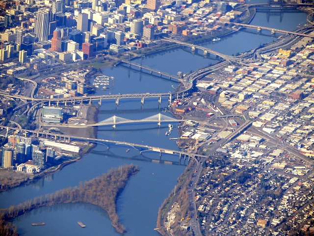
This is a list of bridges and other crossings of the Willamette River in the U.S. state of Oregon from the Columbia River upstream to the confluence of the Middle Fork Willamette River and Coast Fork Willamette River. This confluence, at 44.023318°N 123.023897°W / 44.023318; -123.023897 (Willamette River source), is considered the source of the Willamette River.
Map all coordinates using OpenStreetMap
Download coordinates as:

Remove ads
Sauvie Island
More information Image, Crossing ...
| Image | Crossing | Carries | Location | River mile | Year built | Coordinates |
|---|---|---|---|---|---|---|
| Wapato Bridge | Sauvie Island Road, sidewalks | Sauvie Island | 3 | 2008 | 45.628021°N 122.816307°W / 45.628021; -122.816307 |
Close
Remove ads
Portland
More information Image, Crossing ...
Close
Remove ads
Northern Willamette Valley
More information Image, Crossing ...
Close
Remove ads
Middle Willamette Valley
More information Image, Crossing ...
Close
Remove ads
Southern Willamette Valley
Summarize
Perspective
More information Image, Crossing ...
Close
Remove ads
Former crossings
More information Image, Crossing ...
| Image | Crossing | Carried | Location | River mile | Year built | Coordinates |
|---|---|---|---|---|---|---|
| "First" Steel Bridge (until 1912) | OR&N Railway | Portland | 12.0 | 1888 | ||
| Madison Street Bridge[n 1] | Madison Street | Portland | 13.1 | 1891, 1900[n 1] | 45.51333°N 122.67083°W / 45.51333; -122.67083 (former Madison Street Bridge) | |
| Boones Ferry | Boones Ferry Road | Wilsonville | 38.9 | 1847 | 45.29312°N 122.775038°W / 45.29312; -122.775038 (Boones Ferry (1847–1959)) | |
| Springfield PE&E Streetcar Bridge (until 1926) | Portland, Eugene and Eastern Streetcar | Springfield | 185.3 | 1910 |
Close
Remove ads
See also
Notes
References
External links
Wikiwand - on
Seamless Wikipedia browsing. On steroids.
Remove ads


