| County |
FIPS Code
[5] |
County seat
[6] |
Est.
[6][7] |
Formed from[2] |
Named for[3] |
Density
(Pop./mi2) |
Pop. (2024)
[8] |
Area
[6] |
Map |
| Albany County |
001 |
Albany | Nov 1, 1683 | One of 12 original counties created in the New York colony | James II of England (James VII of Scotland) (1633–1701), who was Duke of York (English title) and Duke of Albany (Scottish title) before becoming King of England, Ireland, and Scotland. | 600.31 |
319,964 |
533 sq mi
(1,380 km2) |  |
| Allegany County |
003 |
Belmont | Apr 7, 1806 | Genesee County | A variant spelling of the Allegheny River | 45.74 |
47,299 |
1,034 sq mi
(2,678 km2) |  |
| Bronx County |
005 |
none (sui generis) | Jan 1, 1914[9] | New York County | The Bronx River | 24,111.51 |
1,384,724 |
57.43 sq mi
(149 km2) |  |
| Broome County |
007 |
Binghamton | Mar 28, 1806 | Tioga County | John Broome (1738–1810), fourth Lieutenant Governor of New York | 274.68 |
196,397 |
715 sq mi
(1,852 km2) | 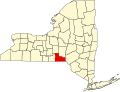 |
| Cattaraugus County |
009 |
Little Valley | Mar 11, 1808 | Genesee County | A word from an uncertain Iroquoian language meaning "bad smelling banks", referring to the odor of natural gas which leaked from Cattaraugus Creek | 57.61 |
75,475 |
1,310 sq mi
(3,393 km2) |  |
| Cayuga County |
011 |
Auburn | Mar 8, 1799 | Onondaga County | The Cayuga tribe of Native Americans | 86.30 |
74,567 |
864 sq mi
(2,238 km2) |  |
| Chautauqua County |
013 |
Mayville | Mar 11, 1808 | Genesee County | Loanword from the Erie language describing Chautauqua Lake; language now lost and cannot be translated | 82.74 |
124,105 |
1,500 sq mi
(3,885 km2) |  |
| Chemung County |
015 |
Elmira | Mar 20, 1836 | Tioga County | A Lenape word meaning "big horn", which was the name of a local Native American village | 197.45 |
81,115 |
410.81 sq mi
(1,064 km2) |  |
| Chenango County |
017 |
Norwich | Mar 15, 1798 | Tioga County and Herkimer County | An Onondaga word meaning "large bull-thistle" | 50.93 |
45,776 |
898.85 sq mi
(2,328 km2) | 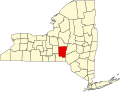 |
| Clinton County |
019 |
Plattsburgh | Mar 4, 1788 | Washington County | George Clinton (1739–1812), fourth Vice President of the United States and first and third Governor of New York | 69.65 |
77,871 |
1,118 sq mi
(2,896 km2) |  |
| Columbia County |
021 |
Hudson | Apr 1, 1786 | Albany County | Christopher Columbus (1451–1506), the European explorer | 93.05 |
60,299 |
648 sq mi
(1,678 km2) |  |
| Cortland County |
023 |
Cortland | Apr 8, 1808 | Onondaga County | Pierre Van Cortlandt (1721–1814), first Lieutenant Governor of New York | 91.52 |
45,945 |
502 sq mi
(1,300 km2) | 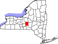 |
| Delaware County |
025 |
Delhi | Mar 10, 1797 | Otsego County and Ulster County | Thomas West, 3rd Baron De La Warr (1577–1618), an early colonial leader in Virginia. Name applied to the bay, river, and Lenape Native Americans | 30.10 |
44,191 |
1,468 sq mi
(3,802 km2) |  |
| Dutchess County |
027 |
Poughkeepsie | Nov 1, 1683 | One of 12 original counties created in the New York colony | Mary of Modena (1658–1718), Duchess of York and wife of King James II of England | 363.59 |
299,963 |
825 sq mi
(2,137 km2) |  |
| Erie County |
029 |
Buffalo | Apr 2, 1821 | Niagara County | The Erie tribe of Native Americans | 774.74 |
950,602 |
1,227 sq mi
(3,178 km2) | 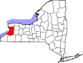 |
| Essex County |
031 |
Elizabethtown | Mar 1, 1799 | Clinton County | The county of Essex in England | 19.18 |
36,744 |
1,916 sq mi
(4,962 km2) |  |
| Franklin County |
033 |
Malone | Mar 11, 1808 | Clinton County | Benjamin Franklin (1706–1790), the early American printer, scientist, and statesman | 27.75 |
47,086 |
1,697 sq mi
(4,395 km2) |  |
| Fulton County |
035 |
Johnstown | Apr 18, 1838 | Montgomery County | Robert Fulton (1765–1815), inventor of the steamship | 97.70 |
52,073 |
533 sq mi
(1,380 km2) |  |
| Genesee County |
037 |
Batavia | Mar 30, 1802 | Ontario County and land acquired in the Holland Purchase | A Seneca phrase meaning "good valley" | 116.37 |
57,604 |
495 sq mi
(1,282 km2) |  |
| Greene County |
039 |
Catskill | Mar 25, 1800 | Albany County and Ulster County | Nathanael Greene (1742–1786), the American Revolutionary War general | 71.28 |
46,903 |
658 sq mi
(1,704 km2) | 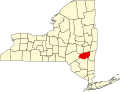 |
| Hamilton County |
041 |
Lake Pleasant | Apr 12, 1816 | Montgomery County | Alexander Hamilton (1755–1804), the early American political theorist and first Secretary of the Treasury | 2.81 |
5,082 |
1,808 sq mi
(4,683 km2) |  |
| Herkimer County |
043 |
Herkimer | Feb 16, 1791 | Montgomery County | Nicholas Herkimer (1728–1777), the American Revolutionary War general | 40.87 |
59,585 |
1,458 sq mi
(3,776 km2) |  |
| Jefferson County |
045 |
Watertown | Mar 28, 1805 | Oneida County | Thomas Jefferson (1743–1826), the early American statesman, author of the Declaration of Independence, and third President of the United States | 60.93 |
113,140 |
1,857 sq mi
(4,810 km2) | 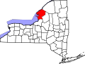 |
| Kings County |
047 |
none (sui generis) | Nov 1, 1683 | One of 12 original counties created in the New York colony | King Charles II of England (1630–1685) | 27,013.74 |
2,617,631 |
96.9 sq mi
(251 km2) | 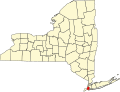 |
| Lewis County |
049 |
Lowville | Mar 28, 1805 | Oneida County | Morgan Lewis (1754–1844), the fourth Governor of New York | 20.60 |
26,570 |
1,290 sq mi
(3,341 km2) | 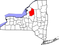 |
| Livingston County |
051 |
Geneseo | Feb 23, 1821 | Genesee County and Ontario County | Robert Livingston (1746–1813), the early American statesman and New York delegate to the Continental Congress | 96.19 |
61,561 |
640 sq mi
(1,658 km2) |  |
| Madison County |
053 |
Wampsville | Mar 21, 1806 | Chenango County | James Madison (1751–1836), the early American statesman, principal author of the Constitution of the United States, and fourth President of the United States | 101.32 |
67,072 |
662 sq mi
(1,715 km2) | 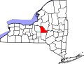 |
| Monroe County |
055 |
Rochester | Feb 23, 1821 | Genesee County and Ontario County | James Monroe (1758–1831), the early American statesman and fifth President of the United States | 550.66 |
752,202 |
1,366 sq mi
(3,538 km2) |  |
| Montgomery County |
057 |
Fonda | Mar 12, 1772 | Albany County | Originally Tryon County after colonial governor William Tryon (1729–1788), renamed after the American Revolutionary War general Richard Montgomery (1738–1775) in 1784 | 121.09 |
49,648 |
410 sq mi
(1,062 km2) |  |
| Nassau County |
059 |
Mineola | Jan 1, 1899 | Queens County | The Princes of Orange-Nassau ruled the Netherlands when Long Island was a Dutch colony | 3,073.81 |
1,392,438 |
453 sq mi
(1,173 km2) | 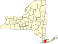 |
| New York County |
061 |
none (sui generis) | Nov 1, 1683 | One of 12 original counties created in the New York colony | King James II of England (1633–1701), who was Duke of York and Albany before he ascended the throne of England, Duke of York being his English title | 49,175.72 |
1,660,664 |
33.77 sq mi
(87 km2) |  |
| Niagara County |
063 |
Lockport | Mar 11, 1808 | Genesee County | The Iroquoian name of a tribe within the Neutral Nation, the exact translation of which remains disputed | 183.83 |
209,570 |
1,140 sq mi
(2,953 km2) | 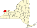 |
| Oneida County |
065 |
Utica | Mar 15, 1798 | Herkimer County | The Oneida tribe of Native Americans | 188.25 |
228,347 |
1,213 sq mi
(3,142 km2) |  |
| Onondaga County |
067 |
Syracuse | Mar 5, 1794 | Herkimer County | The Onondaga tribe of Native Americans | 582.89 |
469,812 |
806 sq mi
(2,088 km2) |  |
| Ontario County |
069 |
Canandaigua | Jan 27, 1789 | Land acquired in the Phelps and Gorham Purchase | An Iroquoian word meaning "beautiful lake" | 170.71 |
113,012 |
662 sq mi
(1,715 km2) |  |
| Orange County |
071 |
Goshen | Nov 1, 1683 | One of 12 original counties created in the New York colony | William of Orange-Nassau (1650–1702), who became King William III of England | 490.78 |
411,767 |
839 sq mi
(2,173 km2) |  |
| Orleans County |
073 |
Albion | Nov 12, 1824 | Genesee County | The French Royal House of Orléans | 48.58 |
39,686 |
817 sq mi
(2,116 km2) |  |
| Oswego County |
075 |
Oswego | Mar 1, 1816 | Oneida County and Onondaga County | The Oswego River, from an Iroquoian word meaning "the outpouring", referring to the mouth of the river | 90.17 |
118,305 |
1,312 sq mi
(3,398 km2) |  |
| Otsego County |
077 |
Cooperstown | Feb 16, 1791 | Montgomery County | A Native American word meaning "place of the rock" | 60.34 |
60,524 |
1,003 sq mi
(2,598 km2) |  |
| Putnam County |
079 |
Carmel Hamlet | Jun 12, 1812 | Dutchess County | Israel Putnam (1718–1790), an American Revolutionary War general | 400.04 |
98,409 |
246 sq mi
(637 km2) |  |
| Queens County |
081 |
none (sui generis) | Nov 1, 1683 | One of 12 original counties created in the New York colony | Catherine of Braganza (1638–1705), Queen of England and wife of King Charles II of England | 12,995.52 |
2,316,841 |
178.28 sq mi
(462 km2) |  |
| Rensselaer County |
083 |
Troy | Feb 7, 1791 | Albany County | In honor of the family of Kiliaen van Rensselaer (before 1596 – after 1643), the early landholder in the Dutch New Netherland colony | 241.73 |
160,749 |
665 sq mi
(1,722 km2) | 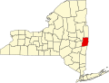 |
| Richmond County |
085 |
none (sui generis) | Nov 1, 1683 | One of 12 original counties created in the New York colony | Charles Lennox, 1st Duke of Richmond (1672–1723), the illegitimate son of King Charles II of England | 4,860.60 |
498,212 |
102.5 sq mi
(265 km2) |  |
| Rockland County |
087 |
New City | Feb 23, 1798 | Orange County | Early settlers' description of terrain as "rocky land" | 1,749.47 |
348,144 |
199 sq mi
(515 km2) |  |
| St. Lawrence County |
089 |
Canton | Mar 3, 1802 | Clinton County, Herkimer County, and Montgomery County | The St Lawrence River, which forms the northern border of the county and New York State | 37.65 |
106,198 |
2,821 sq mi
(7,306 km2) | 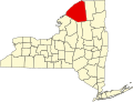 |
| Saratoga County |
091 |
Ballston Spa | Feb 7, 1791 | Albany County | A corruption of a Native American word meaning "the hill beside the river" | 284.79 |
240,360 |
844 sq mi
(2,186 km2) |  |
| Schenectady County |
093 |
Schenectady | Mar 27, 1809 | Albany County | A Mohawk word meaning "on the other side of the pine lands" | 772.67 |
162,261 |
210 sq mi
(544 km2) |  |
| Schoharie County |
095 |
Schoharie | Apr 6, 1795 | Albany County and Otsego County | A Mohawk word meaning "floating driftwood" | 48.16 |
30,151 |
626 sq mi
(1,621 km2) |  |
| Schuyler County |
097 |
Watkins Glen | Apr 17, 1854 | Chemung County, Steuben County, and Tompkins County | Philip Schuyler (1733–1804), the American Revolutionary War general and Senator from New York | 50.06 |
17,121 |
342 sq mi
(886 km2) | 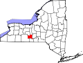 |
| Seneca County |
099 |
Waterloo | Mar 24, 1804 | Cayuga County | The Seneca tribe of Native Americans | 100.46 |
32,650 |
325 sq mi
(842 km2) |  |
| Steuben County |
101 |
Bath | Mar 18, 1796 | Ontario County | Friedrich Wilhelm von Steuben (1730–1794), the Prussian general who assisted the Continental Army during the American Revolutionary War | 65.54 |
92,015 |
1,404 sq mi
(3,636 km2) |  |
| Suffolk County |
103 |
Riverhead | Nov 1, 1683 | One of 12 original counties created in the New York colony | The county of Suffolk in England | 647.24 |
1,535,909 |
2,373 sq mi
(6,146 km2) | 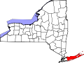 |
| Sullivan County |
105 |
Monticello | Mar 27, 1809 | Ulster County | John Sullivan (1740–1795), an American Revolutionary War general | 80.69 |
80,450 |
997 sq mi
(2,582 km2) |  |
| Tioga County |
107 |
Owego | Feb 16, 1791 | Montgomery County | A Native American word meaning "at the forks", describing a meeting place | 90.96 |
47,574 |
523 sq mi
(1,355 km2) | 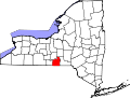 |
| Tompkins County |
109 |
Ithaca | Apr 7, 1817 | Cayuga County and Seneca County | Daniel D. Tompkins (1774–1825), the 6th Vice President of the United States | 221.85 |
105,602 |
476 sq mi
(1,233 km2) |  |
| Ulster County |
111 |
Kingston | Nov 1, 1683 | One of 12 original counties created in the New York colony | The Irish province of Ulster, then an earldom of the Duke of York, later King James II of England | 157.60 |
182,977 |
1,161 sq mi
(3,007 km2) | 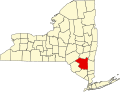 |
| Warren County |
113 |
Queensbury | Mar 12, 1813 | Washington County | Joseph Warren (1741–1775), the early American patriot and American Revolutionary War general | 75.04 |
65,288 |
870 sq mi
(2,253 km2) |  |
| Washington County |
115 |
Fort Edward | Mar 12, 1772 | Albany County | Originally Charlotte County, renamed in 1784 after George Washington (1732–1799), the American Revolutionary War general and first President of the United States | 70.73 |
59,839 |
846 sq mi
(2,191 km2) |  |
| Wayne County |
117 |
Lyons | Apr 11, 1823 | Ontario County and Seneca County | General Anthony Wayne (1745–1796), the American Revolutionary War general | 65.58 |
90,757 |
1,384 sq mi
(3,585 km2) |  |
| Westchester County |
119 |
White Plains | Nov 1, 1683 | One of 12 original counties created in the New York colony | The city of Chester in England | 2,012.89 |
1,006,447 |
500 sq mi
(1,295 km2) |  |
| Wyoming County |
121 |
Warsaw | May 14, 1841 | Genesee County | A modification of a word from the Lenape language meaning "broad bottom lands" | 66.42 |
39,588 |
596 sq mi
(1,544 km2) |  |
| Yates County |
123 |
Penn Yan | Feb 5, 1823 | Ontario County and Steuben County | Joseph C. Yates (1768–1837), eighth Governor of New York | 64.86 |
24,387 |
376 sq mi
(974 km2) |  |


