| Image |
Name |
Status |
Population[79] |
Local authority pre-1974 |
District 1974-2023 |
Coordinates |
Refs |
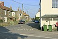
 | Ashwick | Civil parish | 1,352 | Shepton Mallet Rural District |
Mendip | 51.23°N 2.52°W / 51.23; -2.52 (Ashwick) | [80][81] |
 | Baltonsborough | Civil parish | 864 | Wells Rural District |
Mendip | 51.11°N 2.64°W / 51.11; -2.64 (Baltonsborough) | [82][83] |
 | Batcombe | Civil parish | 439 | Shepton Mallet Rural District |
Mendip | 51.15°N 2.44°W / 51.15; -2.44 (Batcombe, Somerset) | [81][84] |
 | Beckington | Civil parish | 983 | Frome Rural District |
Mendip | 51.26°N 2.28°W / 51.26; -2.28 (Beckington) | [85][86] |
 | Berkley | Civil parish | 344 | Frome Rural District |
Mendip | 51.24°N 2.27°W / 51.24; -2.27 (Berkley, Somerset) | [86][87] |
 | Binegar | Civil parish | 313 | Shepton Mallet Rural District |
Mendip | 51.24°N 2.55°W / 51.24; -2.55 (Binegar) | [81][88] |
 | Buckland Dinham | Civil parish | 381 | Frome Rural District |
Mendip | 51.26°N 2.35°W / 51.26; -2.35 (Buckland Dinham) | [86][89] |
 | Butleigh | Civil parish | 823 | Wells Rural District |
Mendip | 51.09°N 2.68°W / 51.09; -2.68 (Butleigh) | [83][90] |
 | Chewton Mendip | Civil parish | 585 | Wells Rural District |
Mendip | 51.28°N 2.58°W / 51.28; -2.58 (Chewton Mendip) | [83][91] |
 | Chilcompton | Civil parish | 2,062 | Clutton Rural District |
Mendip | 51.27°N 2.50°W / 51.27; -2.50 (Chilcompton) | [29][92] |
 | Coleford | Civil parish | 2,313 | Frome Rural District |
Mendip | 51.24°N 2.45°W / 51.24; -2.45 (Coleford, Somerset) | [86][93] |
 | Cranmore | Civil parish | 667 | Shepton Mallet Rural District |
Mendip | 51.19°N 2.48°W / 51.19; -2.48 (Cranmore, Somerset) | [81][94] |
 | Croscombe | Civil parish | 603 | Shepton Mallet Rural District |
Mendip | 51.20°N 2.58°W / 51.20; -2.58 (Croscombe) | [81][95] |
 | Ditcheat | Civil parish | 725 | Shepton Mallet Rural District |
Mendip | 51.13°N 2.54°W / 51.13; -2.54 (Ditcheat) | [81][96] |
 |
Downhead |
Civil parish | 88 | Shepton Mallet Rural District |
Mendip | 51.211°N 2.443°W / 51.211; -2.443 (Downhead) | [81] |
 | Doulting | Civil parish | 618 | Shepton Mallet Rural District |
Mendip | 51.19°N 2.51°W / 51.19; -2.51 (Doulting) | [81][97] |
 | East Pennard | Civil parish | 348 | Shepton Mallet Rural District |
Mendip | 51.14°N 2.62°W / 51.14; -2.62 (East Pennard) | [81][98] |
 | Emborough | Civil parish | 148 | Shepton Mallet Rural District |
Mendip | 51.26°N 2.55°W / 51.26; -2.55 (Emborough) | [81][99] |
 | Evercreech | Civil parish | 2,334 | Shepton Mallet Rural District |
Mendip | 51.14°N 2.51°W / 51.14; -2.51 (Evercreech) | [81][100] |
 | Frome | Town | 26,203 | Frome Rural District
Frome Urban District |
Mendip | 51.23°N 2.32°W / 51.23; -2.32 (Frome) | [86][101] |
 | Glastonbury | Town | 8,932 | Glastonbury Municipal Borough |
Mendip | 51.15°N 2.71°W / 51.15; -2.71 (Glastonbury) | [102][103] |
 | Godney | Civil parish | 237 | Wells Rural District |
Mendip | 51.18°N 2.74°W / 51.18; -2.74 (Godney) | [83][104] |
 | Great Elm | Civil parish | 171 | Frome Rural District |
Mendip | 51.24°N 2.36°W / 51.24; -2.36 (Great Elm) | [86][105] |
 | Hemington | Civil parish | 640 | Frome Rural District |
Mendip | 51.28°N 2.39°W / 51.28; -2.39 (Hemington, Somerset) | [86][106] |
 | Holcombe | Civil parish | 947 | Shepton Mallet Rural District |
Mendip | 51.24°N 2.46°W / 51.24; -2.46 (Holcombe, Somerset) | [81][107] |
 | Kilmersdon | Civil parish | 541 | Frome Rural District |
Mendip | 51.27°N 2.44°W / 51.27; -2.44 (Kilmersdon) | [86][108] |
 | Lamyatt | Civil parish | 183 | Shepton Mallet Rural District |
Mendip | 51.12°N 2.49°W / 51.12; -2.49 (Lamyat) | [81][109] |
 | Leigh-on-Mendip | Civil parish | 514 | Frome Rural District |
Mendip | 51.23°N 2.44°W / 51.23; -2.44 (Leigh-on-Mendip) | [86][110] |
 | Litton | Civil parish | 240 | Clutton Rural District |
Mendip | 51.29°N 2.58°W / 51.29; -2.58 (Litton, Somerset) | [29][111] |
 | Lullington | Civil parish | 162 | Frome Rural District |
Mendip | 51.26°N 2.31°W / 51.26; -2.31 (Lullington, Somerset) | [86][112] |
 | Lydford-on-Fosse | Civil parish | 511 | Shepton Mallet Rural District |
Mendip | 51.07°N 2.62°W / 51.07; -2.62 (Lydford-on-Fosse) | [81][113] |
 | Meare | Civil parish | 1,304 | Wells Rural District |
Mendip | 51.17°N 2.77°W / 51.17; -2.77 (Meare) | [83][114] |
 | Mells | Civil parish | 638 | Frome Rural District |
Mendip | 51.24°N 2.39°W / 51.24; -2.39 (Mells, Somerset) | [86][115] |
 | North Wootton | Civil parish | 317 | Wells Rural District |
Mendip | 51.17°N 2.62°W / 51.17; -2.62 (North Wootton, Somerset) | [83][116] |
 | Norton St Philip | Civil Parish | 858 | Frome Rural District |
Mendip | 51.29°N 2.32°W / 51.29; -2.32 (Norton St Philip) | [86][117] |
 | Nunney | Civil parish | 844 | Frome Rural District |
Mendip | 51.21°N 2.38°W / 51.21; -2.38 (Nunney) | [86][118] |
 | Pilton | Civil parish | 998 | Shepton Mallet Rural District |
Mendip | 51.17°N 2.59°W / 51.17; -2.59 (Pilton, Somerset) | [81][119] |
 | Priddy | Civil parish | 624 | Wells Rural District |
Mendip | 51.25°N 2.68°W / 51.25; -2.68 (Priddy) | [83][120] |
 | Pylle | Civil parish | 160 | Shepton Mallet Rural District |
Mendip | 51.14°N 2.56°W / 51.14; -2.56 (Pylle) | [81][121] |
 | Rode | Civil parish | 1,025 | Frome Rural District |
Mendip | 51.28°N 2.2°W / 51.28; -2.2 (Rode, Somerset) | [86][122] |
 | Rodney Stoke | Civil parish | 1,326 | Wells Rural District |
Mendip | 51.25°N 2.74°W / 51.25; -2.74 (Rodney Stoke) | [83][123] |
| – | Selwood | Civil parish | 798 | Frome Rural District |
Mendip | 51.24°N 2.31°W / 51.24; -2.31 (Selwood, Somerset) | [86][124] |
 | Sharpham | Civil parish | 130 | Wells Rural District |
Mendip | 51.14°N 2.77°W / 51.14; -2.77 (Sharpham) | [83][125] |
 | Shepton Mallet | Town | 10,369 | Shepton Mallet Urban District |
Mendip | 51.19°N 2.55°W / 51.19; -2.55 (Shepton Mallet) | [126][127] |
 | St Cuthbert Out | Civil parish | 3,749 | Wells Rural District |
Mendip | 51.18°N 2.69°W / 51.18; -2.69 (St Cuthbert Out) | [83][128] |
 | Stoke St Michael | Civil parish | 926 | Shepton Mallet Rural District |
Mendip | 51.22°N 2.48°W / 51.22; -2.48 (Stoke St Michael) | [81][129] |
 | Ston Easton | Civil parish | 550 | Clutton Rural District |
Mendip | 51.28°N 2.54°W / 51.28; -2.54 (Ston Easton) | [29][130] |
 | Stratton on the Fosse | Civil parish | 1,108 | Shepton Mallet Rural District |
Mendip | 51.25°N 2.49°W / 51.25; -2.49 (Stratton-on-the-Fosse) | [81][131] |
 | Street | Civil parish | 11,805 | Street Urban District |
Mendip | 51.12°N 2.74°W / 51.12; -2.74 (Street, Somerset) | [132][133] |
 | Tellisford | Civil parish | 182 | Frome Rural District |
Mendip | 51.29°N 2.28°W / 51.29; -2.28 (Tellisford) | [86][134] |
 | Trudoxhill | Civil parish | 423 | Frome Rural District |
Mendip | 51.19°N 2.37°W / 51.19; -2.37 (Trudoxhill) | [86][135] |
 | Upton Noble | Civil parish | 128 | Frome Rural District |
Mendip | 51.15°N 2.41°W / 51.15; -2.41 (Upton Noble) | [86][136] |
 | Walton | Civil parish | 1,106 | Wells Rural District |
Mendip | 51.14°N 2.77°W / 51.14; -2.77 (Walton, Somerset) | [83][137] |
 | Wanstrow | Civil parish | 489 | Frome Rural District |
Mendip | 51.17°N 2.41°W / 51.17; -2.41 (Wanstrow) | [86][138] |
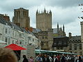 | Wells | City | 10,536 | Wells Municipal Borough |
Mendip | 51.21°N 2.65°W / 51.21; -2.65 (Wells) | [83][139] |
 | West Bradley | Civil parish | 277 | Shepton Mallet Rural District |
Mendip | 51.13°N 2.64°W / 51.13; -2.64 (West Bradley) | [81][140] |
 | West Pennard | Civil parish | 670 | Wells Rural District |
Mendip | 51.14°N 2.65°W / 51.14; -2.65 (West Pennard) | [83][141] |
 | Westbury | Civil parish | 801 | Wells Rural District |
Mendip | 51.24°N 2.71°W / 51.24; -2.71 (Westbury-sub-Mendip) | [83][142] |
 | Whatley | Civil parish | 245 | Frome Rural District |
Mendip | 51.23°N 2.38°W / 51.23; -2.38 (Whatley, Mendip) | [86][143] |
 | Witham Friary | Civil parish | 399 | Frome Rural District |
Mendip | 51.17°N 2.37°W / 51.17; -2.37 (Witham Friary) | [86][144] |
 | Wookey | Civil parish | 1,311 | Wells Rural District |
Mendip | 51.21°N 2.69°W / 51.21; -2.69 (Wookey) | [83][145] |
 | Ashcott | Civil parish | 1,186 | Bridgwater Rural District |
Sedgemoor | 51.12°N 2.81°W / 51.12; -2.81 (Ashcott) | [146][147] |
 | Axbridge | Town | 2,057 | Axbridge Rural District |
Sedgemoor | 51.29°N 2.82°W / 51.29; -2.82 (Axbridge) | [146][76] |
 | Badgworth | Civil parish | 525 | Axbridge Rural District |
Sedgemoor | 51.27°N 2.87°W / 51.27; -2.87 (Badgworth) | [146][76] |
 | Bawdrip | Civil parish | 506 | Bridgwater Rural District |
Sedgemoor | 51.15°N 2.94°W / 51.15; -2.94 (Bawdrip) | [146][147] |
 | Berrow | Civil parish | 1,534 | Axbridge Rural District |
Sedgemoor | 51.27°N 3.01°W / 51.27; -3.01 (Berrow, Somerset) | [146][76] |
 | Brean | Civil parish | 635 | Axbridge Rural District |
Sedgemoor | 51.30°N 3.01°W / 51.30; -3.01 (Brean) | [146][76] |
 | Brent Knoll | Civil parish | 1,271 | Axbridge Rural District |
Sedgemoor | 51.25°N 2.95°W / 51.25; -2.95 (Brent Knoll) | [146][76] |
 | Bridgwater | Town | 35,886 | Bridgwater Municipal Borough |
Sedgemoor | 51.13°N 2.99°W / 51.13; -2.99 (Bridgwater) | [146][147] |
 | Bridgwater Without | Civil parish | 428 | Bridgwater Rural District |
Sedgemoor | 51.14°N 2.97°W / 51.14; -2.97 (Bridgwater Without) | [146][147] |
 | Broomfield | Civil parish | 249 | Bridgwater Rural District |
Sedgemoor | 51.08°N 3.11°W / 51.08; -3.11 (Broomfield, Somerset) | [146][147] |
 | Burnham on Sea and Highbridge | Town | 19,576 | Burnham on Sea Urban District |
Sedgemoor | 51.24°N 2.99°W / 51.24; -2.99 (Burnham-on-Sea and Highbridge) | [146][148] |
 | Burnham Without | Civil Parish | 1,636 | Axbridge Rural District |
Sedgemoor | 51.23°N 2.96°W / 51.23; -2.96 (Burnham Without) | [146][76] |
 | Burtle | Civil parish | 388 | Bridgwater Rural District |
Sedgemoor | 51.17°N 2.87°W / 51.17; -2.87 (Burtle) | [146][147] |
 | Cannington | Civil parish | 2,271 | Bridgwater Rural District |
Sedgemoor | 51.15°N 3.07°W / 51.15; -3.07 (Cannington, Somerset) | [146][147] |
 | Catcott | Civil parish | 531 | Bridgwater Rural District |
Sedgemoor | 51.15°N 2.87°W / 51.15; -2.87 (Catcott) | [146][147] |
 | Chapel Allerton | Civil parish | 401 | Axbridge Rural District |
Sedgemoor | 51.25°N 2.85°W / 51.25; -2.85 (Chapel Allerton, Somerset) | [146][76] |
 | Cheddar | Civil parish | 5,755 | Axbridge Rural District |
Sedgemoor | 51.28°N 2.78°W / 51.28; -2.78 (Cheddar) | [146][76] |
 | Chedzoy | Civil parish | 404 | Bridgwater Rural District |
Sedgemoor | 51.13°N 2.95°W / 51.13; -2.95 (Chedzoy) | [146][147] |
 | Chilton Polden | Civil parish | 698 | Bridgwater Rural District |
Sedgemoor | 51.15°N 2.90°W / 51.15; -2.90 (Chilton Polden) | [146][147] |
 | Chilton Trinity | Civil parish | 260 | Bridgwater Rural District |
Sedgemoor | 51.15°N 3.01°W / 51.15; -3.01 (Chilton Trinity) | [146][147] |
 | Compton Bishop | Civil parish | 620 | Axbridge Rural District |
Sedgemoor | 51.30°N 2.87°W / 51.30; -2.87 (Compton Bishop) | [146][76] |
 | Cossington | Civil parish | 564 | Bridgwater Rural District |
Sedgemoor | 51.16°N 2.92°W / 51.16; -2.92 (Cossington, Somerset) | [146][147] |
 | Durleigh | Civil parish | 548 | Bridgwater Rural District |
Sedgemoor | 51.12°N 3.04°W / 51.12; -3.04 (Durleigh) | [146][147] |
 | East Brent | Civil parish | 1,302 | Axbridge Rural District |
Sedgemoor | 51.26°N 2.94°W / 51.26; -2.94 (East Brent, Somerset) | [146][76] |
 | East Huntspill | Civil parish | 1,146 | Bridgwater Rural District |
Sedgemoor | 51.20°N 2.98°W / 51.20; -2.98 (Huntspill) | [146][147] |
 | Edington | Civil parish | 372 | Bridgwater Rural District |
Sedgemoor | 51.15°N 2.88°W / 51.15; -2.88 (Edington, Somerset) | [146][147] |
 | Enmore | Civil parish | 247 | Bridgwater Rural District |
Sedgemoor | 51.11°N 3.09°W / 51.11; -3.09 (Enmore, Somerset) | [146][147] |
 | Fiddington | Civil parish | 298 | Bridgwater Rural District |
Sedgemoor | 51.16°N 3.12°W / 51.16; -3.12 (Fiddington) | [146][147] |
 | Goathurst | Civil parish | 193 | Bridgwater Rural District |
Sedgemoor | 51.10°N 3.06°W / 51.10; -3.06 (Goathurst) | [146][147] |
 | Greinton | Civil Parish | 71 | Bridgwater Rural District |
Sedgemoor | 51.12°N 2.84°W / 51.12; -2.84 (Greinton) | [147] |
 | Lympsham | Civil parish | 960 | Axbridge Rural District |
Sedgemoor | 51.29°N 2.95°W / 51.29; -2.95 (Lympsham) | [146][76] |
 | Lyng | Civil parish | 338 | Bridgwater Rural District |
Sedgemoor | 51.05°N 2.96°W / 51.05; -2.96 (Lyng, Somerset) | [146][147] |
 | Mark | Civil parish | 1,478 | Axbridge Rural District |
Sedgemoor | 51.23°N 2.89°W / 51.23; -2.89 (Mark, Somerset) | [146][76] |
 | Middlezoy | Civil parish | 725 | Bridgwater Rural District |
Sedgemoor | 51.09°N 2.89°W / 51.09; -2.89 (Middlezoy) | [146][147] |
 | Moorlinch | Civil parish | 408 | Bridgwater Rural District |
Sedgemoor | 51.13°N 2.86°W / 51.13; -2.86 (Moorlinch) | [146][147] |
 | Nether Stowey | Civil parish | 1,373 | Bridgwater Rural District |
Sedgemoor | 51.15°N 3.15°W / 51.15; -3.15 (Nether Stowey) | [146][147] |
 | North Petherton | Town | 6,730 | Bridgwater Rural District |
Sedgemoor | 51.09°N 3.01°W / 51.09; -3.01 (North Petherton) | [146][147] |
 | Othery | Civil parish | 642 | Bridgwater Rural District |
Sedgemoor | 51.08°N 2.88°W / 51.08; -2.88 (Othery) | [146][147] |
 | Otterhampton | Civil parish | 831 | Bridgwater Rural District |
Sedgemoor | 51.18°N 3.08°W / 51.18; -3.08 (Otterhampton) | [146][147] |
 | Over Stowey | Civil parish | 352 | Bridgwater Rural District |
Sedgemoor | 51.15°N 3.15°W / 51.15; -3.15 (Over Stowey) | [146][147] |
 | Pawlett | Civil Parish | 1,038 | Bridgwater Rural District |
Sedgemoor | 51.18°N 3.00°W / 51.18; -3.00 (Pawlett, Somerset) | [146][147] |
 | Puriton | Civil parish | 1,068 | Bridgwater Rural District |
Sedgemoor | 51.17°N 2.97°W / 51.17; -2.97 (Puriton) | [146][147] |
 | Shapwick | Civil parish | 536 | Bridgwater Rural District |
Sedgemoor | 51.14°N 2.83°W / 51.14; -2.83 (Shapwick, Somerset) | [146][147] |
 | Shipham | Civil parish | 1,087 | Axbridge Rural District |
Sedgemoor | 51.31°N 2.80°W / 51.31; -2.80 (Shipham) | [146][76] |
 | Spaxton | Civil parish | 1,012 | Bridgwater Rural District |
Sedgemoor | 51.13°N 3.11°W / 51.13; -3.11 (Spaxton) | [146][147] |
 | Stawell | Civil parish | 386 | Bridgwater Rural District |
Sedgemoor | 51.14°N 2.91°W / 51.14; -2.91 (Stawell, Somerset) | [146][147] |
 | Stockland Bristol | Civil parish | 165 | Bridgwater Rural District |
Sedgemoor | 51.19°N 3.08°W / 51.19; -3.08 (Stockland Bristol) | [146][147] |
 | Thurloxton | Civil parish | 153 | Bridgwater Rural District |
Sedgemoor | 51.07°N 3.04°W / 51.07; -3.04 (Thurloxton) | [146][147] |
 | Weare | Civil parish | 658 | Axbridge Rural District |
Sedgemoor | 51.27°N 2.84°W / 51.27; -2.84 (Weare, Somerset) | [146][76] |
 | Wedmore | Civil Parish | 3,318 | Axbridge Rural District |
Sedgemoor | 51.23°N 2.81°W / 51.23; -2.81 (Wedmore) | [146][76] |
 | Wembdon | Civil parish | 3,613 | Bridgwater Rural District |
Sedgemoor | 51.13°N 3.02°W / 51.13; -3.02 (Wembdon) | [146][147] |
 | West Huntspill | Civil parish | 1,414 | Bridgwater Rural District |
Sedgemoor | 51.20°N 2.98°W / 51.20; -2.98 (Huntspill) | [146][147] |
 | Westonzoyland | Civil parish | 1,801 | Bridgwater Rural District |
Sedgemoor | 51.11°N 2.92°W / 51.11; -2.92 (Westonzoyland) | [146][147] |
 | Woolavington | Civil parish | 2,115 | Bridgwater Rural District |
Sedgemoor | 51.17°N 2.93°W / 51.17; -2.93 (Woolavington) | [146][147] |
 | Abbas and Templecombe | Civil parish | 1,560 | Wincanton Rural District |
South Somerset | 50.99°N 2.41°W / 50.99; -2.41 (Templecombe) | [146][149] |
 | Alford | Civil parish | 63 | Wincanton Rural District |
South Somerset | 51.08°N 2.57°W / 51.08; -2.57 (Alford, Somerset) | [149] |
 | Aller | Civil parish | 410 | Langport Rural District |
South Somerset | 51.05°N 2.85°W / 51.05; -2.85 (Aller, Somerset) | [146][150] |
 | Ansford | Civil parish | 1,085 | Wincanton Rural District |
South Somerset | 51.09°N 2.51°W / 51.09; -2.51 (Ansford) | [146][149] |
 | Ash | Civil parish | 626 | Yeovil Rural District |
South Somerset | 50.98°N 2.75°W / 50.98; -2.75 (Ash, South Somerset) | [146][151] |
 | Ashill | Civil parish | 529 | Chard Rural District |
South Somerset | 50.94°N 2.96°W / 50.94; -2.96 (Ashill, Somerset) | [146][152] |
 | Babcary | Civil parish | 248 | Langport Rural District |
South Somerset | 51.05°N 2.62°W / 51.05; -2.62 (Babcary) | [146][150] |
 | Barrington | Civil parish | 438 | Langport Rural District |
South Somerset | 50.96°N 2.87°W / 50.96; -2.87 (Barrington, Somerset) | [146][150] |
 | Barton St David | Civil parish | 561 | Langport Rural District |
South Somerset | 51.08°N 2.65°W / 51.08; -2.65 (Barton St David) | [146][150] |
 | Barwick | Civil parish | 1,221 | Yeovil Rural District |
South Somerset | 50.92°N 2.62°W / 50.92; -2.62 (Barwick, Somerset) | [146][151] |
 | Beercrocombe | Civil parish | 134 | Langport Rural District |
South Somerset | 50.98°N 2.97°W / 50.98; -2.97 (Beercrocombe) | [146][150] |
 | Compton Pauncefoot | Civil parish | 130 | Wincanton Rural District |
South Somerset | 51.03°N 2.50°W / 51.03; -2.50 (Compton Pauncefoot) | [149] |
 | Bratton Seymour | Civil parish | 104 | Wincanton Rural District |
South Somerset | 51.07°N 2.47°W / 51.07; -2.47 (Bratton Seymour) | [146][149] |
 | Brewham | Civil parish | 441 | Wincanton Rural District |
South Somerset | 51.13°N 2.40°W / 51.13; -2.40 (Brewham) | [146][149] |
 | Broadway | Civil parish | 740 | Chard Rural District |
South Somerset | 50.93°N 2.97°W / 50.93; -2.97 (Broadway, Somerset) | [146][152] |
 | Bruton | Town | 2,907 | Wincanton Rural District |
South Somerset | 51.11°N 2.45°W / 51.11; -2.45 (Bruton) | [146][149] |
 | Brympton | Civil parish | 7,308 | Yeovil Rural District |
South Somerset | 50.94°N 2.68°W / 50.94; -2.68 (Brympton) | [146][151] |
 | Buckland St Mary | Civil parish | 521 | Chard Rural District |
South Somerset | 50.91°N 3.04°W / 50.91; -3.04 (Buckland St Mary) | [146][152] |
 | Castle Cary | Town | 2,276 | Wincanton Rural District |
South Somerset | 51.09°N 2.51°W / 51.09; -2.51 (Castle Cary) | [146][149] |
 | Chaffcombe | Civil parish | 229 | Chard Rural District |
South Somerset | 50.89°N 2.92°W / 50.89; -2.92 (Chaffcombe) | [146][152] |
 | Chard Town | Town | 13,074 | Chard Municipal Borough |
South Somerset | 50.87°N 2.96°W / 50.87; -2.96 (Chard, Somerset) | [146][152] |
 | Charlton Horethorne | Civil parish | 591 | Wincanton Rural District |
South Somerset | 51.01°N 2.48°W / 51.01; -2.48 (Charlton Horethorne) | [146] |
 | Charlton Musgrove | Civil parish | 398 | Wincanton Rural District |
South Somerset | 51.08°N 2.39°W / 51.08; -2.39 (Charlton Musgrove) | [146][149] |
 | Chillington | Civil parish | 164 | Chard Rural District |
South Somerset | 50.89°N 2.87°W / 50.89; -2.87 (Chillington, Somerset) | [146][152] |
 | Chilthorne Domer | Civil parish | 574 | Yeovil Rural District |
South Somerset | 50.97°N 2.68°W / 50.97; -2.68 (Chilthorne Domer) | [146][151] |
 | Chilton Cantelo | Civil parish | 445 | Yeovil Rural District |
South Somerset | 51.00°N 2.60°W / 51.00; -2.60 (Chilton Cantelo) | [146][151] |
 | Chiselborough | Civil parish | 275 | Yeovil Rural District |
South Somerset | 50.93°N 2.76°W / 50.93; -2.76 (Chiselborough) | [146][151] |
 | Closworth | Civil parish | 220 | Yeovil Rural District |
South Somerset | 50.89°N 2.62°W / 50.89; -2.62 (Closworth) | [146][151] |
 | Combe St Nicholas | Civil parish | 1,373 | Chard Rural District |
South Somerset | 50.89°N 2.99°W / 50.89; -2.99 (Combe St Nicholas) | [146][152] |
 | Compton Dundon | Civil parish | 705 | Langport Rural District |
South Somerset | 51.09°N 2.73°W / 51.09; -2.73 (Compton Dundon) | [146][150] |
 | Corton Denham | Civil parish | 189 | Wincanton Rural District |
South Somerset | 51.00°N 2.52°W / 51.00; -2.52 (Corton Denham) | [146][149] |
 | Crewkerne | Town | 7,000 | Crewkerne Urban District |
South Somerset | 50.88°N 2.79°W / 50.88; -2.79 (Crewkerne) | [146][153] |
 | Cricket St Thomas | Civil parish | 50 | Chard Rural District |
South Somerset | 50.87°N 2.89°W / 50.87; -2.89 (Cricket St Thomas) | [152] |
 | Cucklington | Civil parish | 173 | Wincanton Rural District |
South Somerset | 51.05°N 2.35°W / 51.05; -2.35 (Cucklington) | [146][149] |
 | Cudworth | Civil parish | 69 | Chard Rural District |
South Somerset | 50.89°N 2.89°W / 50.89; -2.89 (Cudworth, Somerset) | [152] |
 | Curry Mallet | Civil parish | 306 | Langport Rural District |
South Somerset | 50.99°N 2.96°W / 50.99; -2.96 (Curry Mallet) | [146][150] |
 | Curry Rivel | Civil parish | 2,148 | Langport Rural District |
South Somerset | 51.03°N 2.86°W / 51.03; -2.86 (Curry Rivel) | [146][150] |
 | Dinnington | Civil parish | 65 | Chard Rural District |
South Somerset | 50.91°N 2.85°W / 50.91; -2.85 (Dinnington, Somerse) | [152] |
 | Donyatt | Civil parish | 347 | Chard Rural District |
South Somerset | 50.93°N 2.95°W / 50.93; -2.95 (Donyatt) | [146][152] |
 | Dowlish Wake | Civil parish | 277 | Chard Rural District |
South Somerset | 50.91°N 2.89°W / 50.91; -2.89 (Dowlish Wake) | [146][152] |
 | Drayton | Civil parish | 379 | Langport Rural District |
South Somerset | 51.019°N 2.85°W / 51.019; -2.85 (Drayton, Somerset) | [146][150] |
 | East Chinnock | Civil parish | 479 | Yeovil Rural District |
South Somerset | 50.92°N 2.72°W / 50.92; -2.72 (The Chinnocks) | [146][151] |
 | East Coker | Civil parish | 1,667 | Yeovil Rural District |
South Somerset | 50.91°N 2.65°W / 50.91; -2.65 (East Coker) | [146][151] |
 | Fivehead | Civil parish | 609 | Langport Rural District |
South Somerset | 50.99°N 2.92°W / 50.99; -2.92 (Fivehead) | [146][150] |
 | Hambridge and Westport | Civil parish | 514 | Langport Rural District |
South Somerset | 50.99°N 2.86°W / 50.99; -2.86 (Hambridge and Westport) | [146][150] |
 | Hardington Mandeville | Civil parish | 585 | Yeovil Rural District |
South Somerset | 50.90°N 2.69°W / 50.90; -2.69 (Hardington Mandeville) | [146][151] |
 | Haselbury Plucknett | Civil parish | 744 | Yeovil Rural District |
South Somerset | 50.89°N 2.75°W / 50.89; -2.75 (Haselbury Plucknett) | [146][151] |
 | Henstridge | Civil parish | 1,814 | Wincanton Rural District |
South Somerset | 50.97°N 2.39°W / 50.97; -2.39 (Henstridge) | [146] |
 | High Ham | Civil parish | 909 | Langport Rural District |
South Somerset | 51.08°N 2.82°W / 51.08; -2.82 (High Ham) | [146][150] |
 | Hinton St George | Civil parish | 442 | Chard Rural District |
South Somerset | 50.91°N 2.82°W / 50.91; -2.82 (Hinton St George) | [146][152] |
 | Holton | Civil parish | 238 | Wincanton Rural District |
South Somerset | 51.04°N 2.45°W / 51.04; -2.45 (Holton, Somerset) | [146][149] |
 | Horsington | Civil parish | 571 | Wincanton Rural District |
South Somerset | 51.01°N 2.43°W / 51.01; -2.43 (Horsington, Somerset) | [146][149] |
 | Horton | Civil parish | 812 | Chard Rural District |
South Somerset | 50.93°N 2.97°W / 50.93; -2.97 (Horton, Somerset) | [146][152] |
 | Huish Episcopi | Civil parish | 2,095 | Langport Rural District |
South Somerset | 51.04°N 2.81°W / 51.04; -2.81 (Huish Episcopi) | [146][150] |
 | Ilchester | Civil parish | 2,153 | Yeovil Rural District |
South Somerset | 51.00°N 2.68°W / 51.00; -2.68 (Ilchester) | [146][151] |
 | Ilminster | Town | 5,808 | Chard Rural District
Ilminster Urban District |
South Somerset | 50.93°N 2.91°W / 50.93; -2.91 (Ilminster) | [146][152] |
 | Ilton | Civil parish | 854 | Chard Rural District |
South Somerset | 50.95°N 2.92°W / 50.95; -2.92 (Ilton) | [146][152] |
 | Isle Abbots | Civil parish | 205 | Langport Rural District |
South Somerset | 50.98°N 2.92°W / 50.98; -2.92 (Isle Abbots) | [146][150] |
 | Isle Brewers | Civil parish | 150 | Langport Rural District |
South Somerset | 50.99°N 2.90°W / 50.99; -2.90 (Isle Brewers) | [146] |
 | Keinton Mandeville | Civil parish | 1,068 | Langport Rural District |
South Somerset | 51.07°N 2.65°W / 51.07; -2.65 (Keinton Mandeville) | [146][150] |
 | Kingsbury Episcopi | Civil parish | 1,307 | Langport Rural District |
South Somerset | 50.99°N 2.81°W / 50.99; -2.81 (Kingsbury Episcopi) | [146][150] |
 | Kingsdon | Civil parish | 303 | Langport Rural District |
South Somerset | 51.04°N 2.69°W / 51.04; -2.69 (Kingsdon, Somerset) | [146][150] |
 | Kingstone | Civil parish | 83 | Chard Rural District |
South Somerset | 50.92°N 2.89°W / 50.92; -2.89 (Kingstone, Somerset) | [152] |
 | Kingweston | Civil parish | 128 | Langport Rural District |
South Somerset | 51.08°N 2.68°W / 51.08; -2.68 (Kingweston) | [150] |
 | Knowle St Giles | Civil parish | 244 | Chard Rural District |
South Somerset | 50.90°N 2.93°W / 50.90; -2.93 (Knowle St Giles) | [146][152] |
 | Langport | Town | 1,081 | Langport Rural District |
South Somerset | 51.04°N 2.83°W / 51.04; -2.83 (Langport) | [146][150] |
 | Long Load | Civil parish | 332 | Yeovil Rural District |
South Somerset | 51.01°N 2.76°W / 51.01; -2.76 (Long Load) | [146][151] |
| Long Sutton | Civil parish | 833 | Langport Rural District |
South Somerset | | [146][150] |
 | Lopen | Civil parish | 260 | Chard Rural District |
South Somerset | 50.93°N 2.82°W / 50.93; -2.82 (Lopen) | [146][152] |
 | Lovington | Civil parish | 141 | Wincanton Rural District |
South Somerset | 51.07°N 2.58°W / 51.07; -2.58 (Lovington, Somerset) | [146][149] |
 | Maperton | Civil parish | 140 | Wincanton Rural District |
South Somerset | 51.04°N 2.46°W / 51.04; -2.46 (Maperton) | [146][149] |
 | Marston Magna | Civil parish | 523 | Yeovil Rural District |
South Somerset | 51.00°N 2.58°W / 51.00; -2.58 (Marston Magna) | [146][151] |
 | Martock | Civil parish | 4,766 | Yeovil Rural District |
South Somerset | 50.97°N 2.77°W / 50.97; -2.77 (Martock) | [146][151] |
 | Merriott | Civil parish | 1,979 | Chard Rural District |
South Somerset | 50.91°N 2.79°W / 50.91; -2.79 (Merriott) | [146][152] |
 | Milborne Port | Civil parish | 2,802 | Wincanton Rural District |
South Somerset | 50.97°N 2.46°W / 50.97; -2.46 (Milborne Port) | [146][149] |
 | Misterton | Civil parish | 826 | Chard Rural District |
South Somerset | 50.87°N 2.78°W / 50.87; -2.78 (Misterton, Somerset) | [146][152] |
 | Montacute | Civil parish | 831 | Yeovil Rural District |
South Somerset | 50.95°N 2.72°W / 50.95; -2.72 (Montacute) | [146][151] |
 | Muchelney | Civil parish | 195 | Langport Rural District |
South Somerset | 51.021°N 2.82°W / 51.021; -2.82 (Muchelney) | [146][150] |
 | Mudford | Civil parish | 696 | Yeovil Rural District |
South Somerset | 50.97°N 2.61°W / 50.97; -2.61 (Mudford) | [146][151] |
 | North Barrow | Civil parish | 233 | Wincanton Rural District |
South Somerset | 51.06°N 2.57°W / 51.06; -2.57 (North Barrow) | [146][149] |
 | North Cadbury | Civil parish | 950 | Wincanton Rural District |
South Somerset | 51.05°N 2.52°W / 51.05; -2.52 (North Cadbury) | [146][149] |
 | North Cheriton | Civil parish | 208 | Wincanton Rural District |
South Somerset | 51.03°N 2.44°W / 51.03; -2.44 (North Cheriton) | [146][149] |
 | North Perrott | Civil parish | 246 | Yeovil Rural District |
South Somerset | 50.88°N 2.75°W / 50.88; -2.75 (North Perrott) | [146][151] |
 | Norton sub Hamdon | Civil parish | 743 | Yeovil Rural District |
South Somerset | 50.94°N 2.76°W / 50.94; -2.76 (Norton Sub Hamdon) | [146][151] |
 | Odcombe | Civil parish | 759 | Yeovil Rural District |
South Somerset | 50.94°N 2.70°W / 50.94; -2.70 (Odcombe) | [146][151] |
 | Penselwood | Civil parish | 273 | Wincanton Rural District |
South Somerset | 51.08°N 2.35°W / 51.08; -2.35 (Penselwood) | [146][149] |
 | Pitcombe | Civil parish | 532 | Wincanton Rural District |
South Somerset | 51.10°N 2.47°W / 51.10; -2.47 (Pitcombe) | [146][149] |
 | Pitney | Civil parish | 374 | Langport Rural District |
South Somerset | 51.05°N 2.79°W / 51.05; -2.79 (Pitney) | [146][150] |
 | Puckington | Civil parish | 117 | Langport Rural District |
South Somerset | 50.96°N 2.89°W / 50.96; -2.89 (Puckington) | [146][150] |
 | Queen Camel | Civil parish | 908 | Wincanton Rural District |
South Somerset | 51.02°N 2.58°W / 51.02; -2.58 (Queen Camel) | [146][149] |
 | Rimpton | Civil parish | 235 | Yeovil Rural District |
South Somerset | 50.99°N 2.56°W / 50.99; -2.56 (Rimpton) | [146][151] |
 | Seavington St Mary | Civil parish | 384 | Chard Rural District |
South Somerset | 50.93°N 2.86°W / 50.93; -2.86 (Seavington St Mary) | [146][152] |
 | Seavington St Michael | Civil parish | 127 | Chard Rural District |
South Somerset | 50.93°N 2.84°W / 50.93; -2.84 (Seavington St Michael) | [146][152] |
 | Shepton Beauchamp | Civil parish | 728 | Chard Rural District |
South Somerset | 50.95°N 2.85°W / 50.95; -2.85 (Shepton Beauchamp) | [146][152] |
 | Shepton Montague | Civil parish | 208 | Wincanton Rural District |
South Somerset | 51.08°N 2.47°W / 51.08; -2.47 (Shepton Montague) | [146][149] |
 | Somerton | Town | 4,697 | Langport Rural District |
South Somerset | 51.05°N 2.74°W / 51.05; -2.74 (Somerton) | [146][150] |
 | South Barrow | Civil parish | 162 | Wincanton Rural District |
South Somerset | 51.05°N 2.56°W / 51.05; -2.56 (South Barrow) | [146][149] |
 | South Cadbury and Sutton Montis | Civil parish | 284 | Wincanton Rural District |
South Somerset | 51.03°N 2.52°W / 51.03; -2.52 (South Cadbury and Sutton Montis) | [146][149] |
 | South Petherton | Civil parish | 3,367 | Yeovil Rural District |
South Somerset | 50.95°N 2.81°W / 50.95; -2.81 (South Petherton) | [146][151] |
 | Sparkford | Civil parish | 617 | Wincanton Rural District |
South Somerset | 51.04°N 2.57°W / 51.04; -2.57 (Sparkford) | [146][149] |
 | Stocklinch | Civil parish | 154 | Chard Rural District |
South Somerset | 50.95°N 2.88°W / 50.95; -2.88 (Stocklinch) | [146][152] |
 | Stoke sub Hamdon | Civil parish | 1,068 | Yeovil Rural District |
South Somerset | 50.95°N 2.75°W / 50.95; -2.75 (Stoke-sub-Hamdon) | [146][151] |
 | Stoke Trister | Civil parish | 313 | Wincanton Rural District |
South Somerset | 51.06°N 2.38°W / 51.06; -2.38 (Stoke Trister) | [146][149] |
 | Tatworth and Forton | Civil parish | 2,660 | Chard Rural District |
South Somerset | 50.85°N 2.96°W / 50.85; -2.96 (Tatworth) | [146][152] |
 | The Charltons | Civil parish | 1,073 | Langport Rural District |
South Somerset | 51.05°N 2.68°W / 51.05; -2.68 (Charlton Mackrell) | [146][150][154] |
 | Tintinhull | Civil parish | 902 | Yeovil Rural District |
South Somerset | 50.97°N 2.71°W / 50.97; -2.71 (Tintinhull) | [146][151] |
 | Wambrook | Civil parish | 184 | Chard Rural District |
South Somerset | 50.86°N 3.00°W / 50.86; -3.00 (Wambrook) | [146][152] |
 | Wayford | Civil parish | 114 | Chard Rural District |
South Somerset | 50.85°N 2.85°W / 50.85; -2.85 (Wayford) | [152] |
 | West Camel | Civil parish | 459 | Yeovil Rural District |
South Somerset | 51.02°N 2.60°W / 51.02; -2.60 (West Camel) | [146][151] |
 | West and Middle Chinnock | Civil parish | 592 | Yeovil Rural District |
South Somerset | 50.92°N 2.76°W / 50.92; -2.76 (West Chinnock) | [146][151] |
 | West Coker | Civil parish | 2,018 | Yeovil Rural District |
South Somerset | 50.92°N 2.69°W / 50.92; -2.69 (West Coker) | [146][151] |
| West Crewkerne | Civil parish | 631 | Chard Rural District |
South Somerset | 50.88°N 2.79°W / 50.88; -2.79 (Crewkerne) | [146][152] |
 | Whitelackington | Civil parish | 209 | Chard Rural District |
South Somerset | 50.94°N 2.88°W / 50.94; -2.88 (Whitelackington) | [146][152] |
 | Whitestaunton | Civil parish | 256 | Chard Rural District |
South Somerset | 50.89°N 3.02°W / 50.89; -3.02 (Whitestaunton) | [146][152] |
 | Wincanton | Town | 5,272 | Wincanton Rural District |
South Somerset | 51.06°N 2.41°W / 51.06; -2.41 (Wincanton) | [146][149] |
 | Winsham | Civil parish | 748 | Chard Rural District |
South Somerset | 50.85°N 2.89°W / 50.85; -2.89 (Winsham) | [146][152] |
 | Yarlington | Civil parish | 123 | Wincanton Rural District |
South Somerset | 51.06°N 2.49°W / 51.06; -2.49 (Yarlington) | [146][149] |
 | Yeovil | Town | 30,378 | Yeovil Municipal Borough |
South Somerset | 50.95°N 2.64°W / 50.95; -2.64 (Yeovil) | [146][155] |
 | Yeovil Without | Civil parish | 6,834 | Yeovil Rural District |
South Somerset | 50.96°N 2.65°W / 50.96; -2.65 (Yeovil Without) | [146][151] |
 | Yeovilton and District | Civil parish | 1,425 | Yeovil Rural District |
South Somerset | 51.00°N 2.65°W / 51.00; -2.65 (Yeovilton) | [146][151][156] |
 | Ashbrittle | Civil parish | 225 | Wellington Rural District |
Taunton Deane
Somerset West and Taunton |
50.98°N 3.35°W / 50.98; -3.35 (Ashbrittle) | [146][157] |
 | Ash Priors | Civil parish | 155 | Taunton Rural District |
Taunton Deane
Somerset West and Taunton |
51.06°N 3.21°W / 51.06; -3.21 (Ash Priors) | [146][158] |
 | Bathealton | Civil parish | 194 | Wellington Rural District |
Taunton Deane
Somerset West and Taunton |
51.01°N 3.31°W / 51.01; -3.31 (Bathealton) | [146][157] |
 | Bickenhall | Civil parish | 122 | Taunton Rural District |
Taunton Deane
Somerset West and Taunton |
50.96°N 3.03°W / 50.96; -3.03 (Bickenhall) | [158] |
 |
Bicknoller |
Civil parish |
371 |
Williton Rural District |
West Somerset
Somerset West and Taunton |
51.15°N 3.27°W / 51.15; -3.27 (Bicknoller) |
[146][159] |
 | Bishop's Hull | Civil parish | 2,975 | Taunton Rural District |
Taunton Deane
Somerset West and Taunton |
51.02°N 3.14°W / 51.02; -3.14 (Bishop's Hull) | [146][158] |
 | Bishops Lydeard | Civil parish | 2,839
(includes Cotford St Luke) | Taunton Rural District |
Taunton Deane
Somerset West and Taunton |
51.06°N 3.19°W / 51.06; -3.19 (Bishops Lydeard) | [146][158] |
 | Bradford-on-Tone | Civil parish | 622 | Wellington Rural District |
Taunton Deane
Somerset West and Taunton |
51.00°N 3.18°W / 51.00; -3.18 (Bradford on Tone) | [146][157] |
 |
Brompton Ralph |
Civil parish |
287 |
Williton Rural District |
West Somerset
Somerset West and Taunton |
51.08°N 3.31°W / 51.08; -3.31 (Brompton Ralph) |
[146][159] |
 | Brompton Regis | Civil parish | 449 | Dulverton Rural District |
West Somerset
Somerset West and Taunton |
51.07°N 3.49°W / 51.07; -3.49 (Brompton Regis) | [146][160] |
 | Brushford | Civil parish | 519 | Dulverton Rural District |
West Somerset
Somerset West and Taunton |
51.02°N 3.53°W / 51.02; -3.53 (Brushford, Somerset) | [146][160] |
 |
Burrowbridge |
Civil parish |
508 |
Taunton Rural District |
Taunton Deane
Somerset West and Taunton |
51.07°N 2.92°W / 51.07; -2.92 (Burrowbridge) |
[161][162] |
 |
Carhampton |
Civil parish |
865 |
Williton Rural District |
West Somerset
Somerset West and Taunton |
51.17°N 3.42°W / 51.17; -3.42 (Carhampton, Somerset) |
[146][159] |
 |
Cheddon Fitzpaine |
Civil parish |
1,929 |
Taunton Rural District |
Taunton Deane
Somerset West and Taunton |
51.04°N 3.08°W / 51.04; -3.08 (Cheddon Fitzpaine) |
[161][162] |
 |
Chipstable |
Civil parish |
309 |
Wellington Rural District |
Taunton Deane
Somerset West and Taunton |
51.04°N 3.37°W / 51.04; -3.37 (Chipstable) |
[161][163] |
 |
Churchstanton |
Civil parish |
752 |
Taunton Rural District |
Taunton Deane
Somerset West and Taunton |
50.92°N 3.15°W / 50.92; -3.15 (Churchstanton) |
[161][162] |
 | Clatworthy | Civil parish | 101 | Williton Rural District |
West Somerset
Somerset West and Taunton |
51.07°N 3.35°W / 51.07; -3.35 (Clatworthy) | [159] |
 |
Combe Florey |
Civil parish |
261 |
Taunton Rural District |
Taunton Deane
Somerset West and Taunton |
51.08°N 3.21°W / 51.08; -3.21 (Combe Florey) |
[161][162] |
 | Corfe | Civil parish | 253 | Taunton Rural District |
Taunton Deane
Somerset West and Taunton |
50.97°N 3.09°W / 50.97; -3.09 (Corfe) | [146][158] |
 | Cotford St Luke | Civil parish | created post-census | Taunton Rural District |
Taunton Deane
Somerset West and Taunton |
51.0392°N 3.1886°W / 51.0392; -3.1886 (Corfe) | [158] |
 | Cothelstone | Civil parish | 111 | Taunton Rural District |
Taunton Deane
Somerset West and Taunton |
51.08°N 3.16°W / 51.08; -3.16 (Cothelstone) | [146][158] |
 | Creech St Michael | Civil parish | 2,416 | Taunton Rural District |
Taunton Deane
Somerset West and Taunton |
51.02°N 3.04°W / 51.02; -3.04 (Creech St Michael) | [146][158] |
 | Crowcombe | Civil parish | 489 | Williton Rural District |
West Somerset
Somerset West and Taunton |
51.12°N 3.23°W / 51.12; -3.23 (Crowcombe) | [146][159] |
 | Curland | Civil parish | 225 | Taunton Rural District |
Taunton Deane
Somerset West and Taunton |
50.95°N 3.03°W / 50.95; -3.03 (Curland) | [146][158] |
 | Cutcombe | Civil parish | 361 | Williton Rural District |
West Somerset
Somerset West and Taunton |
51.14°N 3.53°W / 51.14; -3.53 (Cutcombe) | [146][159] |
 |
Dulverton |
Town |
1,408 |
Dulverton Rural District |
West Somerset
Somerset West and Taunton |
51.05°N 3.55°W / 51.05; -3.55 (Dulverton) |
[146][160] |
 |
Dunster |
Civil parish |
817 |
Williton Rural District |
West Somerset
Somerset West and Taunton |
51.18°N 3.45°W / 51.18; -3.45 (Dunster) |
[146] |
 | Durston | Civil parish | 136 | Taunton Rural District |
Taunton Deane
Somerset West and Taunton |
51.05°N 3.01°W / 51.05; -3.01 (Durston) | [146][158] |
 |
East Quantoxhead |
Civil parish |
104 |
Williton Rural District |
West Somerset
Somerset West and Taunton |
51.18°N 3.24°W / 51.18; -3.24 (East Quantoxhead) |
[146] |
 |
Elworthy |
Civil parish |
103 |
Williton Rural District |
West Somerset
Somerset West and Taunton |
51.11°N 3.31°W / 51.11; -3.31 (Elworthy) |
[159] |
 |
Exford |
Civil parish |
405 |
Dulverton Rural District |
West Somerset
Somerset West and Taunton |
51.13°N 3.64°W / 51.13; -3.64 (Exford, Somerset) |
[146][160] |
 |
Exmoor |
Civil parish |
251 |
Dulverton Rural District |
West Somerset
Somerset West and Taunton |
51.14°N 3.75°W / 51.14; -3.75 (Exmoor civil parish) |
[146][160] |
 |
Exton |
Civil parish |
243 |
Dulverton Rural District |
West Somerset
Somerset West and Taunton |
51.09°N 3.54°W / 51.09; -3.54 (Exton, Somerset) |
[146][160] |
 | Fitzhead | Civil parish | 264 | Wellington Rural District |
Taunton Deane
Somerset West and Taunton |
51.05°N 3.26°W / 51.05; -3.26 (Fitzhead) | [146][157] |
 | Halse | Civil parish | 290 | Taunton Rural District |
Taunton Deane
Somerset West and Taunton |
51.04°N 3.23°W / 51.04; -3.23 (Halse, Somerset) | [146][158] |
 | Hatch Beauchamp | Civil parish | 620 | Taunton Rural District |
Taunton Deane
Somerset West and Taunton |
50.98°N 2.99°W / 50.98; -2.99 (Hatch Beauchamp) | [158] |
 | Holford | Civil parish | 392 | Williton Rural District |
West Somerset
Somerset West and Taunton |
51.16°N 3.21°W / 51.16; -3.21 (Holford) | [146][159] |
 | Huish Champflower | Civil parish | 301 | Dulverton Rural District |
West Somerset
Somerset West and Taunton |
51.06°N 3.36°W / 51.06; -3.36 (Huish Champflower) | [146][160] |
 | Kilve | Civil parish | 344 | Williton Rural District |
West Somerset
Somerset West and Taunton |
51.18°N 3.22°W / 51.18; -3.22 (Kilve) | [146][159] |
 | Kingston St Mary | Civil parish | 921 | Taunton Rural District |
Taunton Deane
Somerset West and Taunton |
51.06°N 3.11°W / 51.06; -3.11 (Kingston St Mary) | [146][158] |
 | Langford Budville | Civil parish | 535 | Wellington Rural District |
Taunton Deane
Somerset West and Taunton |
51.00°N 3.27°W / 51.00; -3.27 (Langford Budville) | [146][157] |
 | Luccombe | Civil parish | 157 | Williton Rural District |
West Somerset
Somerset West and Taunton |
51.19°N 3.56°W / 51.19; -3.56 (Luccombe, Somerset) | [146][159] |
 | Luxborough | Civil parish | 237 | Williton Rural District |
West Somerset
Somerset West and Taunton |
51.13°N 3.46°W / 51.13; -3.46 (Luxborough) | [146][159] |
 | Lydeard St Lawrence | Civil parish | 506 | Taunton Rural District |
Taunton Deane
Somerset West and Taunton |
51.09°N 3.25°W / 51.09; -3.25 (Lydeard St Lawrence) | [146][158] |
 | Milverton | Civil parish | 1,438 | Wellington Rural District |
Taunton Deane
Somerset West and Taunton |
51.02°N 3.25°W / 51.02; -3.25 (Milverton, Somerset) | [146][157] |
 | Minehead | Town | 11,981 | Williton Rural District
Minehead Urban District |
West Somerset
Somerset West and Taunton |
51.20°N 3.47°W / 51.20; -3.47 (Minehead) | [146][159][164] |
 | Minehead Without | Civil parish | 60 | Williton Rural District |
West Somerset
Somerset West and Taunton |
51.20°N 3.51°W / 51.20; -3.51 (Minehead Without) | [159] |
 | Monksilver | Civil parish | 113 | Williton Rural District |
West Somerset
Somerset West and Taunton |
51.13°N 3.33°W / 51.13; -3.33 (Monksilver) | [146][159] |
 | Nettlecombe | Civil parish | 174 | Williton Rural District |
West Somerset
Somerset West and Taunton |
51.13°N 3.35°W / 51.13; -3.35 (Nettlecombe, Somerset) | [146][159] |
 | North Curry | Civil parish | 1,640 | Taunton Rural District |
Taunton Deane
Somerset West and Taunton |
51.02°N 2.96°W / 51.02; -2.96 (North Curry) | [146][158] |
 | Norton Fitzwarren | Civil parish | 3,046 | Taunton Rural District |
Taunton Deane
Somerset West and Taunton |
51.02°N 3.15°W / 51.02; -3.15 (Norton Fitzwarren) | [146][158] |
 | Nynehead | Civil parish | 415 | Wellington Rural District |
Taunton Deane
Somerset West and Taunton |
50.99°N 3.23°W / 50.99; -3.23 (Nynehead) | [146][157] |
 | Oake | Civil parish | 765 | Wellington Rural District |
Taunton Deane
Somerset West and Taunton |
51.02°N 3.21°W / 51.02; -3.21 (Oake) | [146][157] |
 | Oare | Civil parish | 68 | Williton Rural District |
West Somerset
Somerset West and Taunton |
51.20°N 3.71°W / 51.20; -3.71 (Oare, Somerset) | [159] |
 | Old Cleeve | Civil parish | 1,672 | Williton Rural District |
West Somerset
Somerset West and Taunton |
51.17°N 3.38°W / 51.17; -3.38 (Old Cleeve) | [146][159] |
 | Orchard Portman | Civil parish | 150 | Taunton Rural District |
Taunton Deane
Somerset West and Taunton |
50.99°N 3.08°W / 50.99; -3.08 (Orchard Portman) | [146][158] |
 | Otterford | Civil parish | 356 | Taunton Rural District |
Taunton Deane
Somerset West and Taunton |
50.92°N 3.10°W / 50.92; -3.10 (Otterford) | [146][158] |
 | Pitminster | Civil parish | 956 | Taunton Rural District |
Taunton Deane
Somerset West and Taunton |
50.97°N 3.11°W / 50.97; -3.11 (Pitminster) | [146][158] |
 | Porlock | Civil parish | 1,440 | Williton Rural District |
West Somerset
Somerset West and Taunton |
51.21°N 3.60°W / 51.21; -3.60 (Porlock) | [146][159] |
 | Ruishton | Civil parish | 1,473 | Taunton Rural District |
Taunton Deane
Somerset West and Taunton |
51.02°N 3.05°W / 51.02; -3.05 (Ruishton) | [146][158] |
 | Sampford Arundel | Civil parish | 268 | Wellington Rural District |
Taunton Deane
Somerset West and Taunton |
50.96°N 3.28°W / 50.96; -3.28 (Sampford Arundel) | [146][157] |
 | Sampford Brett | Civil parish | 270 | Williton Rural District |
West Somerset
Somerset West and Taunton |
51.16°N 3.31°W / 51.16; -3.31 (Sampford Brett) | [146][159] |
 | Selworthy | Civil parish | 477 | Williton Rural District |
West Somerset
Somerset West and Taunton |
51.21°N 3.55°W / 51.21; -3.55 (Selworthy) | [146][159] |
 | Skilgate | Civil parish | 100 | Dulverton Rural District |
West Somerset
Somerset West and Taunton |
51.04°N 3.45°W / 51.04; -3.45 (Skilgate) | [160] |
 | Staple Fitzpaine | Civil parish | 189 | Taunton Rural District |
Taunton Deane
Somerset West and Taunton |
50.96°N 3.05°W / 50.96; -3.05 (Staple Fitzpaine) | [146][158] |
 | Stawley | Civil parish | 279 | Wellington Rural District |
Taunton Deane
Somerset West and Taunton |
51.00°N 3.33°W / 51.00; -3.33 (Stawley) | [146][157] |
 | Stogumber | Civil parish | 702 | Williton Rural District |
West Somerset
Somerset West and Taunton |
51.13°N 3.29°W / 51.13; -3.29 (Stogumber) | [146][159] |
 | Stogursey | Civil parish | 1,385 | Williton Rural District |
West Somerset
Somerset West and Taunton |
51.18°N 3.14°W / 51.18; -3.14 (Stogursey) | [146][159] |
 | Stoke St Gregory | Civil parish | 942 | Taunton Rural District |
Taunton Deane
Somerset West and Taunton |
51.04°N 2.94°W / 51.04; -2.94 (Stoke St Gregory) | [146][158] |
 | Stoke St Mary | Civil parish | 421 | Taunton Rural District |
Taunton Deane
Somerset West and Taunton |
50.99°N 3.05°W / 50.99; -3.05 (Stoke St Mary) | [146][158] |
 | Stringston | Civil parish | 116 | Williton Rural District |
West Somerset
Somerset West and Taunton |
51.18°N 3.18°W / 51.18; -3.18 (Stringston) | [159] |
 | Taunton | Civil parish | | Taunton Municipal Borough |
Taunton Deane
Somerset West and Taunton |
51.019°N 3.100°W / 51.019; -3.100 (Taunton) | |
 | Thornfalcon | Civil parish | 119 | Taunton Rural District |
Taunton Deane
Somerset West and Taunton |
51.01°N 3.02°W / 51.01; -3.02 (Thornfalcon) | [146][158] |
 | Timberscombe | Civil parish | 402 | Williton Rural District |
West Somerset
Somerset West and Taunton |
51.13°N 3.54°W / 51.13; -3.54 (Timberscombe) | [146][159] |
 | Tolland | Civil parish | 81 | Taunton Rural District |
West Somerset
Somerset West and Taunton |
51.08°N 3.28°W / 51.08; -3.28 (Tolland, Somerset) | [158] |
 | Treborough | Civil parish | 51 | Williton Rural District |
West Somerset
Somerset West and Taunton |
51.12°N 3.41°W / 51.12; -3.41 (Treborough) | [159] |
 | Trull | Civil parish | 2,288 | Taunton Rural District |
Taunton Deane
Somerset West and Taunton |
51.00°N 3.12°W / 51.00; -3.12 (Trull) | [146][158] |
 | Upton | Civil parish | 250 | Dulverton Rural District |
West Somerset
Somerset West and Taunton |
51.10°N 3.44°W / 51.10; -3.44 (Upton, Somerset) | [146][160] |
 | Watchet | Town | 3,785 | Watchet Urban District |
West Somerset
Somerset West and Taunton |
51.18°N 3.33°W / 51.18; -3.33 (Watchet) | [146][165] |
 | Wellington | Town | 13,822 | Wellington Urban District |
Taunton Deane
Somerset West and Taunton |
50.98°N 3.22°W / 50.98; -3.22 (Wellington, Somerset) | [146][166] |
 | Wellington Without | Civil parish | 727 | Wellington Rural District |
Taunton Deane
Somerset West and Taunton |
50.96°N 3.23°W / 50.96; -3.23 (Wellington Without) | [146][157] |
 | West Bagborough | Civil parish | 358 | Taunton Rural District |
Taunton Deane
Somerset West and Taunton |
51.09°N 3.18°W / 51.09; -3.18 (West Bagborough) | [146][158] |
 | West Buckland | Civil parish | 1,189 | Wellington Rural District |
Taunton Deane
Somerset West and Taunton |
50.98°N 3.18°W / 50.98; -3.18 (West Buckland) | [146][157] |
 | West Hatch | Civil parish | 306 | Taunton Rural District |
Taunton Deane
Somerset West and Taunton |
50.98°N 3.02°W / 50.98; -3.02 (West Hatch) | [146][158] |
 | West Monkton | Civil parish | 2,787 | Taunton Rural District |
Taunton Deane
Somerset West and Taunton |
51.05°N 3.05°W / 51.05; -3.05 (West Monkton) | [146][158] |
 | West Quantoxhead | Civil parish | 343 | Williton Rural District |
West Somerset
Somerset West and Taunton |
51.17°N 3.27°W / 51.17; -3.27 (West Quantoxhead) | [146][159] |
 | Williton | Civil parish | 2,607 | Williton Rural District |
West Somerset
Somerset West and Taunton |
51.16°N 3.31°W / 51.16; -3.31 (Williton) | [146][159] |
 | Winsford | Civil parish | 321 | Dulverton Rural District |
West Somerset
Somerset West and Taunton |
51.10°N 3.57°W / 51.10; -3.57 (Winsford, Somerset) | [146][160] |
 | Withycombe | Civil parish | 293 | Williton Rural District |
West Somerset
Somerset West and Taunton |
51.16°N 3.41°W / 51.16; -3.41 (Withycombe) | [146][159] |
 | Withypool and Hawkridge | Civil parish | 201 | Dulverton Rural District |
West Somerset
Somerset West and Taunton |
51.11°N 3.65°W / 51.11; -3.65 (Withypool and Hawkridge) | [146][160] |
 | Wiveliscombe | Town | 2,893 | Wellington Rural District |
Taunton Deane
Somerset West and Taunton |
51.04°N 3.31°W / 51.04; -3.31 (Wiveliscombe) | [146][157] |
 | Wootton Courtenay | Civil parish | 264 | Williton Rural District |
West Somerset
Somerset West and Taunton |
51.18°N 3.52°W / 51.18; -3.52 (Wootton Courtenay) | [146][159] |

.svg)


_St_Peter's_Church_-_geograph.org.uk_-_67585.jpg)


_All_Saints_Church_-_geograph.org.uk_-_67722.jpg)


_Holy_Trinity_Church_-_geograph.org.uk_-_67726.jpg)


_St_Mary's_Church_-_geograph.org.uk_-_67849.jpg)


.jpg)


.jpg)


.jpg)


