Le Fayel
Commune in Hauts-de-France, France From Wikipedia, the free encyclopedia
Le Fayel (French pronunciation: [lə fajɛl]) is a commune in the Oise department in northern France.
Le Fayel | |
|---|---|
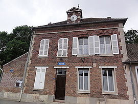
 The town hall in Le Fayel | |
| Coordinates: 49°22′22″N 2°41′58″E | |
| Country | France |
| Region | Hauts-de-France |
| Department | Oise |
| Arrondissement | Compiègne |
| Canton | Estrées-Saint-Denis |
| Intercommunality | Plaine d'Estrées |
| Government | |
| • Mayor (2020–2026) | Isabelle Fafet[1] |
Area 1 | 2.56 km2 (0.99 sq mi) |
| Population (2022)[2] | 233 |
| • Density | 91/km2 (240/sq mi) |
| Time zone | UTC+01:00 (CET) |
| • Summer (DST) | UTC+02:00 (CEST) |
| INSEE/Postal code | 60229 /60680 |
| Elevation | 47–81 m (154–266 ft) (avg. 60 m or 200 ft) |
| 1 French Land Register data, which excludes lakes, ponds, glaciers > 1 km2 (0.386 sq mi or 247 acres) and river estuaries. | |
See also
References
Wikiwand - on
Seamless Wikipedia browsing. On steroids.


